Erhalten Sie Zugang zu diesem und mehr als 300000 Büchern ab EUR 5,99 monatlich.
- Herausgeber: Birlinn
- Kategorie: Gesellschafts- und Liebesromane
- Sprache: Englisch
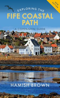
This is the ideal guide to the whole route, so rich in history and natural beauty. Designed to be used by walkers on the Path or visitors to any point along it, it introduces a wealth of castles, churches, harbours, monuments and red-roofed houses. Hamish Brown gives practical advice on all aspects of walking the Path, whether you are making a seven-day trip along its whole length or walking a short section on a Sunday afternoon. Revising his earlier guide to the route, he explores every part of the Fife coast, including the famous Forth bridges, the charming East Neuk fishing villages of Pittenweem, Elie and St Monans, as well as Anstruther, Crail and St Andrews. Along the way he provides a mass of fascinating information about people and places that can be read for pleasure and kept as the souvenir of a unique and unforgettable part of Scotland.
Sie lesen das E-Book in den Legimi-Apps auf:
Seitenzahl: 306
Veröffentlichungsjahr: 2021
Das E-Book (TTS) können Sie hören im Abo „Legimi Premium” in Legimi-Apps auf:
Ähnliche
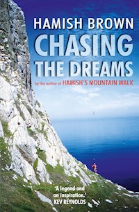


Exploring theFife Coastal Path
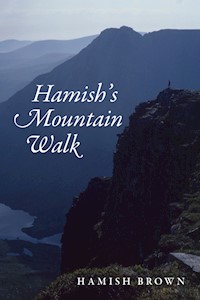
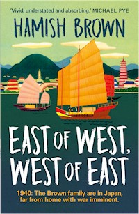
Hamish Brown is a well-known outdoors writer, lecturer and photographer, the first person to walk all the Scottish Munros in a single trip, an adventure he describes in Hamish’s Mountain Walk (1978). He has published many other bestselling books, including a family saga East of West, West of East, with its climax the Fall of Singapore in 1942. He has lived all his adult life on the Fife coast. He prepared this new edition in his 86th year, walking each section of the route whenever the Covid-19 restrictions of 2020—21 permitted.
First published in 2004 by Mercat Press
A second edition published in 2009 by Birlinn Limited
This third edition published in 2021 by
Birlinn Limited
West Newington House
10 Newington Road
Edinburgh
EH9 1QS
www.birlinn.co.uk
Copyright © Hamish Brown 2004, 2009, 2021
All photographs © Hamish Brown/St Andrews University Special
Collections unless otherwise acknowledged
The moral right of Hamish Brown to be identified as the author ofthis work has been asserted by him in accordance with the Copyright,Designs and Patents Act 1988.
Cartography by Helen Stirling
All rights reserved. No part of this publication may be reproduced,stored or transmitted in any formwithout the express written permissionof the publisher.
ISBN: 978 1 78885 448 1
British Library Cataloguing-in-Publication Data
A catalogue record for this book is available from the British Library
Designed and typeset in Gill Sans and Palatinoby Tom Johnstone Editorial Services
Printed and bound in Great Britainby Bell & Bain Ltd, Glasgow
CONTENTS
List of Maps
Introduction
Practical Information
Coast and Country Code
I The Upper Forth Reaches
Kincardine Bridge to Forth Bridges
II From Forth Bridges to Burntisland
By Inverkeithing–Dalgety Bay–Aberdour
III Burntisland, Kinghorn, Kirkcaldy
To Kinghorn–Kirkcaldy
IV The Old Coal Coast (Kirkcaldy to Leven)
Dysart–To West Wemyss–East Wemyss and ItsCaves–Buckhaven, Methil, Leven (the Urban Miles)
V Largo Bay (Leven to Elie)
To Lower Largo–Largo Bay to Kincraig Point–Earlsferry and Elie
VI The East Neuk
St Monans–Pittenweem–Anstruther–Cellardyke to Crail
VII Crail to St Andrews (The Cold Coast)
Out to Fife Ness–Balcomie, Cambo–Kenly Burn–St Andrews
VIII Exploring St Andrews
IX By Tentsmuir to Newport
X Newport to Newburgh
By Balmerino and along the Hills
Appendices
1. The Binn
2. Largo Law
3. The Chain Walk
4. Isle of May
Acknowledgements
Index
Maps
The Fife Coastal Path
Kincardine to Queensferry
Queensferry to Aberdour
Aberdour to Kirkcaldy
Kirkcaldy
Kirkcaldy to Methil
Largo Bay–Leven to Elie
The East Neuk–Elie to Crail
The Cold Coast–Crail to St Andrews
St Andrews
St Andrews to Wormit
Wormit to Newburgh
INTRODUCTION
Sources of the River Forth lie as far off as the slopes of Ben Lomond and the river falls just eighty feet in 37 miles to where it becomes tidal. Loch Ard is a pretty footnote to the Ben, then, from Aberfoyle onwards, the river twists and turns, circles and loops, through the rich flat farmlands–with names like Faraway, Pendicles of Collymoon, Backside of Garden, Goodie Water, Kersebonny and Barbadoes. At Stirling Geography clashes with History: Stirling Castle, the Wallace Monument, the Stewarts’ story, all because here was ‘the lowest bridging point’ of the Forth. Traffic, trade, armies all had to come this way. Stirling was dubbed ‘the bellybutton of Scotland’. And that was how it remained (surprisingly) until 1936 when a bridge was built at Kincardine. This was a swing bridge, as some shipping would head up to Alloa, but it was Kincardine and on to the Forth Bridges triptych that was the commercial, exploitative stretch–what we are setting out to explore at the start of the Fife Coastal Path (FCP).
This runs round the Fife coast, Fife something of a peninsula, lapped by Tay and Forth, with a snout to the North Sea. Kincardine lies just in from the boundary with Scotland’s smallest county, Clackmannanshire, and ends just past Newburgh, with Perth and Kinross c. 117 miles (188km) by the FCP. Walking the FCP should take about ten days but I suggest a two-week exploration. I’ve lived on the Fife coast all my adult life and I’m still finding new interests and surprises.
The FCP is not a demanding mountain trail through remote country demanding necessary disciplines and timetabling, so there is no need to rush it. Make its exploration the primary object, not the ticking off of another listed route. Any official long-distance route has certain restrictions, which pinioning is reflected in guide books. To me it is the exploring that matters, so I can give much more in the way of what to do and see. Guidance for walking the Fife coast could be reduced to six words: ‘keep the sea on your right’! Intense guidance is somewhat superfluous. What this book does is indicate the interests (past and present). Take time to explore. Deviate from the signposted FCP. Make discoveries. With so many attractive villages along the way there are also many welcoming cafés and pubs and restaurants (and award-winning chip shops). Make the most of them. To rush is to sin. This guide, by its nature, also appeals to any kind of visitor: the curious traveller above all. You don’t have to be a walker–but walking is best.
The FCP originally followed from Forth Bridge to Tay Bridge, which had a pleasing symmetry, entering and leaving Fife by notable features. Since then the FCP has been pushed to cover the whole coast, a proud claim for any county. And what a proliferation of bridges, with the building of the Clackmannanshire Bridge (which touches down in Fife!) and the glorious Queensferry Crossing. At some stage do walk across Forth Road Bridge and Tay Bridge, whether to start/end the FCP or on other occasions. I particularly enjoyed walking into Fife by the Road Bridge and exiting by the Tay Bridge to Dundee to then catch a train to Edinburgh, over the most famous bridge of all. Half of Scotland’s population lies within an hour’s drive of the Fife coast, and good rail and road systems bring it within easy reach of the rest of the world! The FCP is also part of the grand concept of ‘The North Sea Trail’.
It was James VI who described Fife as ‘a beggar’s mantle fringed with gold’, and you won’t be allowed to stay ignorant that the fringe was the Fife coast and the gold the export trade from its ports and later the fishing industry. Not much of this prosperity survives. If the salt panning died two centuries ago and industries like shale oil, linen and coal mining have followed, then one gain has been ours, as the squalor of such industries is replaced with rural regeneration and urban renewal. Tourism is big business now, which is one reason the Fife Coastal Path has been developed. Walking a route like this, we actually put our money where our feet are!
The non-walking visitor will equally well find this a useful guide for the towns and sites that dangle like beads on the Fife fringe, but I hope it encourages such to do some walking as well, linking places of interest afoot and so discovering the great benefit to wellbeing that comes from walking. Sir Walter Scott, when work drove him to despair, would go for a good long walk ‘to regain his elasticity of mind’.
There is nothing to beat exploring on foot, and the natural linear progression of following a coast also means transport is fairly straightforward, so one can travel to a town, walk, and then, at the day’s end, be able to return easily to the start. The whole coast could be explored piecemeal like this but how much more rewarding to win free of the wheeled monsters and for a couple of weeks go footloose and fancy free along the Castles Coast, East Neuk and the ‘Silvery Tay’. If you are a walker this is obvious, if you are a nascent walker there’s no place better to give ‘real’ walking a try. You will also be made aware of the voices of nature: skylarks reeling, curlews calling, eiders commenting, seals singing, and the everlasting sounds of wind and water.
For most of the time the route is obvious. ‘Continue eastwards’ is the most repeated directive, but even this can have odd local quirks. Everyone talks of the east end and the west end of Kirkcaldy High Street, but a glance at the maps shows it runs due north-south! Changes will go on happening too, and any note of these would be welcomed by the author. (Send such addressed to the publishers.)
The FCP does not necessarily indicate what to see and do along the way, especially in the towns, so I don’t hesitate to deviate; with this guide we are exploring the Fife coast. The panorama from the Binn, the interest of the Kirkcaldy Museum and Art Gallery, the mining tunnels at St Andrews Castle, the charm of the East Neuk villages, Norman’s Law– these just have to be explored. There’s comfortable tourist accommodation, public transport is adequate. Make use of everything and weave your own cloth of gold.
The two additional stretches of Fife Coastal Path emphasise some practical problems. There is no obvious accommodation available at either Kincardine or Newburgh or along some sections of the FCP. However, this is not as insurmountable a problem as believed. In 2020 I walked the entire FCP, from Kincardine to Newburgh (but breaking it down into much smaller daily distances, as researching/checking everything en route for this book) and was, throughout, entirely reliant on public transport. I always found a bed at night using buses or trains. The only place this was not possible was walking the rump of the Ochils and I simply took a taxi from Brunton to Cupar, and back next day. Bus services all along the coast were surprisingly good. Examples: having walked from Kincardine I then spent the rest of the day enjoying Culross, and walking round Preston Island, then caught a bus to Dunfermline; having explored the delights of Cambo I caught a bus back to Crail. There is one soft option, to sign up for one of the tour-operating companies who organise accommodation and provide a baggage transfer service, but they at present stick to Bridges to Bridges. Another trick on the busier, touristy parts, to stay on in a B&B for successive nights and using bus or taxi to return to the known comforts. We can only hope as more people tackle the whole FCP (likewise the Fife Pilgrim Way) the local facilities will appear to meet the need; after all, the first and last sections add considerable character and interest to the FCP. Dealing with these kinds of problems is both part of the fun and frustration of any worthwhile challenge. Note too, many sites and services close from October to Easter while, post the Coronavirus period, some listed facilities may not have survived. Check whatever you can; ahead. If phoning a B&B, obtain directions of how to find it. Lastly, if the British Open Golf Championship is being played at St Andrews, every bed in the East Neuk will be taken and the St Cuthbert’s Way would be a better option. On several occasions the route edges golf courses and it is only courteous not to disturb play. Stand still and watch (which sometimes causes more nervousness!) and keep dogs in control (players don’t really want golf balls ‘fetched’) but, quite seriously, watch out for flying golf balls. (The Golf Museum in St Andrews has a stuffed skylark in a glass case, along with the ball that struck it dead in flight.)
The importance of Fife historically is seen in most of the coastal towns being Royal Burghs: Inverkeithing, Kinghorn and Crail as early as the twelfth century, Burntisland, Dysart, Pittenweem and Anstruther in the sixteenth century, Kirkcaldy and St Andrews in the next century, though they are now the biggest towns on the coast. Newburgh had its charter confirmed by Charles I. One result of this background is the surviving architectural and historical richness: castles, churches, tolbooths, harbours, doocots, milestones and redroofed ‘little houses’. Every town seemed to have a harbour, ferries abounded and Fife was criss-crossed with routes taking pilgrims to St Andrews, courtiers to the one-time capital of Dunfermline or Falkland (the Stewarts’ Balmoral) or merchants to the mines of Culross and the wheatlands of Cupar, or royal corpses to Inchcolm, which followed Iona as the burial place of kings. The Forth and Tay also gave Fife a natural unity if not insularity. Fife was not easily invaded, with the ‘lowest bridging points’ being Stirling or Perth. Even the Romans hardly touched Fife. (But you can read later why I live next to Cromwell Road.)
There are still some sorry sights/sites along the way, more now from personal vandalism than the industrial past (the Fife authorities have had international recognition for their ‘green’ efforts) and one of the best defences against such misuse is the presence of people. People are the best deterrent to vandalism and I feel, too, as things improve, there is less inclination to damage. Late, late, too, we are beginning to realise the sea is not a sewer or rubbish dump, but it will take generations yet to undo the damage from dumping Frances or Randolph colliery redd (spoil) into the Forth. The estuary still sees something like 6500 ship movements a year (numbers fall as tonnage rises). The walk gives quite a mix of rural peace and town bustle.
The word road always implies a tarred surface and public use, track will be unsurfaced but motorable and may or may not be private for vehicles while quite walkable, path means a route only practical on foot. Most of what is described will be right-of-way or a created route, but there may be places which are technically private. If behaviour is sensible there should be no problems. ‘Walk softly, take nothing but photographs, leave nothing but memories.’ Remember too, we share the land with other users. (I’ve heard of walkers complaining because there were sheep on the path!) Savour the sea too. Paddle. Swim. Feel the flukies under your toes or find butterfish below the seaweeds. Walk the vast sands. Watch the abundant bird life. Enjoy pub chat and a haggis supper, B&B and gourmet dining. Make it a fun walk.
Many of the towns are popular summer resorts and there are advantages in going in spring or autumn. Sharp winter days can be good but some attractions will not be open. July and August may still give richer rewards than the 3M flaws of the Highlands: mobs, midges and monsoon. Rainfall on the coast is fairly slight but it can be cold, especially if an east wind is coming from Russia without much love. In the height of summer some woodland spots can suffer from a plague of flies. No logic. No warning. Nothing to do except walk on.
The tides will make or mar some sections, so become aware of their movement from the start. Tide tables, set to Leith, are available but it is largely a matter of using one’s eyes. Burntisland tides, where I live, are the same as Leith, while Inverkeithing is Leith +9 minutes, Methil —9, Elie —17 and Fife Ness —21. If warnings are needed they will be given in the text, and there are few if any problems an hour or two either side of high tide, so don’t over-react to this problem. (There are no such problems on the River Tay.)
Wild camping is difficult (scarce drinking water) but more camping facilities are appearing.
The route is usually given as a 9—10-day walk, but most people would want to take longer if looking at all the interests along the way, and at least a day would be needed to explore St Andrews. With reasonable transport, moving about the eastern parts is easy, so a wide range of accommodation opens up. One could use a B&B for several days in a row even. It is perhaps safest to book accommodation ahead day by day. It is a great relief to know the bed for the night is secure.
While every care has been taken to describe the route accurately, neither author nor publisher accepts responsibility regarding information, or its interpretation by readers. Signposts vanish (or are turned round!), brambles grow, paths vanish under new roads or housing schemes. Before many years I’m sure there will be plenty alterations. As many are improvements, I hope so. While welcoming information on changes, entering into correspondence on such matters is not possible. There should always be an expectation of the unexpected on any walk. We explore and walk the Fife coast for fun. To create memories. Enjoy!
Hamish Brown
Burntisland 2021.
PRACTICAL INFORMATION
Sites and facilities may be seasonable and many have complicated opening hours, or certain days closed and are apt to change, so checking ahead is advisable; otherwise one takes ‘pot luck’. Venues are listed under their town (e.g. for Byre Theatre see under St Andrews). Be aware that post-coronavirus there may be changes or closures not recorded here.
Tourist Information
St Andrews Tourist Information Centre is the only such now in Fife but you may find some information available at major venues such as the Kirkcaldy Galleries, the Fisheries Museum, Crail Heritage Centre. Large Information Centres also exist in Dundee and Edinburgh.
St Andrews Tourist Information Centre, 70 Market Street, KY16 9NU. Tel: 01334-472021.
Dundee Tourist Information Centre, 16 City Square, DD1 3BG. Tel: 01382-527527.
Edinburgh Tourist Information Centre, 3 Princes Street, EH2 20P. Tel: 0131-473-3800.
Transport
Traveline Scotland: Tel: 0871-2002233, www.travelinescotland.com.
Rail enquiries: www.nationalrail.co.uk
Bus services: the main bus service providers are Stagecoach East Scotland (01383-660880, www.stagecoachbus.com) and Moffat & Williamson (01382-541159, www.moffat-william-son.co.uk).
Fife Council: www.fifedirect.org.uk. www.travelfife.com is a new comprehensive travel guide to the area.
Taxis: often a forgotten option and readily available in the coast towns and villages.
If still published there are three complete guides covering Fife bus services, however all bus station offices are being closed. Nicolson’s Fife Street Atlas (2020) is of interest.
Tide Times
Coastguard, Tel: 01224-592354, www.tides4fishing.com.
Countryside Ranger Services
Ranger services can be found at Craigtoun Country Park (01334-473666), Lochore Meadows (01592-414300) and in the Lomond Hills Regional Park (01592-583240).
Sites and Services
Aberdour Castle. Tel: 01383-860519. Seasonal (Historic Scotland).
Adam Smith Centre (see Kirkcaldy)
Anstruther, Scottish Fisheries Museum. Tel: 01333-310628, www.scottishfisheriesmuseum.org.
Balmerino Abbey. Open all year (NTS).
British Golf Museum (see St Andrews).
Buckhaven Museum, 63 College Street (in local library). Tel: 01592-583202.
Burntisland Beacon Leisure Centre. On seafront. Tel: 01592-583383.
Burntisland Church. Tel: 01592-872139 to arrange opening.
Burntisland Edwardian Fair Museum, Library Building, 102 High Street. Tel: 01592-583203. Open library hours.
Burntisland Heritage Trust, 4 Kirkgate. Tel: 01592 872121. Seasonal exhibitions.
Burntisland Museum of Communications, 131 High Street. Tel: 0842-8163952, www.mocft.co.uk.
Byre Theatre (see St Andrews)
Cambo Gardens, Kingsbarns. Tel: 01333-450054. Open all year.
Crail Museum and Heritage Centre, Marketgate. Tel: 01333-450869, www.crailmuseum.org.uk.
Crail Pottery. Tel: 01333-451212.
Crawford Art Centre (see St Andrews)
Culross, Royal Burgh of. Tel: 01383-880359, www.nts.org.uk. Open all year (NTS).
Deep Sea World (see North Queensferry)
Dysart, Harbourmaster’s House. Tel: 01592-656080. Open daily. Bistro, Tel: 01592-654862.
East Sands Leisure Complex (see St Andrews)
Eden Estuary Centre. For entry, phone FC and CT, Tel: 01592-656080 or Ranger, Tel: 07985-707593.
Falkland Palace. Open Easter-October (NTS).
Fife Coast and Countryside Trust. Authority for the Fife Coastal Path, based in the Harbourmaster’s House, Dysart. Tel: 01592-656080, www.fifecoastalpath.co.uk.
Guardbridge Brewery and Distillery, Tel: 01333-158337
Historic Scotland (Historic Environment Scotland). Tel: 0131-6688999.
Inchcolm Abbey. Tel: 01383-823332. Open: Easter–September (Historic Scotland). Ferry from Hawes Pier, Queensferry (Maid of the Forth) Tel: 0131-3315000.
Kirkcaldy, Adam Smith Theatre. Tel: 01592-583306. Open all year. Café.
Kirkcaldy Galleries (Museum and Art Gallery). Tel: 01592-538206. Open all year as Library hours (same building). Café.
Kirkcaldy Leisure Centre, Esplanade. Tel: 01592-583306. Open all year.
Levenmouth Pool and Sports Centre (Leisure Centre). Tel: 01333-659325. Open all year.
Lindores Abbey Distillery. Tel: 01337-842547. Open all year.
May Island. Sailings for/from Anstruther, May Princess. Tel: 07597-585200, www.anstrutherpleasurecruises.co.uk. Osprey and Osprey II (RIBS). Tel: 07437-631671, www.isleofmayboattrips.co.uk.
Methil Heritage Centre. 272 High Street. Tel: 01334-659339. Open: Tues-Thur.
Newburgh Laing Museum, 120 High Street. Tel: 01334659380 (limited opening).
North Queensferry, Deep Sea World. Tel: 01383-411880. Open all year.
North Queensferry, Forth Sea Safaris. Tel: 07752-156733, www.forthseasafaris.co.uk.
Pittenweem, St Fillan’s Cave. Open all year. Notice indicates where to obtain key.
Ravenscraig Castle. Open all year. No custodian; parts locked (Historic Scotland).
Silverburn Park. Open all year, dawn to dusk. Tel: 01333-278775. Café, restaurant, pods, camping.
St Andrews Aquarium. Tel: 01334-474786.
St Andrews, Botanic Gardens, Canongate. Tel: 01334-476452. Open all year. (Tropical butterfly house.)
St Andrews, British Golf Museum. Tel: 01334-460046, www.britishgolfmuseum.co.uk. Open all year.
St Andrews, Byre Theatre, 36 South Street. Tel: 01334-475000.
St Andrews Castle and Visitor Centre. Tel: 01334-477196. Open all year (Historic Scotland).
St Andrews Cathedral and Museum. Tel: 01334-472563. Open all year (Historic Scotland). At either Castle or Cathedral, a ticket can be bought to cover both sites.
St Andrews East Sands Leisure Centre. Tel: 01334-659473. Open all year.
St Andrews Museum, Kinburn Park. Tel: 01334-659380. Open all year. Café.
St Andrews Preservation Trust Museum and Garden, 12 North Street. Tel: 01334-477629. Seasonal.
St Andrews, Wardlaw Museum, aka MUSA (Museum of the University of St Andrews). 7a The Scores. Tel: 01334-461660.
St Monans Windmill. Interior open summer only.
Maps
OS 1:50,000 Landranger sheets 59, 65 and 66, and 1:25,000 Explorer sheets 367, 370 and 371 cover the route. The relevant map numbers are given at the start of each chapter.
Glossary
Some names encountered or on the map may puzzle.
burn: stream
causeys: squared-off cobbles (setts), streets of such
close: passage access to flats/narrow lane
crowstep gables: squared stones like steps on the gable, often where there are pantiles which were laid from a plank resting on the steps.
den: dell/lowland glen
doocot: dovecote
dyke: a wall (or geological feature looking like such)
gait: street (e.g. Seagait)
glebe: parish minister’s land
law: hill
links: seaside grassy area/common/golf course
manse: home of parish minister
marriage lintel: husband and wife’s initials, usually over door, marking the completion of construction rather than the marriage date
ness: headland/point
pend: passage through a building/or under railway
port: ancient town gateway, sometimes porte
redd: mining waste material
tollbooth: medieval town offices (often incorporating a prison cell)
well: in Scotland covers any water source–spring, fountain, even a tap
wynd: lane
yett: door(way)
Pronunciation
This is shown when introducing places which are apt to cause confusion; both Scots and English having the habit of making the written and vocal quite different in place names. (There are local pronunciations as well: Buck-hyne for Buckhaven, Ainster for Anstruther, Balmernie for Balmerino etc., but these won’t concern visitors.) If the English think it is only Scotland that gives such problems then think again, from as simple names as Derby and Keswick.
Aberdour: aber-dower
Burntisland: burnt-island
Culross: coo-rus
Elie: ee-lee
Kincardine: kin-car-din
Kirkcaldy: kir-coddy
Longannet: long-annat
Wormit: Wer-mit
Abbreviations
NTS: National Trust for Scotland
SWT: Scottish Wildlife Trust
HS: Historic Scotland (Historic Environment Scotland)
SSSI: Site of Special Scientific Interest
SPA: Special Protection Area
Bookshops
Sites visited will often carry interesting local booklets. On the Fife coast Waterstones have shops at 171 High Street, Kirkcaldy, Tel: 01592-263755 and at 101-103 Market Street, St Andrews, Tel: 01334-477893.
St Andrews New books, Topping and Company, 7 Greyfriars Gardens, Tel: 01334-595111 and also a good antiquarian/second-hand shop, Bouquiniste, 31 Market Street, Tel: 01334-476724; while Barnardo’s (Bell Street) and Oxfam (South Street) have bookshops (second-hand).
Burntisland has a large second-hand bookshop, Hanselled Books, Kirkgate, Tel: 01592 873323.
It may be worth carrying a flower and/or bird book with you.
Further Reading
Here a few books, for reference, or following up interests, which I have enjoyed.
Allan, J., The Isle of May (Tervor Ltd, 2000). The best general guide.
Baird, B., Shipwrecks of the Forth and Tay (Whittles, 2008).
Bardwell, S. and Megarry, J., Fife Coastal Path (Rucksack Readers, 2018). Best current straight guide book in waterproof, ringback form. Has updates.
Bathurst, B., The Lighthouse Stevensons (Harper, 1999).
Bradley, I., The Fife Pilgrim Way (Birlinn, 2019). Comprehensive historical/architectural guide.
Brockie, K., One Man’s Island (Harper and Row, 1984). May Island.
Brockie, K., Return to One Man’s Island (Birlinn, 2012). A bird artist’s evocative work.
Brodie, I., Steamers of the Forth (David and Charles, 1976).
Brown, H. M., A Scottish Gravestones Miscellany (Birlinn, 2008). Topical/historical study.
Bruce, W. S., The Railways of Fife (Melven Press, 1980).
Corbett, G. B. (ed.), The Nature of Fife (Scottish Cultural Press, 1988). Wildlife and ecology.
Christie, G., Harbours of the Forth (Johnson, 1955).
Fawcett, R. and McRoberts, D., Inchcolm Abbey and Island (HMSO, 1990).
Frazer, D., Historic Fife (Melven Press, 1982). Good background; illustrated.
Frazer, D., Illustrious Fife (Akros, 1998). Literary, historical, topographical.
Gifford, J., Fife (Yale University Press, 2003). Pevsner-style: comprehensive on architecture.
Glen, D. and Hubbard, T., Fringe of Gold: The Fife Anthology (Birlinn, 2008).
Hendrie, W. F., The Firth of Forth (John Donald, 1998).
Kinninmouth, S., Fife Folk Tales (History Press, 2017).
Low, L., St Andrews’ Untold Stories (Savage, 2015). (Also Largo’s Untold Stories, 2013 and The Battle of St Monans, 2017.) Interesting shorter works.
Macdonald, S., The Witches of Fife (John Donald, 2002).
Macintyre, L. and Adamson, P., Portrait of the East Neuk (Alvie Press, 1999).
Mackay, S., The Forth Bridge: A Picture History (Mowbray House, 1990).
McMullan, S., Hidden St Andrews (Black and White, 2014). Pictures and text on sites.
Moffat, A. and Brown, G., Fife (Deerpath Press, 2019). History.
Neeley, K. A., Mary Somerville (Cambridge University Press, 2001).
Peterkin, G. A. G., Scottish Dovecotes (Culross, 1980).
Pride, G. L., The Kingdom of Fife: An Illustrated Architectural Guide (RIAS, 1990. Excellent.
Prebble, J., The High Girders (Secker, 1956). The Tay Bridge story.
Reid, N. H., Ever to Excell: An Illustrated History of the University of St Andrews (Dundee University Press, 2011).
Rush, C., A Twelvemonth and a Day (Aberdeen University Press, 1985). A striking novel on a Fife fishing community, made into a film, Venus Peter.
Scott-Bruce, W., The Railways of Fife (Melven Press, 1980).
Stephen, W., The Story of Inverkeithing and Rosyth (Moray Press, 1938).
Stevenson, S., Anstruther (John Donald, 1989).
The Statistical Accounts of Scotland were a series of parish surveys carried out at roughly century intervals and give information on everything at the time. The First appeared 1791-1799, a reprint of Fife in 1978; The New Statistical Account of Scotland, Vol. 9, Fife, 1845; The Third Statistical Account of Scotland: County of Fife, ed. Smith, A., 1952.
Thomas, D., Cochrane, Britannia’s Sea Wolf (Andre Deutsch, 1978).
Wilkie, J., Bygone Fife: from Culross to St Andrews (Blackwood, 1931).
COAST AND COUNTRY CODE
Before leaving home:
• Acquire adequate waterproofs, comfortable boots and emergency items.
• If going alone, organise some system of phoning home or to someone acting as base. If you break a leg by the Kenly Water it is nice to know someone will be worried sooner rather than later.
• Learn something of elementary first-aid and prepare a small field kit. (Blisters the commonest complaint.) Plan within your capabilities. Tired people are far more accident-prone.
Read up about the areas being visited. The curious traveller is usually the happiest traveller. Buy all the maps you need and read through this book with the maps.
During the walk:
• Close all gates. There is nothing calculated to annoy farmers more than having to round up strayed livestock. Don’t go over walls or through fences or hedges.
• Leave livestock, crops and machinery alone.
• Guard against all risk of fires.
• Dump your litter in bins, not on the shore or in the countryside. You’ll see some bad sights, so don’t add to them. Polythene bags can mean disaster to a grazing cow, broken glass is wicked for both man and beast, and drink cans are an insufferable eyesore. (Why not pick up some litter as you go?)
• Leave wildlife alone. Collecting eggs or flowers is illegal. ‘Lost’ creatures are rare; parents will soon find their young unless some unhelpful person has carried them off.
• Walk quietly in the countryside. Nature goes unobtrusively and you’ll see far more if you are not clad in garish colours and walking with intrusive music in your ear.
• While most of this trip is on rights-of-way or other established walking routes, it is still running through a farmed and used landscape, so treat it with respect. Local people’s livelihood depends on this countryside. There is no wilderness.
• Dogs are a mixed blessing. In sheep/farming country they need strict control so neither dog nor owner can relax much. In the lambing season (February-May) dogs are particularly unwelcome.
• Be extra careful when walking on roads, however quiet these appear. Maniac drivers and cyclists are no respecters of pedestrians.
• Keep an eye on incoming tides. Do not pick up unusual or mystery objects from the beach. Report them to the police.
• Swimming may be dangerous and is best kept for recognised beaches.
• Make local contacts. Rural people are still sociable and a ‘crack’ will often be welcomed. Those met in bars, cafés or overnight stops are often a fund of information. They may even find us interesting.
It is rewarding to keep a record of some kind, one’s own notes and photographs, perhaps with added postcards, drawings, anything that appeals. In later years a record like this becomes a treasured souvenir.
IThe Upper Forth Reaches:Kincardine Bridge to ForthBridges
O.S. 65/367
Back in the nineteenth century Kincardine and Culross were a ‘detached’ part of Perthshire. (Boundary changes are not new.) Kincardine today seems a sleepy, unpretentious sort of place and it is hard to envisage that, in the eighteenth and nineteenth century its shipbuilding activity was second only to Leith on the Forth. (In 1812, 15 vessels were recorded ‘on the stocks’.) There were fifteen salt pans in 1780. Steamers called on a Granton-Stirling service and there was a ferry across the half mile of river. One odd statistic: in 1881 the population was 1985, of whom 1141 were female. The only notable born in Kincardine was the scientist Sir James Dewar (1842-1923) to whom walkers are indebted: he invented the thermos flask.
The official Fife Coastal Path (FCP begins at Kincardine; ‘at’ rather than ‘in’ for it is slap up beside the dual carriageway near the bridge, with traffic speeding past or tailing back when busy. There are pedestrian lights to reach it, however I’d suggest a far pleasanter start–from the 1675 market cross in the High Street. That is where buses stop and parking is possible. The name is pronounced Kin-car-din (I was once asked the way to Kinker-deane).
Before setting off there is one place to discover: a kirkyard with one of the country’s best displays of eighteenth-century gravestones, notably those showing trade symbols. Head along the High Street and cross the A977 to Kirk Road. The church lies at the far end but the kirkyard gate is locked. Pick up the key from the café on the left starting up Kirk Street. Because stones have been re-erected where necessary and all are cleaned the carvings are beautifully clear. With the town’s maritime history many show ships (perhaps owned by the person interred; there were 50 ship owners in Kincardine in 1823), or ships being built (one has a wright and apprentice shown at work), navigation instruments, an anchor (the ‘wrong way’ up indicates ‘anchored in heaven’), the sock and coulter of farmers, the crown and hammer of hammermen (all who worked in metal), the tools of a miner and even a tree-feller. Because much trade was with the Baltic, when winter froze the ports, many took up a separate winter trade, such as mariner and weaver, or farmer, or mason, and this duality will be shown on a stone’s having two symbols.
Shipwrights at work on a Tulliallan gravestone.
For the Fife Coastal Path set off trom the High Street seawards, cross a street and continue down Keith Street. (Looking left at the crossing you’ll see the attractive clock tower.) This is a street of handsome older houses and when Keith Street swings right one ‘auld hoose’ (old house) has a marriage lintel for JJ and KS dated 1734. Steps go up to the end of the Kincardine on Forth Bridge (its full name) and a quick visit to stand on the fine bridge gives a pleasing view upriver. Near is the Clackmannanshire Bridge, which actually touches down in Fife. The new bridge was designed by W.A. Fairhurst & Co. (who built the Tay Bridge) and is the world’s second longest ‘incrementally launched’ bridge–pillars being sunk and the bridge then pushed outwards. There are 26 spans.
The Ochils lie off right and on our last day of the FCP we will walk their lower, eastern end. The Wallace Monument shows well and also Ben Ledi and Ben Lomond, if lucky. Return to Keith Street but almost at once turn left to walk under the bridge (cycleway 76 sign). That’s it, now you come to the official FCP, the official start just up left, a rather fine arch in the FCP colours set on artistic pillars. A good view of the bridge too. Culross lies four miles ahead.
The Kincardine Bridge was the first to span the Forth from Fife, opening in 1936, and becoming the new ‘lowest bridging point’. Kincardine Bridge was all too well known to people waiting for the Queensferry ferry. Commuters to Edinburgh knew the exact spot in the queue when it would be quicker to go round by Kincardine. Kincardine Bridge’s engineer was Sir Alexander Gibb, who was given the remit of the bridge still allowing ships to pass upriver, so the bridge’s central section pivots. I was lucky enough to see it in action before it closed in 1988.
Sheltering from rain below the bridge with only a map for companion I was thinking of the East Neuk’s reputation for unusual place names, so had a look at the map of this end of Fife to see what I could find. Balbougie, Gallowridge, Blinkeerie, Burrowine, Pitconochie, Bouprie Banks, Stand Alane, Ashes . . . Not so bad, and so thoroughly Lowland Scottish.
Kincardine Bridge.
Boats at Kincardine, Longannet beyond.
There’s some proliferation of FCP and Cycle Routes signs and all the way to Culross paths, wide or narrow, are shared. You are warned; cyclists seldom have the manners to announce their arrival at your side. It must be a sort of ego thing: sissy to have a bell, embarrassing to shout. We have a roar of traffic on our left to begin with and march towards the chimney of Longannet ahead. We are on tarmac throughout this section, good for cyclists but hard on the feet of walkers. We pass a timberyard making stobs (posts) of all sizes. (At Burntisland they make pallets.) At the entrance to the now ex-power station we cross over to a cycle/walkway on the seaward side of the Culross road. Fortunately the traffic is now more minutes per car than cars per minute and we wend through pretty enough countryside. At one place there’s an open space (two lines of pylons) which gives us the only good near view of Longannet (pronounced Long-annat, nothing to do with a certain seabird).


