6,84 €
Mehr erfahren.
- Herausgeber: Modern History Press
- Kategorie: Lebensstil
- Sprache: Englisch
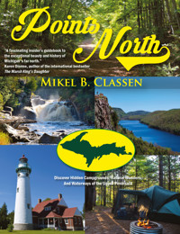
Featuring more than 150 color photos of the U.P.'s most beautiful, historic, and natural locations!
I've spent many years exploring the wilderness of Michigan's Upper Peninsula (U.P.), and one thing has become apparent: no matter what part in which you find yourself, fascinating sights are around every corner. There are parks, wilderness areas and museums. There are ghost towns and places named after legends. There are trails to be walked and waterways to be paddled. In the U.P., life is meant to be lived to the fullest. In this book, I've listed 40 destinations from every corner of the U.P. that have places of interest. Some reflect rich history, while others highlight the natural wonders that abound. So, join in the adventures. The Upper Peninsula is an open book--the one that's in your hand.
"Without a doubt, Mikel Classen's Points North needs to be in every library, gift shop and quality bookstore throughout the country--particularly those located in Michigan's Lower Peninsula. Not only does Classen bring alive the U.P. through his polished words, his masterful use of color photography also makes this book absolutely beautiful. Points North will long stand as a tremendous tribute to one of the most remarkable parts of our country."
--Michael Carrier, author, Murder on Sugar Island
"Mikel Classen's love for Michigan's Upper Peninsula shines from every page in Points North, a fascinating insider's guidebook to the exceptional beauty and history of Michigan's far north. Whether you're still in the planning stages of your trip, or you're looking back fondly on the memories you created--even if you wish merely to enjoy a virtual tour of the Upper Peninsula's natural wonders from the comfort of your armchair, you need this book."
--Karen Dionne, author of the international bestseller, The Marsh King's Daughter
"Many of the places in Points North may sound familiar, but Classen has spent time exploring them all, finding out the wonders others drive by and miss. And some of them may baffle you as much as they did me: the UP has a WWII glider museum? Classen has scoured every inch of the UP, visiting every campground, ghost town, lighthouse, waterfall, and beach that you may have never heard of. This book is full of surprises for even the most knowledgeable visitors to the UP. And if you're like me, you'll find yourself marking up the pages, making notes of places you have to visit next time you're up north."
--Steve Lehto, author of Death's Door: The Truth Behind the Strike of 1913 and the Italian Hall Disaster and Michigan's Columbus: The Life of Douglass Houghton
"Until I read this book, I had not realized the large number of hidden treasures that the U.P. has. More than just an interesting history, this book is a descriptive roadmap to these treasures. Points North can be used as a guide to an adventure you would never have known about on your own. The pictures and place descriptions here are fantastic! These hidden locations have suddenly become easy to find with this book. I recommend it highly."
--Bob Hruska, author of Humorous Hunting, Fishing, and Camping in the U.P. and Canada
Das E-Book können Sie in Legimi-Apps oder einer beliebigen App lesen, die das folgende Format unterstützen:
Seitenzahl: 202
Veröffentlichungsjahr: 2019
Ähnliche


POINTS NORTH
Discover Hidden Campgrounds, Natural Wonders, and Waterways of the Upper Peninsula
Mikel B. Classen
Modern History PressAnn Arbor, MI
Points North: Discover Hidden Campgrounds, Natural Wonders, and Waterways of the Upper Peninsula
Copyright © 2020 by Mikel B. Classen. All Rights Reserved
ISBN-13 978-1-61599-490-8 paperback
ISBN-13 978-1-61599-491-5 hardcover
ISBN-13 978-1-61599-492-2 eBook
Cataloging-in-Publication data is available at the Library of Congress online site
Learn about the author’s other books at www.MikelClassen.com and unlock extra content for this book at www.PointsNorthBooks.com/sites
Distributed by Ingram (USA/CAN/AU), Bertram’s Books (UK/EU)
Published by
Modern History Press
5145 Pontiac Trail
Ann Arbor, MI 48105
www.ModernHistoryPress.com
Tollfree 888-761-6268
Fax 734-663-6861
CONTENTS
Introduction
Au Sable Point Lighthouse – Alger County
Au Train Rising – Alger County
Big Knob State Forest Campground & Hiking Area – Mackinac County
Big Two Hearted River – Luce County
Black River – Gogebic County
Brevort Lakes – Mackinac County
Canyon Falls Roadside Park – Baraga County
Cornish Pump and Mining Museum and World War II Glider Museum – Dickinson County
Donnelley Wilderness Tract – Marquette County
Drummond Island – Chippewa County
Eben Ice Caves – Alger County
Fortune Lakes, Bewabic Historical State Park – Iron County
Grand Island for a Grand Time – Alger County
Iron County Historical Museum – Iron County
Kingston Lake – Alger County
Lake Antoine – Dickinson County
Lake Gogebic – Ontonagon County
Little Girls Point – Gogebic County
Little Presque Isle – Marquette County
Manistique Lakes and Curtis – Schoolcraft County
McCormick Wilderness Tract – Marquette County
McLain State Park – Houghton County
Monocle Lake – Chippewa County
North Country Trail – Entire UP
Old Victoria – Ontonagon County
Pentoga Park – Iron County
Pequaming: Ghost on the Water – Baraga County
Piers Gorge – Dickinson County
Porcupine Mountains – Ontonagon County
Portage Bay State Forest Campground – Delta County
Sault Ste. Marie Campgrounds – Chippewa County
Seney National Wildlife Refuge and Museum – Schoolcraft County
Seul Choix Pointe Lighthouse Park and Museum – Schoolcraft County
Museum of Ojibwa Culture – Mackinac County
Stonington Peninsula – Delta County
Sturgeon River Gorge Wilderness – Baraga County
Twin Lakes State Park – Houghton County
Tyoga Historical Pathway – Alger County
Woodland Park – Alger County
Whitefish Point Maritime Museum – Chippewa County
About the Author
Bibliography
Map Key
U.P. Places of Interest Map
Dedication
This book is dedicated to the Upper Peninsula of Michigan. Its extraordinary beauty has touched my soul every day, and I hope that some of that is reflected in this book. I also want to dedicate this book to Mary Lina Underwood, my wife, without whose wholehearted support this book wouldn’t have been written.
Introduction
This book has been a labor of love that spans many years. The love is for Michigan’s Upper Peninsula (U.P.), its places and people. I’ve spent many years exploring the wilderness of the U.P., and one thing has become apparent. No matter what part you find yourself in, fascinating sights are around every corner. There are parks, wilderness areas, and museums. There are ghost towns and places named after legends. There are trails to be walked and waterways to be paddled. In the U.P., life is meant to be lived to the fullest.
Many years ago, I started writing a feature column called “Off the Beaten Path.” The idea was, for every column, to check out a new place that wasn’t your usual destination, such as Tahquamenon Falls and Mackinac Island. Thus began a lifetime of discovery. The column did well.
One day, my editor received a call from Reader’s Digest Books wanting permission to use the name “Off the Beaten Path.” She gave it. I was horrified. Now we could no longer use the column name I had established for several years. I settled on “Points North,” which I have used since, and it now graces the cover of this book.
One can’t write a book like this without noticing changes to some of the destinations originally slated for inclusion. Specifically, they had disappeared. Most were parks with campgrounds that no longer exist—ghost parks. I come across more and more every day.
Across the Upper Peninsula are dozens of state parks, state forest campgrounds, and U.S. Forest Service campgrounds. Many are in remote places that typically have fewer than 10 campsites. One can have a solitary experience at such locations, as, oftentimes, the number of campers is zero to five. In other words, the campsites’ remoteness makes them rarely used, and therein lies the problem. As budgets are cut, these low-use sites are always in danger of elimination. We need people to find, use, and enjoy these places, because they are slowly going away. Some of these places are highlighted in the book, but many more exist. Chippewa County alone has over 30 of these remote-adventure opportunities.
In this book, I’ve listed 40 destinations from every corner of the U.P. that have places of interest. Some reflect rich history, while others highlight natural wonders that abound across the peninsula. So many sights exist, in fact, that after a lifetime of exploration, I’m still discovering new and fascinating places that I’ve never seen or heard of. So, join in the adventures. The Upper Peninsula is an open book—the one that’s in your hand.
Mikel B. Classen, 2019
Au Sable Point Lighthouse Alger County
Au Sable Point Lighthouse as it appears today. Its light still shines across Lake Superior.
Pictured Rocks National Lakeshore, located on the North Coast of Michigan’s Upper Peninsula, is well known for its scenic beauty, but visitors to the park often overlook its one man-made attraction. Most visitors drive by the nearly unmarked Au Sable Point Lighthouse without ever realizing that the fully intact, historically significant, still functioning lighthouse is there.
Located at the scene of several shipwrecks, this graphic example of life along Lake Superior’s shipwreck coast is located 12 miles west of Grand Marais. The remains of the Mary Jarecki, Sitka, and Gale Staples can still be seen along the shore. Even now, Au Sable Point Light stands isolated on a battered spit of sandstone that endures the fiercest wrath Superior can muster. To the east stands the majesty of Grand Sable Dunes. To the west, forest and miles of beach that merge into the cliffs of Pictured Rocks. Continuing six feet under the surface of the lake, the point becomes a mile-long sandstone reef, a dangerous trap for sailors.
It must have been terrifying, sailing hard toward Grand Marais, a harbor of refuge, the screaming winds and the massive waves pounding against the ship, and then the sickening crunch as the Au Sable sandstone destroyed the hull. Plunging into the angry ice-cold surf would be the only option for survival. Then it was in god’s hands.
In 1871, according to the Marquette Mining Journal, it was deemed that “in all navigation of Lake Superior, there is none more dreaded by the mariner than that from Whitefish Point to Grand Island.” Further, a light was thought more a necessity at Au Sable Point than at any other unprotected location in the district.
Consequently, a light was constructed there and went into operation in August 1874. The same light still stands over 125 years later, a monument to a bygone era.
The light tower is 85 feet high, and the base of it extends 23 feet underground. Written accounts describe when the wind blew so hard that light keepers feared the lighthouse would topple because the tower shook so much. Picture it: You’re tending the light in the top of the tower when the winds of Superior shake and batter everything around. The fear grows in your belly that it all can come down around you.
Walking about the property, one can easily envision the harshness of life that must have permeated even the most mundane of daily chores. Isolation and loneliness were constant companions, and those who couldn’t handle it didn’t last long. Originally it was planned that only one keeper would run the light, but within a year an assistant was assigned, and then a third was put on. But even then the isolation was nearly unbearable. One lighthouse keeper wrote that Au Sable “was just as isolated as if it were 30 miles from land.”
When the lighthouse was first built, there were no roads (the first access road was built in 1939). The only access to Au Sable Point (originally called Big Sable Point) was by boat, usually from Grand Marais, though boats came from Munising as well. Most years the residents were isolated for six months without seeing another soul.
The buildings of the main complex included the main lighthouse keeper’s building, the assistant’s building with the light tower, the fog-signal building, the boathouse, and the oil houses.
Of course, one could stave off the boredom a bit with daily routines. Keeping the steam up in the fog signal and oil filled in the lighthouse were full-time jobs. They were also necessary jobs—a shipwreck on Lake Superior meant death. The lighthouse keeper’s dedication to routine saved lives. Quiet and no emergencies meant the keeper did the job.
When a wreck did happen (after the lighthouse was built the instances dropped), the keepers had to battle the deadliest waters to save sailors’ lives. They used boats a fraction of the size of the ships that the angry waters had just destroyed. A very special individual was needed to deal with life at Au Sable Point.
Au Sable Point is located 1.5 miles northeast of the lower Hurricane River Campground in Pictured Rocks National Lakeshore. The Hurricane River Campground is 12 miles west of Grand Marais on County Road H-58. Visitors park their vehicles in the day-use area and then hike out to the lighthouse along the North Country Trail. Walking the shoreline off the trail will lead to remnants of shipwrecks, the old ribs leaving an eerie feeling of disasters past.
The Au Sable Lighthouse complex has been fully restored, with the last building finished in 2002. A new visitor’s center and bookstore will open in what used to be the main lighthouse keeper’s building. Interpretive programs run daily during the summer months, along with lighthouse tours. On your next trip to the Pictured Rocks National Lakeshore area, don’t miss the point. Nowhere will you have the opportunity for a Lake Superior experience like this.
A kayaker paddles past the shipwreck of the Gale Staples which lies on the shore near the point.
Historical picture of Au Sable Lighthouse in 1874 when it was built.
Author standing atop some of the wreckage of the Mary Jarecki.
The walkway from the fog building to the keeper’s quarters.
One of the best ways to enjoy Au Sable Point is to camp there. On the North Country Trail, about a short half mile past the lighthouse complex, are several tent sites for camping. The view here is breathtaking, and the sites are well sheltered. This way to spend quality time on the shore of Lake Superior is my personal favorite.
If you don’t want to get quite so remote, the Hurricane River Campground is also a wonderful place to camp. It has a lovely beach, and the Hurricane River supports excellent fishing.
For more information on the Au Sable Point Lighthouse, contact Pictured Rocks National Lakeshore at 906-387-3700 or check out its website at www.nps.gov/piro or via http://pointsnorthbooks.com/sites
Au Train Rising Alger County
The village of Au Train as seen from M-28.
Across the Upper Peninsula are many small communities; most struggle daily to survive. Some don’t succeed and become historical footnotes. Au Train is one of those small towns—or so it seemed a few years ago. In recent years, the town has been on the rise.
For a century, Au Train has depended on its natural beauty for its lifeblood. Au Train Lake, Au Train River, and the sand beaches of Au Train Bay on Lake Superior made for a powerful lure in the early 1900s. As resorts sprang up, the one-time logging town became a tourist destination. It has remained so to this day, but in the late ‘90s and early 2000s, the community seemed on its last legs. Resorts were for sale, and the few businesses that remained either barely eked out a living or failed completely.
Suddenly Au Train is transforming—not away from the nice, small town it always has been but into a recreational destination once again. As one shop keeper put it, “When kayaking became popular in Munising and Pictured Rocks, they found us too.”
The Au Train River, similar to paddling the Au Sable of the Lower Peninsula, has always been the best river in the U.P. for a canoe or kayak. Even pontoons cruise it periodically. Not only is it fairly large and wide, but also it connects Au Train Lake with Lake Superior. The river meanders a lot. When it leaves Au Train Lake, the river flows under Forest Lake Road. It then meanders for several miles before going under Forest Lake Road again, not even a mile from where it crossed before. Then it flows for a few more miles into Lake Superior, again barely a mile from where it crossed before. It doesn’t get more paddle-friendly than that. You can take the river in pieces, or you can start at the Au Train Lake Campground and paddle all of Au Train Lake and River.
Au Train Lake Campground is a U.S. Forest Service campground and is located on the south end of Au Train Lake. This 32-site campground is primitive—no hookups and vault bathrooms, though the bathrooms are well taken care of and nice. A boat launch for public access to Au Train Lake and the River is at the site. Like many U.S.F.S. campgrounds, no ATVs are allowed, though the area has an intricate ATV trail system and Au Train Township itself is quite ATV-friendly.
The Au Train Lake Campground also contains the Au Train Songbird Trail, developed by the Michigan Department of Natural Resources, U.S. Forest Service, Hiawatha National Forest, and lots of local folks. The 2-mile interpretive hiking trail through U.P. forest eventually follows an incredibly picturesque stream. Signs depict local songbirds and describe how to recognize them. Local stores sell a songbird cassette tape with each of the birdcalls that are meant to be played along the trail at the signs. You’re on your own for a player.
Alger County is famous for its waterfalls, and Au Train has them too. The turnoff for Au Train Falls runs east, about 100 feet before M-94 when travelling south on Forest Lake Road. It is poorly marked but worth looking for. Au Train Falls consists of two falls: the lower falls, which is easier to access and therefore more visited, and the upper falls, which causes some to say “Am I crazy trying to get to these falls?” The slope leading down to it is very steep and fit for mountain goats. Naturally, I had to investigate. South of the Upper Au Train Falls, the Au Train River is dammed, and the steel spillway runs across the upper falls past the lower for some of the area’s hydroelectricity. This can make the upper falls seem not to flow well, whereas the lower falls flows hard. As I stood at the bottom of the upper falls, I saw no less than six small streams, all coming from springs in the surrounding rock, flowing hard, feeding the Au Train River. This small cradle of life, refusing to be beaten by logging and dams, still flowed, making the Au Train one of the clearest rivers in Michigan.
Forest scene
With cars lining the road at access points to the river, the town of Au Train seems to be prospering. The Northwoods Resort has set up shop at the river crossings, renting canoes and spotting paddlers to launch points along the river. The resort is even now renting fat-tire bikes. The amazing thing to me was the lunch truck it had set up along the river at one of the pull-out points. The truck is parked daily along the Au Train River! The food isn’t bad either.
Old cabin overlooking the picturesque Au Train River, a paddlers paradise.
Where Au Train Lake and Au Train River meet. Some of the historical old resorts can be seen in the distance.
Au Train Falls in mid-summer.
The food isn’t bad anywhere in Au Train. The Au Train Grocery makes good meaty pasties daily. It also serves subs, but I couldn’t get by the pasties. The A&L Party Store, the first place you see when you come into Au Train, serves an excellent pizza by any standards and oven-baked subs that were being made here in Au Train long before Quiznos and those other chains thought of it. When I met my wife many moons ago, she lived in Au Train, and we ate here on a regular basis. It’s still as good, and it’s still owned by the same family. Actually, the same person cooked my sub now as back then.
Au Train is one of the oldest place names along the Lake Superior coast. It was the site of Native American fishing and home of the legendary Face in the Rock carving. Then it became a fur trading post. When Schoolcraft County was reorganized to create Alger County, Au Train was the first county seat. It was home of one of the first UP newspapers, the Au Train Alpha. At one time, nearly one thousand people lived around Au Train. Some of the old homes of Au Train still reflect those early days. Where the railroad once ran, ATVs now follow the old route.
It seems fitting that a place of such antiquity should continue to rise up and thrive in spite of the odds of the modern world. Those that have lived in the Upper Peninsula know what it is. The Finns called it sisu. It’s the refusal to quit when signs indicate you should. Whether Au Train found life or life found Au Train doesn’t matter. What matters is Au Train is rising. How far or how long remains to be seen, but right now the odds are looking good. More info at http://pointsnorthbooks.com/sites
Big Knob State Forest Campground and Hiking Area Mackinac County
Lake Michigan beach at Big Knob Campground. The sandy shore here is great for summer.
This little hidden gem is a few miles west of Naubinway off U.S. 2. Situated on the shore of Lake Michigan, the Big Knob State Forest Campground and Hiking Area is usually known by word of mouth. But, secrets have a way of revealing themselves. Deep in the heart of the Mackinac State Forest, surrounded by primordial forest, an extraordinary experience awaits for one who is willing to find it.
Big Knob is a quiet place and is meant to be that way. With three developed hiking paths, and no public access for boats, noise is a stranger here. But paddlers might want to take note. Carrying a kayak, paddleboard, or canoe to the shore is easy. The reward is a nice paddle on a portion of the Lake Michigan Water Trail.
A nice sand beach here seems to cradle the Lake Michigan waves and is perfect for swimming, paddling, or even a hike along the sand, as it isn’t so soft that walking is difficult. This eases the task of transporting your craft as well. Transport wheels for kayaks work well, though only a couple hundred yards separate the shore from the parking lot.
The real attraction of this park is the hiking trails. The three trails each have their own appeal and degree of difficulty, though none are excessively difficult. Descriptions follow.
Marsh Lake
Big Knob campsite
Marsh Lake Trail
The trailhead for Marsh Lake Trail is at the day- use parking lot at Big Knob, and the trail is an easy hike through the woods. It winds deep into a marshland that has wilderness beauty in a short walk. The trail, about 1.5 miles long, loops back to the road a few hundred yards from its starting point. One can find blueberries along the trail in late July. Marsh Lake itself is an extensive wetland that abounds with wildlife.
Crow Lake Trail
This trail begins about 2 miles up the entrance road to Big Knob and runs about 2.5 miles, requiring a medium-level hiking ability. Many ups and downs roll along the trail, but the effort is worth it. The heavy pine presence in the forest exudes a pleasant fragrance. Crow Lake itself is a wilderness lake, and the hike down to the shore is steep. Although the trail proceeds from that point, don’t follow it. Turn around and head back. It is poorly marked and eventually becomes impossible to follow.
Big Knob Crow Lake
Marsh Lake Trail
Big Knob Trail
This trailhead is also two miles up the entrance road, across from the Crow Lake trailhead. With a length of a half mile, Big Knob Trail is mostly uphill. The hiker catches glimpses of Big Knob Lake in the distance, but foliage blocks most views. Ideally the trail should be hiked when the leaves are off. The path through the trees is beautiful, and the ridge it follows gives the hike its own character.
The Big Knob State Forest Campground and recreation area has 40 sites. The campsites are primitive, and so are the facilities. The water pump is by hand. Large RVs have a difficult time maneuvering in the tight access roads. Sites are largely situated in a hardwood forest in a hollow near the shore, nicely sheltered from any Lake Michigan tantrums.
Big Knob is one of those overlooked places that simply shouldn’t be. Its remote wilderness hiking trails give it a flavor that isn’t matched other places. More info at or http://pointsnorthbooks.com/sites
Big Two Hearted River Luce County
I stepped into the stone-and-sand-bottom river with my waders on and fly rod in hand. My creel bounced against my side, making a hollow sound as I braced myself against the force of the current. From the start, I’d made the decision to do it exactly as he had in the story. I sort indulged a fantasy. “Big Two-Hearted River,” one of Ernest Hemingway’s finest short stories and one of the Nick Adams outdoors tales, is set here in Michigan’s Upper Peninsula, with the river running north of Newberry. The story is about trout-fishing the river and is the epitome of outdoors writing. Hemingway spent a good amount of time fishing the area, and the story makes clear how truly wonderful trout fishing is and the near reverence afforded the sport by the avid trout man. When I read it, I thought taking an excursion up to the Two-Hearted River to see if all the luck Hemingway seemed to have was simply writer’s license would be interesting. What I found was a lot more than just a good fishing hole.
No doubt, Hemingway would probably no longer recognize the area, but I’m sure he would still find it as enjoyable. Over the years, much of the area has been logged and some of it is still in the process of logging. Furthermore, the area was hit hard a few years back by fire. Consequently, some tracts are completely clear, others have full growth, and every stage of development exists in between. Don’t get me wrong—clear-cutting has proven to be not all bad, and I’ll get into why later. The river and its bed remain unchanged, and the surrounding forest sports the old deep hard and soft wood mixture so wonderfully panoramic and so typical for the Upper Peninsula.
Misty morning
Swing bridge walkway


