
Erhalten Sie Zugang zu diesem und mehr als 300000 Büchern ab EUR 5,99 monatlich.
- Herausgeber: Andes
- Kategorie: Lebensstil
- Serie: The Andes, A Guide For Climbers
- Sprache: Englisch
'The Andes - A Guide for Climbers' is the only comprehensive guidebook to the peaks of the Andes.
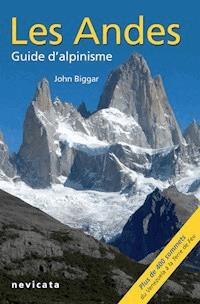
This is the 4th English edition of the only comprehensive climbing guidebook to the peaks of the Andes. It covers many areas not described in any other source. This new edition has expanded coverage of the whole range, with many new photos and route diagrams plus extended coverage of the ski-mountaineering opportunities in the Andes.The book contains details of how to climb all 100 of the major 6000m peaks in the Andes, plus route information for approximately 300 other peaks. There are over 240 route diagrams, 150 additional photos and 80 sketch maps.
Because an unforgettable journey starts with a thorough preparation, find out everything you need to know about climbing the Andes in the Cordiellera Occidental in this guide
ABOUT THE AUTHOR
The author John Biggar is a professional mountaineering instructor based in Castle Douglas, Kirkcudbrightshire, Scotland. His first publication was an internal report for the nuclear physics department at Edinburgh University, entitled "Anisotropies in the Sequential Break-up of Li6". Since those days John has done little nuclear physics but has been climbing and ski-mountaineering in the Andes a lot. He has climbed many of the highest peaks, including 19 of the 20 highest, made over 100 ascents of 6000m peaks, plus 180 ascents of Andean 5000m peaks. He has made first ascents of six 6000m peaks and also made the first ski descent of Domuyo, the highest peak in Patagonia. A professional mountaineering instructor, he runs a business which specialises in mountaineering, skiing and ski-mountaineering expeditions to South America.
Sie lesen das E-Book in den Legimi-Apps auf:
Seitenzahl: 123
Veröffentlichungsjahr: 2015
Das E-Book (TTS) können Sie hören im Abo „Legimi Premium” in Legimi-Apps auf:
Ähnliche


Read This First
This E-book is an extract from “The Andes – A Guide for Climbers”. Included in this E-book are the Introduction and the Appendices from the complete guidebook. Please note that some of the photographs and information in these two sections may not be relevant to this chapter.
DISCLAIMER
Mountaineering is an inherently dangerous activity. The author accepts no liability whatsoever for any loss, injury or inconvenience resulting from the use of this guide. Mountain conditions, especially routes on glaciers, can vary dramatically from one season to the next; always seek local advice on current conditions.
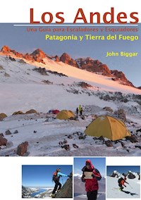
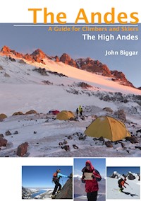
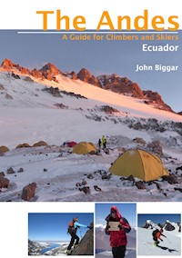
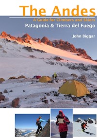
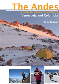
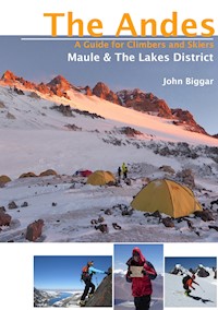
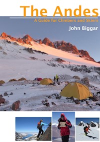
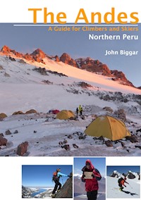
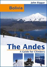
Front cover photo: Volcan Llaima from the peak of Sierra Nevada, Lakes District, Chile.
Front cover inset photos, L to R: Climbing the S face of Palomani, Bolivia. The summit of Cazadero, Argentina. Skiing Volcan Lanin, Argentina.
Title page photo: Espeletia flowers on Pan de Azucar, Sierra Nevada del Cocuy, Colombia.
Photo below: Parinacota and Pomerape from high on Volcan Guallatiri, Cordillera Occidental, Chile.
INTRODUCTION
The Andes are one of the world’s greatest mountain ranges, second in height to only the Himalaya. The range extends the full length of the west coast of South America, often rising straight from the Pacific. Much of the range consists of an upland plateau from 3000-4500m high with scattered mountain ranges and isolated volcanoes rising to over 6000m.
The Andes offer mountaineers an experience that is in many ways half way between the European Alps and the Himalaya. In terms of height, difficulty and access the Andes fall somewhere between the relatively civilised mountains of Europe or North America and the wild peaks of Asia. They are an ideal destination for experienced mountaineers aspiring to greater heights or remoter peaks without the bureaucratic problems of a Himalayan expedition.
Within the Andes you can choose from a complete range of mountaineering experiences. There is something for everyone, from easily ascended volcanoes to desperate ice faces. Peru and Bolivia are countries still steeped in the culture of the Incas, but Chile and Argentina are modern nations very much like a part of Europe. The Andes of Venezuela and Ecuador rise from tropical forests, those of northern Chile rise above the driest desert in the world, those of Patagonia from some of the wettest temperate forest and largest temperate ice-caps in the world.
SCOPE OF THIS GUIDEBOOK
This fourth edition of this guidebook covers the whole of the Andes range. Included are details of how to climb all the major 6000m peaks and the most accessible and popular 5000m peaks, plus information on a selection of the most popular and prominent of the mountains of Patagonia. This edition has extended coverage of the ski-mountaineering opportunities in the range.
This guidebook is intended for the average mountaineer who wants to climb some prominent peaks by moderately interesting routes. In most cases only the easiest ascent route for any peak is described in detail, with other harder routes being described where they are climbed relatively often. The majority of more technically difficult routes are not detailed, but references to where this information can be obtained are given.
This guidebook assumes a basic ability to route find in high mountain terrain and as a consequence fairly brief descriptions are given. A mixture of maps, photos and sketches are used to illustrate the routes as appropriate.
Information is as reliable and accurate as possible. But because this guidebook is a compilation of information from many hundreds of sources and contains over ten thousand items of information complete reliability cannot be guaranteed. Personal experience or the knowledge of close friends was used for the vast majority of the routes described. Other reliable sources have been used for most of the other routes. However to produce a comprehensive guidebook some peaks have been included for which information is scanty or even non-existent; in these cases the best guess at routes and access has been made from visual inspection of the peak and/or maps. One such route description from our second edition was used successfully to make the first ascent of an unclimbed 6000m peak! Hopefully this edition will also inspire further exploration - please let me know what you find out there.
This guidebook is intended to be used along with a good travel guide to the countries concerned which will provide more general information about public transport, hotels, etc.
USING THIS GUIDEBOOK
The mountains of the Andes are described from North to South, split as logically as possible into ranges and areas. Where necessary a secondary West to East order has been used. There is an introduction for each chapter detailing general conditions. The facilities (particularly those useful to climbers) in base towns and cities are described where appropriate.
TIMES
Timings (in days) given in the peak heading bars are for a return trip to climb the one named peak approaching from the base camp or town listed in the access section. Climbing several summits in one area will obviously save on approach times. All these times assume climbers are already acclimatised to the height of the normal base camp/area and are reasonably fit. Because acclimatisation is so crucial at altitude and varies so much between individuals it is difficult to please everyone. For example high but easy and accessible peaks like Pissis and Ojos del Salado, which are both given 4 days in this guidebook, have been climbed from sea level in 24 hours by exceptionally acclimatised people, but each could take a week or more for slower acclimatisers.
The compromise times used in this book should be seen as ‘reasonable minimums’ for fit people with a week or more acclimatisation. These allow for no delays in travelling to the mountain and as much use of 4x4 vehicles as possible. They allow for no route finding problems and no spare days for bad weather, but do allow for further days of acclimatisation high on the mountains if these are thought to be necessary for the average climber. To be sure of a successful ascent it would be wise to plan an extra day or more to allow for bad weather, route finding problems or other unforeseen circumstances. Extra days will almost certainly be needed if relying on public transport.
Times given within the text descriptions (usually in hours) are for ascent only.
NAMES
Names used in the descriptions are normally those used on the recommended map, however there are several spelling systems for translating Quechua and Aymará names via Spanish into English. The system used is the one (consistent with the Spanish alphabet) where HU is used for W and either C, QU or Q is used for K. Alternative names and spellings are given if they are in common use. Translations are given where these are available but many mountain names are not translatable.
HEIGHTS
When possible the height used by the relevant national military mapping agency (IGM) is given. In the case of border peaks on the Chile-Argentina frontier precedence has normally been given to the Chilean heights as their surveys are more recent, more extensive and probably more accurate.
Other sources include Neate’s reference book and the 2000 SRTM (Shuttle Radar Topography Mission) data. The SRTM data has been used to improve the heights of some previously poorly surveyed peaks. The accuracy of any given SRTM height measurement is about 10m. However the data cannot give accurate peak heights since it is based on a 3 second (c.100m) grid. Although the data is fairly useful in areas of low relief (e.g. Puna de Atacama) it is of limited use in areas of high relief like Peru and Bolivia and in areas of extreme relief there is usually no data. In general the SRTM data has only been used in two circumstances 1. When it gives a higher height than accepted surveys (this gives at least a new minimum value for the height) or 2. When it indicates a height that is at least 50m lower than the IGM or previously accepted height. I have received much help over the years on interpreting this data from both Jonathan de Ferranti and Eberhard Jurgalski.
GRADES
For each peak standard UIAA alpine grades (F, PD, AD, D, TD, ED, ED+) are given for the easiest ascent route in ‘normal’ conditions. These alpine grades should be found consistent in any one range but because of the variety of information sources used there may be some variation between ranges. Split grades denote either some uncertainty or mountains where conditions are variable. The AD+, PD-, PD+ etc. grades are not used in the main headings as it is felt they give an impression of a precise grade which does not reflect the very variable conditions in the Andes. N/K denotes that the grade is not known - an estimate of the difficulty will be found in the text.
There is a wide range in the overall physical effort needed to climb the different peaks, (e.g. Huayna Potosi is for this reason an ‘easier’ peak than Aconcagua). No attempt has been made to grade for this, but a glance at the height and number of days needed to climb a peak will give an indication of the effort needed to reach the summit.
An indication will be given in the text whether a route is mainly on rock, snow, glacier or on mixed ground. Pitch grades are occasionally given using the standard UIAA system (I, II, III, IV for rock and 40°, 50° etc. for snow or ice). For a few of the harder rock routes in Patagonia, French grades F6b, F7a etc., are given. A rough comparison table for the lower rock grades is given here.
GRADE VARIATION
The grades given in this guidebook are for good normal conditions and any variation is likely to make routes harder. These effects are particularly severe in El Niño - La Niña cycles; e.g. in summer 1997 the Peruvian ranges were swamped by large quantities of snow and many routes became dangerous, then in summer 1998 there was virtually no snow and many peaks in Peru and Bolivia were bare and icy (and therefore harder). The single biggest factor in these variations is probably the quantity of off-season (winter) snowfall, but the weather patterns of the last month or two will also have an effect. The climatic disturbances of El Niño may also have been to blame for the irregularities experienced in 2002-03 and again in 2010. The simple and sensible solution is to obtain recent local reports on the condition of a peak before attempting it.
PHOTO-DIAGRAMS AND SKETCHES
Arrows indicate the approximate line of a route. Where a route is not shown on a mountain it is for one of two reasons. Either it is because the mountain is climbable with the same degree of difficulty pretty much anywhere, or because the route is on the other side of the peak and a photo of the route was unavailable.
GPS CO-ORDINATES
At altitude, when skiing and particularly on the Patagonina ice-caps the use of a GPS is highly recommended. With a record of vehicle and camp locations and other major route finding waypoints a safe descent should be possible even in bad weather.
Whenever possible GPS co-ordinates have been given for base camps, road-ends, higher camps and summits. These have been given to the nearest arc-second, i.e. about 30m on the ground. As with the sketch maps these are intended to help with general orientation only and are not intended to be a complete set of navigational waypoints. Some peaks may require as many as twenty waypoints.
MAPS
The sketch maps are intended to help with general orientation only and are of very limited use for navigation. Not all mountains, rivers, glaciers etc. are shown. A vehicle track may only be passable to a high wheel base 4x4, a walking route does not imply that there is actually a path and a campsite sign does not imply that there is any water (there certainly won’t be any hot showers!). Please refer to the text for more specific information about route conditions and facilities. All maps have north at the top.
WHERE TO GO AND WHEN TO CLIMB
Please refer to the table on the following page which contains a quick reference summary of the different areas including the best times to travel, reliability of weather and conditions in the best season, type of peaks and accessibility. Unfortunately, at the best times of year peaks will be busiest. When choosing where and when to climb in the Andes one of the main considerations is the climate. Two main factors determine the best climbing seasons in South America. South of the Tropic of Capricorn (the Puna de Atacama and anywhere further south) the best time to climb is the southern hemisphere summer. In the tropical areas covering the remainder of the Andes the best time to climb is in the dry season. This occurs in the hemisphere winter for the area concerned - i.e. around July for Peru and Bolivia and around January for Colombia and Venezuela. There are two transition zones with less well defined seasons - Ecuador is wet most of the year and the Atacama area is dry all year. There is quite a wide variation in the reliability of weather and climbing conditions in the different areas of the Andes and the areas have been given a star rating * to *****, in the table to give a general indication of the reliability of climate and conditions.
Two other main considerations are whether you wish to climb easier volcanic peaks or harder ‘alpine’ peaks (see table on opposite page), and what sort of cultural experience you want. If you want to see llamas, traditional costumes and bustling markets then go to either Peru, Bolivia or Ecuador. If you want a modern country and infrastructure with big air conditioned buses and supermarkets go to Chile or Argentina. Venezuela and Colombia are about half way between these two extremes. This advice should be treated only as a useful generalisation as all the Andean countries are a bit of a mixture between the old and the modern.
GENERAL ADVICE FOR TRAVEL TO THE ANDES
VISAS
At present visas are not needed by most US, Canadian and EU citizens for short stays (up to 60-90 days) in any of the Andean nations. French, Spanish and Portuguese citizens need visas for some countries and Australian, New Zealand and South African citizens will need visas for most countries. Other nationalities may need visas for some or all of the countries. The requirements are sure to change so it is best to check with the embassy in your country.
FLYING TO SOUTH AMERICA
Further details of how to get to each area of the Andes are given in each chapter. There are only a few direct flights from London to South America, e.g. Bogota, Buenos Aires and Sao Paulo.


