Erhalten Sie Zugang zu diesem und mehr als 300000 Büchern ab EUR 5,99 monatlich.
- Herausgeber: Andes
- Kategorie: Lebensstil
- Sprache: Englisch
'The Andes - A Guide for Climbers' is the only comprehensive guidebook about the peaks of the Andes.
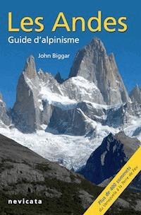
This is the 5th English edition of the only complete guidebook to the peaks of the Andes. It covers many areas not described in any other source. Previous editions have been translated into French, Spanish, Polish and Czech. The author, John Biggar, is a very experienced high-altitude mountaineer who has been climbing and skiing in the Andes for 30 years and has made ascents of over 350 peaks higher than 5000m. The 5th edition includes route information for all 100 of the major 6000m mountains, plus over 300 other peaks. With over 200 diagrams, 270 photos and 80 maps it also gives the best ski-mountaineering peaks in over 10 areas across 5 countries.
Because an unforgettable journey starts with a thorough preparation, find out everything you need to know about climbing and skiing the Andes in this guide !
ABOUT THE AUTHOR
John Biggar is a professional mountaineering instructor based in Castle Douglas, Kirkcudbrightshire, Scotland. His first publication was an internal report for the nuclear physics department at Edinburgh University, entitled "Anisotropies in the Sequential Break-up of Li6". Since those days John has done little nuclear physics but has been climbing and ski-mountaineering in the Andes a lot. He has climbed many of the highest peaks, including 19 of the 20 highest, made over 100 ascents of 6000m peaks, plus 180 ascents of Andean 5000m peaks. He has made first ascents of six 6000m peaks and also made the first ski descent of Domuyo, the highest peak in Patagonia. A professional mountaineering instructor, he runs a business which specialises in mountaineering, skiing and ski-mountaineering expeditions to South America.
Sie lesen das E-Book in den Legimi-Apps auf:
Seitenzahl: 543
Veröffentlichungsjahr: 2021
Das E-Book (TTS) können Sie hören im Abo „Legimi Premium” in Legimi-Apps auf:
Ähnliche


Couverture
Page de titre
DISCLAIMER
Like many activities, mountaineering and skiing are inherently dangerous. The author accepts no liability whatsoever for any loss, injury or inconvenience resulting from the use of this guidebook. Mountain conditions, especially routes on glaciers, can vary dramatically from one season to the next; always seek local advice on current conditions.
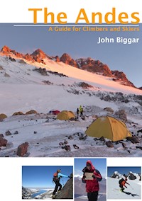
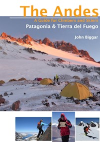
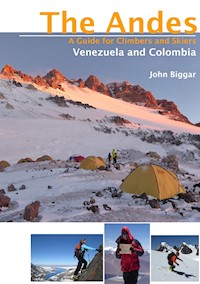
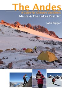
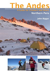
Front cover main photo: Aconcagua at sunset from 5600m at Nido de Condores camp, Argentina.
Front cover inset photos, L to R:-
Scrambling at 5000m on Aricoma Chico, Cordillera Aricoma, Peru.
Thom on his 30th 6000m summit, El Ermitaño, Puna de Atacama, Chile.
Skiing at 5200m on Culin Thojo, Cordillera Real, Bolivia.
Title page photo: Nearing the top of Volcan Villarrica, Chilean Lakes District.
Photo below: Climbing at 5400m on Pico Colon, Sierra Nevada de Santa Marta, Colombia.
Map
INTRODUCTION
The Andes are one of the world’s greatest mountain ranges, second in height to only the Himalaya. The range extends the full length of the west coast of South America, often rising straight from the Pacific. Much of the range consists of an upland plateau from 3000-4500m high with scattered mountain ranges and isolated volcanoes rising to over 6000m.
The Andes offer mountaineers an experience that is in many ways half way between the European Alps and the Himalaya. In terms of height, difficulty and access the Andes fall somewhere between the relatively civilised mountains of Europe or North America and the wild peaks of Asia. They are an ideal destination for experienced mountaineers aspiring to greater heights or remoter peaks without the bureaucratic problems of a Himalayan expedition.
Within the Andes you can choose from a complete range of mountaineering experiences. There is something for everyone, from easily ascended volcanoes to desperate ice faces. Peru and Bolivia are countries still steeped in the culture of the Incas, but Chile and Argentina are modern nations very much like a part of Europe. The Andes of Venezuela and Ecuador rise from tropical forests, those of northern Chile rise above the driest desert in the world, those of Patagonia from some of the wettest temperate forest and largest temperate ice-caps in the world.
SCOPE OF THIS GUIDEBOOK
The fifrh edition of this guidebook covers the whole of the Andes range. Included are details of how to climb all the major 6000m peaks and the most accessible and popular 5000m peaks, plus information on a selection of the most popular and prominent of the mountains of Patagonia. This edition has extended coverage of the ski-mountaineering opportunities in the range.
This guidebook is intended for the average mountaineer who wants to climb some prominent peaks by moderately interesting routes. In most cases only the easiest ascent route for any peak is described in detail, with other harder routes being described where they are climbed relatively often. The majority of more technically difficult routes are not detailed, but references to where this information can be obtained are given.
This guidebook assumes a basic ability to route find in high mountain terrain and as a consequence fairly brief descriptions are given. A mixture of maps, photos and sketches are used to illustrate the routes as appropriate.
Information is as reliable and accurate as possible. But because this guidebook is a compilation of information from many hundreds of sources and contains over ten thousand items of information complete reliability cannot be guaranteed. Personal experience or the knowledge of close friends was used for the vast majority of the routes described. Other reliable sources have been used for most of the other routes. However to produce a comprehensive guidebook some peaks have been included for which information is scanty or even non-existent ; in these cases the best guess at routes and access has been made from visual inspection of the peak and/or maps. One such route description from our second edition was used successfully to make the first ascent of an unclimbed 6000m peak ! Hopefully this edition will also inspire further exploration – please let me know what you find out there.
This guidebook is intended to be used along with a good travel guide to the countries concerned which will provide more general information about public transport, hotels, etc.
USING THIS GUIDEBOOK
The mountains of the Andes are described from North to South, split as logically as possible into ranges and areas. Where necessary a secondary West to East order has been used. There is an introduction for each chapter detailing general conditions. The facilities (particularly those useful to climbers) in base towns and cities are described where appropriate.
TIMES
Timings (in days) given in the peak heading bars are for a return trip to climb the one named peak approaching from the base camp or town listed in the access section. Climbing several summits in one area will obviously save on approach times. All these times assume climbers are already acclimatised to the height of the normal base camp/area and are reasonably fit. Because acclimatisation is so crucial at altitude and varies so much between individuals it is difficult to please everyone. For example high but easy and accessible peaks like Pissis and Ojos del Salado, which are both given 4 days in this guidebook, have been climbed from sea level in 24 hours by exceptionally acclimatised people, but each could take a week or more for slower acclimatisers.
The compromise times used in this book should be seen as ‘reasonable minimums’ for fit people with a week or more acclimatisation. These allow for no delays in travelling to the mountain and as much use of 4x4 vehicles as possible. They allow for no route finding problems and no spare days for bad weather, but do allow for further days of acclimatisation high on the mountains if these are thought to be necessary for the average climber. To be sure of a successful ascent it would be wise to plan an extra day or more to allow for bad weather, route finding problems or other unforeseen circumstances. Extra days will almost certainly be needed if relying on public transport.
Times given within the text descriptions (usually in hours) are for ascent only.
NAMES
Names used in the descriptions are normally those used on the recommended map, however there are several spelling systems for translating Quechua and Aymará names via Spanish into English. The system used is the one (consistent with the Spanish alphabet) where HU is used for W and either C, QU or Q is used for K. Alternative names and spellings are given if they are in common use. Translations are given where these are available but many mountain names are not translatable.
HEIGHTS
When possible the height used by the relevant national military mapping agency (IGM) is given. In the case of border peaks on the Chile-Argentina frontier precedence has normally been given to the Chilean heights as their surveys are more recent, more extensive and probably more accurate.
Other sources include Neate’s reference book and recent satellite digital elevation data. Digital elevation data has been used to improve the heights of some previously poorly surveyed peaks. The accuracy of any given digital elevation height measurement is about 10m. However the data cannot give accurate peak heights since it is based on a 3 second (c.100m) grid. Although the data is fairly useful in areas of low relief (e.g. Puna de Atacama) it is of limited use in areas of high relief like Peru and Bolivia and in areas of extreme relief there is usually no data. In general the digital elevation data has only been used in two circumstances 1. When it gives a higher height than accepted surveys (this gives at least a new minimum value for the height) or 2. When it indicates a height that is at least 50m lower than the IGM or previously accepted height. I have received much help over the years on interpreting this data from both Jonathan de Ferranti and Eberhard Jurgalski.
GRADES
For each peak standard UIAA alpine grades (F, PD, AD, D, TD, ED, ED +) are given for the easiest ascent route in ‘normal’ conditions. These alpine grades should be found consistent in any one range but because of the variety of information sources used there may be some variation between ranges. Split grades denote either some uncertainty or mountains where conditions are variable. The AD +, PD-, PD + etc. grades are not used in the main headings as it is felt they give an impression of a precise grade which does not reflect the very variable conditions in the Andes. N/K denotes that the grade is not known – an estimate of the difficulty will be found in the text.
There is a wide range in the overall physical effort needed to climb the different peaks, (e.g. Huayna Potosi is for this reason an ‘easier’ peak than Aconcagua). No attempt has been made to grade for this, but a glance at the height and number of days needed to climb a peak will give an indication of the effort needed to reach the summit.
An indication will be given in the text whether a route is mainly on rock, snow, glacier or on mixed ground. Pitch grades are occasionally given using the standard UIAA system (I, II, III, IV for rock and 40º, 50º etc. for snow or ice). For a few of the harder rock routes in Patagonia, French grades F6b, F7a etc., are given. A rough comparison table for the lower rock grades is given here.
UIAA
British
USA
French
Australian
I
Mod
5.2
1
-
II
Diff
5.3
2
11
III
V. Diff
5.4
3
12
IV
4a-4b
5.5
4
13
V
4b-4c
5.6
5
14-15
VI-
5a
5.7
5
16-17
VI
5a/b
5.8
6a
18
VI+
5b
5.9
6a+
19
GRADE VARIATION
The grades given in this guidebook are for good normal conditions and any variation is likely to make routes harder. The single biggest factor in these variations is probably the quantity of off-season (winter) snowfall, but the weather patterns of the last month or two will also have an effect. The climatic disturbances of El Niño and La Niña may also have been to blame for the irregularities experienced in 2002-03 and again in 2010-11 and 2014-16. Another major factor is the steady retreat of glaciers, which almost always makes routes harder (and/or more dangerous) than they used to be, due to steepening ice and seracs and recently exposed unstable rock.
The simple and sensible solution is to obtain recent local reports on the condition of a peak before attempting it.
PHOTO-DIAGRAMS AND SKETCHES
Arrows indicate the approximate line of a route. Where a route is not shown on a mountain it is for one of two reasons. Either it is because the mountain is climbable with the same degree of difficulty pretty much anywhere, or because the route is on the other side of the peak and a photo of the route was unavailable.
GPS CO-ORDINATES
At altitude, when skiing and particularly on the Patagonina ice-caps the use of a GPS is highly recommended. With a record of vehicle and camp locations and other major route finding waypoints, such as crevasses and cliffs, a safe descent should be possible even in bad weather.
Whenever possible GPS co-ordinates have been given for base camps, road-ends, higher camps and summits. These have been given to the nearest arc-second, i.e. about 30m on the ground. As with the sketch maps these are intended to help with general orientation only and are not intended to be a complete set of navigational waypoints. Some peaks may require as many as twenty waypoints to make a safe descent.
MAPS
The sketch maps are intended to help with general orientation only and are of very limited use for navigation. Not all mountains, rivers, glaciers etc. are shown. A vehicle track may only be passable to a high wheel base 4x4, a walking route does not imply that there is actually a path and a campsite sign does not imply that there is any water (there certainly won’t be any hot showers !). Please refer to the text for more specific information about route conditions and facilities. All maps have north at the top.
WHERE TO GO AND WHEN TO CLIMB
Please refer to the table on the following page which contains a summary of the different areas including the best times to travel, reliability of weather and conditions in the best season, type of peaks and accessibility. Unfortunately, at the best times of year peaks will be busiest.
When choosing where and when to climb in the Andes one of the main considerations is the climate. Two main factors determine the best climbing seasons in South America. South of the Tropic of Capricorn (the Puna de Atacama and anywhere further south) the best time to climb is the southern hemisphere summer. In the tropical areas covering the remainder of the Andes the best time to climb is in the dry season. This occurs in the hemisphere winter for the area concerned – i.e. around July for Peru and Bolivia and around January for Colombia and Venezuela. There are two transition zones with less well defined seasons – Ecuador is wet most of the year and the Atacama area is dry all year.
There is quite a wide variation in the reliability of weather and climbing conditions in the different areas of the Andes and the areas have been given a star rating * to *****, in the table to give a general indication of the reliability of climate and conditions.
Two other main considerations when choosing an objective are whether you wish to climb easier volcanic peaks or harder ‘alpine’ peaks (see table on opposite page), and what sort of cultural experience you want. If you want to see llamas, traditional costumes and bustling markets then go to either Peru, Bolivia or Ecuador. If you want a modern country and infrastructure with big air conditioned buses and supermarkets go to Chile or Argentina. Venezuela and Colombia are about half way between these two extremes. This advice should be treated only as a useful generalisation as all the Andean countries are a bit of a mixture between the old and the modern.
AREA
BEST SEASON
RELIABILITY
in season
TYPE OF PEAKS
HEIGHT OF PEAKS
ACCESS
VENEZUELA
Sierra Nevada
NDJFM
***
Alpine
4500-5000m
Easy
COLOMBIA
Santa Marta & Cocuy
Los Nevados
DJFM
***
****
Alpine
Volcanic
4500-5700m
4500-5500m
Medium-Diff.
Easy
ECUADOR
Volcanoes
JJASONDJF
**
Volcanic
4500-6300m
Easy
NORTHERN PERU
Cordillera Blanca
Cordillera Huayhuash
Cordillera Central
MJJAS
***
***
****
Alpine
Alpine
Alpine
5000-6800m
5000-6700m
5000-5900m
Easy-Medium
Easy-Medium
Easy-Medium
SOUTHERN PERU
Cordillera Urubamba
Cordillera Vilcanota
AMJJAS
**
***
Alpine
Alpine
5000-6300m
5000-6400m
Medium-Diff.
Medium
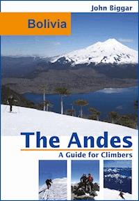
BOLIVIA
Cord. Apolobamba
Cordillera Real
Cordillera Lipez
MJJAS
****
*****
*****
Alpine
Alpine
Volcanic
5000-6100m
5000-6500m
5500-6000m
Medium
Easy-Medium
Medium-Diff.
PERU.BOLIVIA.CHILE
Cordillera Occidental
AMJJASON
*****
Volcanic
5500-6600m
Easy-Medium
ARGENTINA
Chañi and Cachi
SONDJF
***
Alpine & Volcanic
5500-6400m
Medium-Diff.
ARGENTINA/CHILE
Puna de Atacama
NDJFMA
****
Volcanic
5500-6900m
Easy-Difficult
ARGENTINA/CHILE
Agua Negra
Aconcagua Area
DJFM
****
***
Alpine & Volcanic
5000-6400m
5000-7000m
Easy-Medium
Easy-Difficult
ARGENTINA/CHILE
Maule
Lakes District
NDJFM
****
***
Alpine & Volcanic
3000-4700m
2000-3500m
Easy-Medium
Easy
ARGENTINA/CHILE
Chaiten and Aisen
Southern Patagonia
Tierra del Fuego
NDJFM
**
*
*
Alpine, Volcanic & Icecap
2000-4000m
2000-3500m
1500-2500m
Medium-Diff.
Easy-Difficult
Very Difficult
TRAVEL TO THE ANDES
VISAS
At present visas are not needed by most US, Canadian, UK and EU citizens for short stays (up to 60-90 days) in any of the Andean nations. French, Spanish and Portuguese citizens need visas for some countries and Australian, New Zealand and South African citizens will need visas for most countries. Other nationalities may need visas for some or all of the countries. The requirements are sure to change so it is best to check with the embassy in your country.
FLYING TO SOUTH AMERICA
Further details of how to get to each area of the Andes are given in each chapter.
From Europe and the UK there are three main options. 1. Fly with a European airline via a European capital e.g. British Airways from London, Air France via Paris, KLM via Amsterdam, Iberia or Air Europa via Madrid or Lufthansa via Frankfurt. This is often the best option in terms of service and economy. 2. Fly with either United, Delta or American Airlines, via the USA. This is usually more expensive and a bit more time consuming, but there are daily schedules to almost all big South American cities. 3. Fly with a South American airline, either direct or via some other South American city. These flights are usually cheaper and you may get a very good deal with a South American airline if you also need an internal flight in the country concerned. In Europe, the cities of Madrid, Paris, Milan and Frankfurt are well served by LATAM and Avianca.
From North America the cheapest option is often to fly via Miami or Atlanta which are served daily by all the major national South American airlines and United, Delta and American Airlines. These three also have daily services from New York, LA and Houston to many South American capital cities. There are also some direct flights from Toronto on Air Canada.
From Australasia there are LATAM and Qantas flights direct across the Pacific from Australia and NZ to Santiago, or flights often on US airlines, via Los Angeles and/or Miami.
BUDGET AND MONEY
Prices given in this guidebook are given in US$, the most commonly accepted external currency in the region.
South America is not particularly cheap. On the whole it is not expensive either, but expect to pay prices similar to those in the US or Europe for many services, particularly in the more expensive countries like Chile and Argentina. Public transport everywhere is usually a bargain. If you need to save money you can use budget hotels and eat from street stalls, but on an expedition with specific mountaineering objectives these measures may be counterproductive if you end up ill or have all your equipment stolen.
An average expedition staying in clean and secure hotels, eating in reasonable restaurants and using some hired transport and mule services will work out at about US$40-50 per person per day, noticeably more for ascents of Aconcagua, trips to Patagonia or very remote Puna mountains, slightly less in Ecuador and Bolivia. Budgeting carefully and always using public transport you could easily half this figure to under $20 per day and still have a great time.
Money should be taken in a mixture of US$ cash and credit or ATM cards (VISA and MasterCard are good, AMEX is not). Cash dollars can be used readily in some countries and may get you a better exchange rate in countries like Argentina and Venezuela with poor financial systems. They can almost always be used if you’re stuck for local currency. Credit cards are accepted widely by larger businesses in all cities. ATM’s are now widely available in all the main cities, but the system is often unreliable in Argentina and Venezuela.
SPANISH
The more Spanish you speak the easier your trip to South America will be. Some knowledge is essential. Only in Cuzco and a few other tourist centres is much English spoken. Out in the mountains there is no chance of finding anyone who speaks English. It is a fact that people with poor Spanish are more likely to be charged inflated prices by muleteers, drivers, etc., and if things go wrong you could have real trouble getting help. You have to be able to negotiate and make yourself understood to get good prices, good service and to make friends. Make the effort.
ACCOMMODATION
This guidebook does not list recommended hotels in the access towns and cities, for which a regular travel guide or internet booking service will be necessary. Hotel accommodation varies enormously in price and you don’t always get what you pay for, but in most cities you’ll get a comfortable bed, with private bathroom for about US$40-50 for a double room. Accommodation down to about $20 per couple can still be very reasonable, but budget accommodation tends to be shabby, insecure and with poor service. Camping is not a safe or practical option in South American cities.
SECURITY
The author has personally experienced only one theft in thirty years of travelling in South America. The overwhelming majority of Andean people are friendly and honest. You should not be paranoid about crime, just sensible. Don’t get drunk, wander into poor parts of towns, walk down quiet alleys or walk alone at night. If you do any of these things you may get into trouble – if you do more than one you are almost sure to have a problem.
Be especially careful in markets and at bus stations and anywhere that there are lots of tourists. Take taxis round town if arriving late or leaving early or if you’ve lots of luggage. Never put a bag down in the street. Keep your camera hidden.
Armed robbery and banditry, often linked to the drug trade, does occur occasionally in Colombia, Peru, Ecuador and Bolivia but is extremely rare in Chile and Argentina. This is not a problem that should stop you going to South America but take local advice about the current situation and avoid any dangerous areas.
In the mountains there are occasional problems with organised theft of large amounts of climbing kit. The Ecuador peaks, the Q. Ishinca and Alpamayo base camps in the Cordillera Blanca, and the Zongo pass in Bolivia are the areas which have been troubled in the past. In these areas you should consider hiring someone locally to watch your tent. This will only cost a few $ per day and can be better than an insurance policy. In Chile and Argentina and all quieter valleys in Peru and Bolivia, or above the snow-line anywhere, there is virtually no problem.
A more minor problem in some areas is petty theft and pilfering. Never leave any belongings outside your tent when it is unattended during the day or at any time overnight if there are likely to be people around.
HEALTH
For most of the countries concerned the following immunisations are advisable : Tetanus, Typhoid, Polio and Hepatitis A. Yellow fever and Malaria precautions are only needed if you will be below 2500m in forest areas i.e. Venezuela, Colombia, Ecuador and the Amazon side of the Andes in Peru and Bolivia.
Biting insects are very rare in the mountains, but there are very occasionally problems in Peru with black flies or Patagonia with mosquitos. Dogs can be a nuisance, particularly in Peru and Bolivia – to chase them away throw a stone towards them or pretend to throw a stone – some dogs will even back off if you just pretend to pick up a stone !
Remember the problems of cold injury, both frostbite and hypothermia. Above 6000m it is difficult for the body to generate enough heat to keep warm, so good insulating layers are necessary. Peripheral circulation is impaired at altitude so good gloves and warm boots and socks are essential.
Water will need to be purified at all busier camps and in all villages and small settlements. Boiling for two minutes is by far the best, cheapest and safest method. Iodine or Chlorine Dioxide tablets or drops are probably the next best method for mountaineers. Specially designed water filters may clog up rapidly in silty glacial water, are hard work to pump at altitude and are heavier to carry.
A basic medical kit should be carried with plasters, blister kit, needle and thread, spare lip-salve, scissors, strong safety pins and drugs for diarrhoea, headaches, coughs and perhaps altitude illness (diamox, dexamethasone and nifedipine). On more remote trips consider antibiotics, antihistamine, strong painkillers, eye-drops and an anti-inflammatory.
ALTITUDE AND ACCLIMATISATION
Anyone travelling to the high Andes must make themselves aware of the symptoms of altitude illness, both mild and severe. Read and absorb a good textbook such as ‘Medicine for Mountaineering’ by Wilkerson, or better still one specifically on Altitude Illness such as ‘Altitude Illness’ by Bezruchka.
Generally speaking at least a week should be spent over 4000m before contemplating an ascent to over 6000m. A good plan is to spend the first three or four nights at 3000m – many towns and base camp areas in the Andes are at this height. Then spend three or four nights at 4000m, then think about moving to 5000m for two nights and only then attempt a 6000m peak. Spend the first day at each new camp resting. If anyone in the group is ill at any time stop ascending and if the illness persists for more than 24 hours, descend to your last camp. While your body gets used to the altitude you can climb lower peaks, trek, or enjoy the cultural and archaeological sites that are numerous in the Andean nations. Or just chill at base camp with a good book or some music.
After camping for an extended time at 5000m or higher it is a very good idea to descend for a couple of nights (e.g. to 3000m) to allow your body time to rest and recover.
Fitness, particularly heart and lung fitness, certainly helps with performance at high altitude. But it does not protect against altitude illness. Fit people who are poor natural (genetic) acclimatisers are probably the most susceptible to altitude illness because they can push themselves too high and too hard. The risk is even higher on a first trip to altitude. With no history of previous acclimatisation you will not know if you are a good or poor acclimatiser, and on a first visit to altitude you can’t always judge what to expect in terms of effort, shortness of breath, severity of headaches, etc. Everyone should go very cautiously on their first trip to altitude.
Monitoring your pulse is a good idea on early trips to altitude. Even in good acclimatisers your rest pulse will jump by 20-30 % on first exposure to a new sleeping altitude (e.g. from sea level to 3000m, or 3000m to 4000m). However within 2 to 3 days it should return to near normal, at which point it is generally safe to climb to a higher sleeping altitude. On descent to sea level the opposite effect happens, with very low rest pulses for a day or two (see photo) A pulse oximeter is a handy tool to measure your pulse accurately, but a stopwatch will do.
TWO ALTITUDE “MYTHS”
There are two popular aphorisms about altitude which, although partly true, are often mis-interpreted.
1. « Fitness is not important. It doesn’t matter how fit you are you can still get altitude illness ». While the second sentence is true, your fitness is still extremely important for a successful high-altitude expedition. As stated above, the key to avoiding altitude illness is not to push yourself too hard and “over-exercise”. Being as fit as you can be will only help you achieve this. Get fit first, then take it easy when you are at altitude so that you don’t stress your body too hard.
2. « Climb High, Sleep Low »… is another often used phrase that is not entirely correct. While it is certainly not a good idea to sleep any higher than necessary, you do need to sleep at high altitudes to acclimatise to even higher altitudes. It is very hard (and potentially dangerous) to climb a 6000m peak if you haven’t slept above 4000m for at least a few nights. For really high (6500m +) peaks at least a few nights above 5000m are necessary.
Think of your acclimatisation level as a mix, or average, of the altitudes you have climbed, walked and slept at over the last week or two. So someone who sleeps 3 nights at 3000m then 3 nights at 4000m but does no exercise will probably be better acclimatised than someone who sleeps every night at 1000m, but walks every day for only 3 or 4 hours at 3000-4000m. Or to put this another way, 8 hours of exposure to an altitude produces significantly less acclimatisation than 24 hours of exposure to the same altitude.
PLANNING MOUNTAIN EXPEDITIONS
PEAK FEES AND PERMITS
Peak fees are currently only required for Aconcagua in Argentina, costing up to $1000 per person for foreigners to climb in high season (but they do keep the mountain tidy !). There are national park fees in many other areas, but these are usually only a few US$ per person, per day.
Several areas of the Andes now require you to hire a local guide, including all big peaks in Ecuador, some areas of Colombia and (intermittently) the Cordillera Blanca in Peru. These kind of regulations are often brought in after an accident or near-miss, but then rescinded after a few years because of the damage they do to the local tourist economy.
BORDER PEAKS
Problems climbing border peaks are very rare. Officially you need permission to climb a border peak in Chile, but this only ever seems to be enforced around Ojos del Salado and Parinacota. For details of how to obtain permission see page 230. In all border areas you should obviously travel with your passport at all times. If approaching by road you may need to officially leave the country at the last border post and/or you may need to leave your passport with the border guards. Different systems often operate at each individual border control.
MAPS
Alpenvereinskarte of Austria publish a few maps of the Cordillera Blanca and Cordillera Real. Otherwise the best maps are generally those published by the Instituto Geografico Militar (IGM) of the country concerned. These are usually only available from the head office in the capital city, but some are now available from www.omnimap.com Although they are useful, these maps are generally poor. Rivers, roads and snowfields are often incorrectly marked and such features should not be relied on.
In the UK it’s worth trying The Map Shop (01684 593146) or Stanford’s (0207 836 1321) to obtain these and other maps.
The addresses for the national IGM’s are as follows. Opening hours vary – it is best to go in the morning. Take local currency and your passport.
Colombia
Agustin Codazzi, Carrera 30 # 48-51, Bogota
Ecuador
Seniergues E4-676 y Gral. T. Paz y Miño, El Dorado, Quito
Peru
Av. Aramburu 1190, San Isidro, Lima (best to take a taxi)
Bolivia
“Catastro Rural” - a small door on Calle Juan XXIII, near the junction of Calle Rodriguez and Calle Murillo, or the main office at Estado Mayor General, Av. Saavedra 2303, La Paz.
Chile
Dieciocho 369, Santiago (Metro station Los Heroes)
Argentina
Cabildo 381, Casilla 1426, (Subte D to Ministero Carranza), Buenos Aires
OTHER GUIDEBOOKS & ONLINE SOURCES
As already stated, this guidebook does not include general travel information which can be obtained in many other guidebooks and online. Other climbing and walking guidebooks and online resources which might be useful are mentioned in each area introduction and in the bibliography on page 346. Although a bit dated ‘Mountaineering in the Andes’ by Jill Neate is a very useful book for tracking down journal references to obscure peaks and routes.
OBTAINING LOCAL INFORMATION
In Huaraz, La Paz, Mendoza and a few other major mountaineering centres it will be fairly easy to obtain up to date information on the peaks you wish to climb and any access problems. Just ask in the many agencies, the better ones are listed in this book. In places like Cuzco you may be able to get some useful information from the numerous trekking agencies. In most other areas of the Andes there is very little known about the mountains and mountaineering. However even in the smallest and most remote village the locals will know the surrounding area very well and asking around can often produce valuable information on access routes and conditions as well as valuable help in organising transport, accommodation and mules. The author has never been stuck for long in South America ; if you speak Spanish and are not in too much of a hurry the people in out of the way areas are invariably very friendly and helpful. When arriving in an unknown village and needing help with transport or accommodation try asking in shops or cafes, in the town hall or at the police station.
PUBLIC TRANSPORT
Many peaks in this guidebook can be reached reasonably well using public transport, especially if you are prepared to pay for a short taxi ride. Exceptions are mainly in the Cordillera Occidental of Chile and Bolivia and the Puna de Atacama as well as some of the more remote Peruvian and Bolivian ranges. Good areas to go to if you’ll only be using public transport are the Cordillera Blanca, the Cordillera Real, the Sajama area of the Cordillera Occidental, the Mendoza and Santiago area and the Chilean Lakes District.
The abbreviation (PT) in the text denotes the last place on the way to a mountain which can be reached easily and regularly using public transport. Specific details of transport connections are not given as they change so frequently and are available in general travel guidebooks.
HIRED TRANSPORT
In many areas the best way to reach the mountain is by hiring a pick-up or similar 4x4 vehicle with a local driver. This is relatively expensive but very convenient. Expect to pay about $100 for a driver to drop you off 100km away (and another $100 to get picked up). Some spoken Spanish and prior knowledge of the condition of your road are very useful to help negotiate a good price. With a brief written contract and a written record of collection dates and times most drivers are very reliable. To find a driver in an unfamiliar town try either tourist agencies, car hire companies or mountaineering organisations. For short journeys on good roads just use local taxi drivers.
CAR AND 4x4 RENTAL
If climbing multiple peaks in a few days in one area, e.g. the Andean Lakes District, the Puna de Atacama or Cordillera Occidental, then a self drive rental vehicle may be the most economical and practical option. This is particularly the case in Chile and Argentina where driving standards and road standards are relatively high and wages to pay a driver are also higher. While an ordinary car is adequate for the Lakes District a 4x4 camioneta (pick-up truck) will be more useful for the Puna de Atacama and Occidental. See page 24 for some high altitude driving tips.
MOUNTAIN RESCUE
With the exception of Aconcagua there is little reliable and well organised mountain rescue in South America and on most of the higher peaks rescue from an outside agency before you die is extremely unlikely, if not impossible. Expeditions should be self sufficient and able to effect their own rescues. In a few areas where mountaineering is better developed e.g. Cordillera Blanca, Cordillera Real, Ecuador, there is an informal system in place where the local ‘guides’ will assist any mountaineers in trouble but this is likely to take several days at least.
PACK ANIMALS
In many parts of the Andes llamas, donkeys, mules or horses are available to assist with establishing a base camp. They will always come with an arriero (muleteer) to look after them. They are particularly useful for approaching more technical or more remote peaks, where the weight of kit is much higher, but be sure that you can speak a little Spanish to the arriero. Try to get a written contract (though the arriero may not be able to write) and agreed price in writing. Booking through an agency in a town or city will put up the price but eliminate some of the hassles.
Llamas can carry about 20kg, donkeys can carry 40kg, mules and horses up to 60kg. One arriero can look after 3 or 4 animals. Prices are extremely variable. Normal rates in Peru and Bolivia are about US$20 per day per animal and about $30 per day per arriero, but in Argentina and particularly on Aconcagua expect to pay $50 or more per animal per day and $50 or more per day for an arriero. In Peru and Bolivia you will be expected to feed and shelter your arriero, or at least to pay for the food.
In popular areas you can often just turn up and leave with your donkeys and arriero, sometimes within ½h ! In less popular areas you may need to wait one or two days for animals to be gathered and locals to organise themselves to help you. Book in advance if you can.
PORTERS
Porters are readily available in only a few parts of the Andes, such as on the busier peaks of Peru and Bolivia. In many places either the standard of living is too high for this to be attractive work or there is not the mountaineering infrastructure to support these jobs. Rates in Peru and Bolivia are about $20 per persoan per day, up to $50 for porters with glacier skills in the Cordillera Blanca. On Aconcagua and around Chalten in Patagonia porters are also available but will cost from $100-$200 per person per day.
MOUNTAIN GUIDES
There are mountain guides available in a few of the main mountaineering centres in South America, particularly Quito, Huaraz, La Paz, Mendoza and Bariloche. They don’t always have the same level of training and experience as a European or North American guide, even the IFMGA approved guides in Argentina and Peru. In some areas some ‘qualified’ guides are genuinely dangerous. Try to get good reports from someone who knows the guide well and don’t expect to get a cheap guide without compromising your safety.
However there are also many good guides, particularly in Argentina, and they can be well worth hiring as they have extensive knowledge of the local mountains and conditions, are good at organising arrieros, porters etc. and are very fit at altitude. Rates are from about $100 per day in Peru and Bolivia, depending on the size of the group and the technical difficulty of the climb. In Argentina and Chile expect to pay $200 or more per day.
CAMPING FOOD
Most cities have a reasonably good supermarket somewhere – see individual city information entries. The quality and variety of food is very good in Chile and Colombia. Supermarkets are less good in Argentina, Peru, Ecuador and Bolivia, except in the bigger cities. They are often harder to find, tucked away in an affluent suburb. For these countries it’s a good idea to bring some dried or high altitude food from home. In smaller cities, notably Huaraz, there are no good supermarkets but most supplies can be found eventually.
Useful camping food always available in the larger towns in South America includes : - bread, flour, sugar, dried milk, tea and coffee, dried soups, porridge oats, dried potato mix and pasta. Also available are chocolate bars, biscuits, boiled sweets, powdered fruit drinks.
Items not usually available include : - freeze dried food, dehydrated meals, instant puddings.
In some areas such as Huaraz, Cuzco and La Paz, local cooks can be employed for base camp.
FUEL
The recommended fuels to use in South America are either butane gas or white gas (bencina blanca). White gas is now quite easy to find at chemists (farmacias) or hardware stores (ferreterias) in most popular trekking and climbing areas. It ignites easily, burns powerfully and is very clean. Petrol is more dangerous and more likely to cause problems with blocked stoves, but of course is readily and almost universally available.
The best alternative to a white gas stove is a butane (camping) gas stove. The style with a flexible hose are probably the best at altitude because you can pre-heat the cylinder in the warming water. However gas cylinders are expensive and they can be hard to find outside the most popular climbing destinations such as Huaraz, Quito, Cuzco and La Paz. Screw on style cylinders are generally only available in towns like these where there are many climbers or trekkers, but piercing style cylinders are more often available from hardware stores (ferreterias).
Remember that you can’t carry any fuel on an aeroplane.
RENTING AND BUYING EQUIPMENTIN SOUTH AMERICA
If you can possibly avoid it do so. There is some equipment for purchase and rental in major centres like Huaraz, Quito, Cuzco and La Paz where you may even get half decent equipment, but the choice is usually limited and climbing equipment is of dubious origin. In many areas finding any camping equipment to rent will be a long job and finding climbing equipment will be impossible.
CLIMBING CONDITIONS AND HAZARDS
Only conditions and hazards particular to the Andes are mentioned here. All areas suffer to some extent from the usual mountain hazards of bad weather, loose rock, avalanches etc.
SUN
The sun is much stronger at high altitude in the Andes than it is in the mountains of Europe and the USA. It is higher in the sky, the air is thinner, there are fewer clouds and there is generally more snow cover. UV radiation levels rise very rapidly with altitude and snow cover. Levels at 6000m are up to 5 or 6 times higher than those normally encountered at sea level. A hat with a brim and neck flap, glacier goggles and high factor sun cream and lip salve are essential for a safe expedition.
ELECTRICAL STORMS
These are rare compared with the European Alps but do occur from time to time, most frequently in Peru, Bolivia and NW Argentina in the wet season.
GLACIERS
True valley glaciers are common only in the Patagonian Andes where there are some enormous 100km long glaciers. In the rest of the Andes glaciers are normally only found on the steeper upper parts of mountains though there are a few small valley glaciers in the Cord. Blanca and Vilcanota in Peru and in the Santiago area of the High Andes. No glacier in the Cordillera Blanca is even 5km long and the longest glacier in the Santiago area is 15km. Glaciers are receding everywhere. Treat all descriptions of glacier routes in this guidebook with some caution as glacier retreat means many routes are becoming steeper and/or more dangerous and/or significantly harder.
Seracs and crevasses on glaciers in the tropical areas should be treated with at least the same caution as anywhere else. There is some evidence that seracs may be more unstable due to the large daily temperature variations and very strong sun. Crevasses tend to be larger than they are in the temperate Alps or Rockies.
SNOW AND ICE
In the tropical areas, from Colombia to Bolivia, all but the very steepest parts of the mountains are glaciated. Steep serac covered slopes are a feature of this area and make the mountains look very different to the bare rock faces of the summertime Alps or Rockies. In some parts of the Andes snow lies on faces up to 70º and forms unconsolidated snow flutings which give rise to very precarious climbing. The Peruvian Cordilleras (Blanca, Huayhuash, Vilcabamba and Vilcanota) are particularly notorious for these beautiful but dangerous features. In much of Peru there is generally good quality hard ice on north facing slopes while the shaded south facing slopes have the worst of the unconsolidated powder snow. East and west slopes are a bit of a mixture.
Further south, the Cordillera Real of Bolivia has very stable conditions and some of the best hard snow and ice on all faces during the very cold months of June and July. In the Puna and Cordillera Occidental the small glaciers and snowfields also generally remain firm all day.
Conditions around Mendoza, Santiago and down into Patagonia tend to be more like the Alps or Rockies in summer. Snow does not lie on such steep faces, so there are generally more exposed rock faces in this part of the Andes. The snowpack will usually soften considerably during the day and freeze again overnight.
AVALANCHES
Snow and ice slopes tend to be stable in the Andes in the regular climbing seasons. Long spells without precipitation, very cold nights and penitente formations probably account for this. Avalanches undoubtedly happen but seem to be relatively rare in the climbing seasons. Ecuador with its stormy climate has the worst reputation, with some well documented, large and fatal slab avalanches. Fresh snow avalanches have also been seen by the author in the Cordillera Blanca and on Aconcagua. In the driest parts of the Andes, such as the Puna, Cordillera Occidental and Bolivia, avalanches are very rare.
PENITENTES
Penitentes are vertical spikes of snow or ice common in parts of the Andes. At 20cm they are a mild nuisance but at 5m they can make a climb virtually impossible. Formed due to vapour transport properties in very dry air and/or accumulations of dust they are at their worst in the driest areas such as the Puna de Atacama and Cordillera Occidental, but are common also around Aconcagua and in parts of southern Peru and Bolivia. They tend to line up in rows ; climbing with the grain is much easier than going across it. Penitentes can often be seen with binoculars or a sharp eye and avoided. In the Puna and Santiago-Mendoza area they grow during the summer and will be at their worst in February.
While often a nuisance, on the good side penitentes are probably responsible for the low avalanche risk in parts of the Andes. In some areas they can also form nice little walls along the edges of crevasses, preventing snowblind mountaineers from plunging to their deaths !
ROCK QUALITY
With the obvious exception of Patagonia there are few areas of the Andes renowned for good quality rock. Volcanic areas such as the Puna, Cord. Occidental and Ecuador tend to have only extremely poor rock. Much of the Cord. Blanca, Cord. Real and the High Andes of Chile and Argentina are composed of poor shale type rock, though in all three regions there are small areas of granite which give much better climbing. Patagonia, particularly Cochamó and the Fitzroy and Torres del Paine areas, have some superb granite big walls with generally good rock.
MINEFIELDS
These are signalled in Spanish by ‘Zona de minas’ or ‘Campo de minas’. They are a potential hazard in passes on or near the Chile-Bolivia and Chile-Argentina borders. These are probably anti-vehicle mines but they should be presumed dangerous to pedestrians too. Though usually fenced the minefields are not always well marked (and certainly not on maps). Any fence, upright or not, in any remote border area should be treated with some suspicion as it may indicate the edge of a minefield.
LACK OF WATER
On many peaks in the Cordillera Occidental and Puna de Atacama lack of water is a serious problem. The following notes give some tactics for dealing with this logistical problem but the seriousness of running out of water on a remote desert mountain should never be underestimated. Allow up to 5 litres per day per person and don’t put all your supply in one big water barrel ! Always carry a day or two supply on a vehicle when driving.
A recent snowfall will make water logistics much easier. In some cases a fit and well acclimatised party can reach the snow line in only one day from the nearest road. The dry climate and easy nature of the mountains mean a fast and lightweight bivvy expedition can help offset having to carry more water. Another tactic is to climb high and carry snow back down to a lower camp – this is easier than carrying water uphill but should only be attempted if easily achievable.
If nothing else is going to work you may just have to load carry water uphill separately from the other equipment.
EQUIPMENT
CAMPING EQUIPMENT
Tents used at altitude need to be lightweight and strong enough to survive the occasional storm force winds. There are many such tents available these days e.g. those from North Face, Mountain Hardwear, MSR and Terra Nova. Don’t try to use a cheap tent ; it won’t survive the high winds common in many parts of the Andes. Add loops of cord to the main pegging points so that you can use rocks to pitch your tent. Practice pitching and maintaining your tent in extreme weather conditions before you go to the Andes.
Stoves must be robust, able to melt snow quickly and easy to repair in the field. Again it is very worthwhile testing your stove and cooking system in bad weather before your expedition. At altitude a cigarette lighter may be easier to use than matches – flames don’t burn well without oxygen !
Very low temperatures (-20ºC) at night mean a 5 season sleeping bag is more or less essential for camps above 5000m, particularly in southern Peru, Bolivia and the Puna in the coldest months of June and July. See also the following ‘tips’ section for more details on camping equipment.
MOUNTAINEERING EQUIPMENT
One ice-axe and crampons are needed for almost every ascent in this guide. Many routes are also on glaciers and full precautions against a crevasse fall must be taken. This will require a rope, harness, prussik loops and snow and ice belay equipment – and, of course, at least one companion. The knowledge of how to use this equipment to prevent a serious crevasse fall is also crucial. A chest harness (improvised) should be used on glaciers when carrying a heavy rucksack.
Routes of AD or above will obviously require a second ice tool and more belay and climbing equipment. Snow stakes and ice-screws are the most commonly used protection on the harder routes in Peru and Bolivia, with rock protection obviously useful on the mixed routes.
Trekking poles are strongly recommended because they save energy on loose ground (like snow or scree) and at altitude and when carrying heavy packs. Energy savings of c.20-30 % easily make two poles worth the extra weight. The author has also found poles useful for improvised navigation markers, river crossings, fending off dogs, making washing lines and walking with bad blisters.
Snowshoes may be a good idea if attempting some of the less frequently climbed peaks with large snowy plateaux in the Cordillera Blanca and other Peruvian ranges. Hualcan, Copa and Ausangate are all peaks where they could be very useful.
CLOTHING
In most areas clothing suitable for a summer trip to the highest peaks of the European Alps will be suitable for climbing most 6000m peaks. However an extra layer (e.g. down jacket) will be required for early starts and to climb peaks over 6500m. It can feel extremely hot on a glacier at 6000m in the sunshine, but in bad weather hypothermia and frostbite are very real dangers. Wind chill is a particular hazard in the Puna de Atacama and on Aconcagua, where good insulation and windproof layers are essential for the highest 6700m + peaks. Essential items for all peaks are several fleece layers and a complete windproof shell, a warm hat and mountain gloves or mitts.
NAVIGATION EQUIPMENT
A GPS is a highly recommended piece of navigation equipment for many peaks in this guidebook. None of the published IGM maps are adequate for fine navigation in bad weather or at night and most are difficult to use with a compass. In order to safely retrace your steps from a summit take GPS waypoints as necessary during the ascent, paying particular attention to avoid hazardous areas such as cliffs and crevasses.
TIPS FOR HIGH ALTITUDE EXPEDITIONS
This section contains some notes for novices to high altitude which will hopefully make your first expedition run more smoothly. Many climbers fail on their first expedition to high altitude due to poor expedition and logistical skills rather than a lack of climbing skills. High altitude is not the place to learn any new skill. This problem is particularly prevalent on Aconcagua. Here are a few tips to help make things go more smoothly, but the best advice of all is to go out and practice camping in some foul winter weather at home first.
EXPECTATIONS
Don’t travel to South America expecting to achieve as much as you would in the Alps or Rockies. Most Andean peaks are more remote, travel is generally more complicated and altitude will certainly cut down the number of routes you can do in a given time. A typical 3 week expedition might only achieve two or three 5000m peaks followed by two 6000m peaks. Fitness, particularly heart and lung fitness helps with performance at altitude (though its no guarantee you won’t get altitude illness) so get fit before you go to South America.
See page 12 for more information about altitude and acclimatisation and their effects on the body.
REST AND RECOVERY
Remember your body will not recover and repair itself above 5000m. If possible descend to a lower altitude (e.g. 3000m) and better living conditions (e.g. hotels and restaurants) for a rest between peaks. Any acclimatisation you lose will be nothing to what you gain in general fitness and well-being.
PITCHING TENTS
You’ll probably need to pitch your tent with rocks, so either buy one with valances or add on 2m loops of cord (rock guys) to the main pegging points. The wind does not blow tents down, it blows them up, so pitch tents carefully to stop the wind getting underneath the base. If you’re leaving the tent unattended in very stormy weather you can weight the internal groundsheet with some well protected rocks. When pitching on snow and glaciers use either 15cm snow-pegs, (which often bend because they are not strong enough), or fill plastic bags with snow and bury them. Overnight and in storms you can reinforce these with your ice-axes and snow-stakes and/or skis. Never leave anything outside the tent overnight as it may get buried in the snow. Practice pitching your tent in high winds before you travel.
STOVES
If using a petrol stove bring a small wooden board to sit your stove on to prevent it melting down into the snow – this can also help protect vegetation. Melt snow the night before a climb and store it (insulated) in a water carrier (e.g. those by Ortlieb) overnight so that you can get away quickly in the morning. Ice melts faster than snow and both melt faster when immersed in water. Practice using your stove in extreme conditions before you reach 5000m ! Work out how much fuel you will use before leaving home. Generally a litre of white gas or petrol will last two people about five days. A small 190/250g gas cylinder will generally be enough for two people for two nights. A good rule of thumb is that melting snow to get water will require twice the amount of fuel.
SKI STICKS – TREKKING POLES
Use them. They save a lot of energy at high altitude, when carrying a big pack and on loose scree or deep snow.
VEHICLES
Diesel vehicles don’t perform well at altitude due to the cold and low air pressure (which results in poor compression). Unfortunately it is very difficult to get a petrol 4x4, but this is definitely the best solution if it is possible. Otherwise try to rent a 4x4 with as low a mileage as possible so that the engine compression is better, and also make sure the battery is good. Park the vehicle at night so that the engine will be in the sun first thing in the morning (i.e. facing east). Consider using some sort of insulating tarpaulin or blanket over the engine. It may also help to heat the engine compartment by placing a gas stove underneath, or push hot air from a stove into the air intake… but take care !
Poor quality vehicles are common, as are punctures and electrical faults. A few common problems are illustrated below.
ENVIRONMENTAL IMPACT & RESPONSIBLE TOURISM
There is no excuse for the poor attitude of previous generations and previous expeditions. People will follow in your footsteps and have to suffer the consequences of your actions.
1.
Travel as a small lightweight group. Four to six climbers is probably the best size. This is guaranteed to improve your chance of success and reduce your impact.
2.
Carry as little as possible into the mountains and all your refuse back out.
3.
Be careful where you defecate. Use a toilet if there is one. In busy areas try to go during the day when away from camps if at all possible, or walk a long way from the camp and dig a pit to bury your faeces. In very low use areas leave your faeces exposed to the wind and sun. Do not foul water or snow supplies.
4.
Never give unearned gifts. This only encourages begging, which will probably become aggressive. If you give a present in return for a favour or good service try to make it a useful or educational item, e.g. a pen for a child, a pocket knife for an arriero.
5.
Don't give children sweets. In rural areas they often don't have dentists.
6.
Respect privacy when taking photos
7.
Treat local staff (guides, porters, arrieros) with respect and consideration. Look after them if they are ill.
SKIMOUNTAINEERING
Some brief notes follow on the best ski-mountaineering opportunities in the Andes.
The only area to receive significant winter snowfall is from latitude 35º southwards. This is therefore the only area which produces similar conditions to the Alps or North America (but in the Southern Hemisphere spring months of August-October). It is also the only area where the snow-line ever extends significantly below the glaciers and longer ski tours from valley to valley are possible.
In all other areas skiing is almost exclusively on individual mountains and glaciers. In these tropical and sub-tropical areas crevasses are not always as well bridged as they are in the Alps during the spring touring season, potentially making the skiing more dangerous. The best snow conditions in these areas are generally found towards the end of the wet season (i.e. March-May in Peru and Bolivia).
Ski resorts of a reasonable standard exist in several places in the southern Andes. The best of these are the large linked resorts of La Parva, El Colorado and Valle Nevado near the Chilean capital Santiago. Portillo further north in Chile and the small resort of Penitentes near Mendoza are interesting and quirky. Further south in the Chilean Lake District the new resort at Corralco on Volcan Lonquimay, and Pucon-Villarrica on the slopes of the same volcano are good. Chapelco at San Martin and Catedral on the outskirts of Bariloche in Argentina are also both good. Further south are a scattering of small but intriguing resorts and ski-fields. Typically resorts are open from early July to late September.
COLOMBIA
In the Los Nevados range, Nevado El Ruiz is a good, if short, ski peak with few crevasses and nice slopes. In the north of the country, in the Sierra Nevada del Cocuy the peak of Ritacuba Blanco can also be skiied, generally with good snow conditions. The final summit pyramid is often 45º. Best season is probably November-March.
ECUADOR
Only the big four peaks, Chimborazo, Cotopaxi, Cayambe and Antisana can sensibly be skied and all have some potentially dangerous crevasses and relatively high avalanche risk. However access to all the peaks is very easy, with roads almost to the snow-line.
CORDILLERA BLANCA
Several areas provide good ski-mountaineering opportunities. The Copa and Hualcan massif is reputed to make a good ski traverse, although it is a long climb to the snow-line. Huascaran has been skied and snowboarded and steep peaks like Tocllaraju and Artesonraju have been skiied by the brave. Several areas further south with lower peaks, such as the Raria group, are more limited but often much less crevassed. Best season is the end of the wet season, about April-June.
BOLIVIA
The most extensive glaciated area is the Sorata massif and Ancohuma probably provides the best opportunity to ski a really big peak in the Cordillera Real. The Khara Khota valley makes a great base from which to do multiple smaller peaks of about 5000m, see page 165-167. At the southern end of the Cordillera Real the peak of Mururata is an ideal ski peak. Parts of the Apolobamba, e.g. Huellancalloc and around Ascarani, could also offer good skiing. Chacaltaya, at over 5000m, used to have the worlds highest drag tow but the skiing is now only occasionally possible. The best season is the end of the wet season, about April-June.
CORDILLERA OCCIDENTAL
Sajama and Parinacota have both been skied, and are both very good under good snow conditions. In Peru the massive plateau of Coropuna (12km continuously above 5900m) would make a fine traverse. A common problem in this range are the penitentes which can easily make skiing impossible – recent wet season snow or significant recent wind packed snow will be required. The best season is generally March to May.
PUNA DE ATACAMA


