6,99 €
Mehr erfahren.
- Herausgeber: Books on Demand
- Kategorie: Lebensstil
- Sprache: Englisch
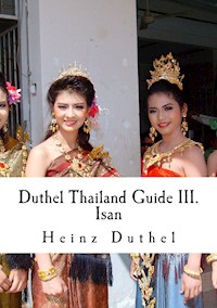
Duthel Thailand Guide III. Isan - 16th. Edition 2015 Isan Amnat Charoen Province The Bodyguard 2 Bueng Kan Province Buriram Province Chi River Chrieng Brunh Dynamite Warrior Economy of Isan History of Isan Hua Na Dam I-San Special Isan language Tony Jaa Kai yang Kalasin Province Kantrum Khao Yai National Park Khon Kaen Khon Kaen Province Khon Kaen Silk Festival Khorat Plateau Lam Phra Phloeng Dam Loei Province Maha Sarakham Province Mekong
Sie lesen das E-Book in den Legimi-Apps auf:
Seitenzahl: 719
Veröffentlichungsjahr: 2015
Ähnliche


Table Of Contents
30
index_split_007
index_split_006
index_split_005
index_split_004
index_split_003
index_split_002
index_split_001
Copyright
30
Thailand Guide III. Isan
Isan – 16th. Edition 2015
Heinz Duthel
Copyright © 2015 Heinz Duthel
All rights reserved. ISBN-13:978-1475106817
ISBN-10:1475106815
CONTENTS
Mekong River Basin Hydropower
Mukdahan Province
Mun River
Na Khun Yai
Naga fireball
Nakhon Phanom Airport
Nakhon Phanom Province
Nakhon Phanom Royal Thai Navy Base
Nakhon Ratchasima
Nakhon Ratchasima Province
Nam Phong Dam
Nong Bua Lamphu Province
Nong Khai Province
Pak Mun Dam
Phanom Rung historical park
Phetchabun Mountains
Phi Ta Khon
Phimai historical park Phra That Phu Pek Phu Phan Mountains Pong lang
Rocket Festival
Roi Et Province Sato (rice wine) Sirindhorn Dam Sisaket Province Som tam
Son of the Northeast Khamsing Srinawk Pira Sudham
Surin Elephant Round-up
Surin Province
Tongpan
Tua Tham alphabet
Ubol Ratana Dam
Ubon Ratchathani
Ubon Ratchathani Candle Festival
Ubon Ratchathani University
Udon Thani
Udon Thani Province
Wot (instrument) Yam Yasothon Yasothon Province
Alcohol advertising in Thailand
Censorship in Thailand
Constitutional Court of Thailand
Copyright law of Thailand
Foreign Business Act of 1999 (Thailand) Internet censorship in Thailand
Law of Thailand
Legal profession in Thailand LGBT rights in Thailand Ministry of Justice (Thailand)
Psychotropic Substances Act (Thailand)
Royal Thai Government Gazette
Rulings of the Constitutional Court of Thailand
Utthalum
Media of Thailand
Asia Times Online
Edith Clampton
Monarchy of Thailand
1924 Palace Law of Succession
Amarindra
Bureau of the Royal Household
Crown Prince of Thailand
Dusit Palace Emerald Buddha Grand Palace
Great Crown of Victory
Inthawichayanon
The King Never Smiles
List of children of Chulalongkorn
List of Thai Monarchs
Chao Keo Naovarat
Rama (Kings of Thailand) Rambhai Barni
Royal Barge Procession Royal Flags of Thailand Royal Nine-Tiered Umbrella Royal Staff
Royal Standard of Thailand Sansoen Phra Barami Saovabha Bongsri
Savang Vadhana
Sukhumala Marasri Intavaroros Suriyavongse Sword of Victory
Thai royal and noble titles Thai Royal Guards parade Thong Daeng
Uparaja
ISAN
Isan (Isan/Thai: ]; also written as Isaan, Isarn, Issan, or Esarn; ) is the northeastern region of Thailand. It is located on the Khorat Plateau, bordered by the Mekong River (along the border with Laos) to the north and east, by Cambodia to the southeast and the Prachinburi mountains south of Nakhon
Ratchasima. To the west it is separated from Northern and Central Thailand
by the Phetchabun mountain range.
Since the beginning of the 20th century, northeastern Thailand has been
officially known as Isan, a term adopted from Sanskrit Ishan, meaning in a “north east direction.” The term “Isan” was derived from Isanapura, the capital of the Chenla kingdom. The Lao-speaking population of the region, who comprise the majority, distinguish themselves not only from the Lao of Laos but also from the central Thai by calling themselves Khon Isan or Thai Isan. The Khmer-speaking minority and Kuy (Suai), who live in the south of Isan, speak dialects and follow customs more similar to those of Cambodia than either the Thai people or the Lao people.
Agriculture is the main economic activity. Production lags behind the rest of the country due to the socio-economic conditions and the exceptionally hot, dry climate. Isan remains Thailand’s poorest region.
The main language is Isan, which is a dialect of the Lao language. Currently written with the Thai alphabet (instead of the slightly different Lao alphabet), Isan belongs to the Chiang Seng and Lao–Phutai language groups, which along with Thai are members of the Tai languages of the Tai–Kadai language family. Thai is also spoken by almost everyone. Khmer, the language of
Cambodia, is widely spoken in areas along the Cambodian border: Buriram, Surin, and Sisaket. The people are aware of their Lao ethnic origin, but Isan has been incorporated into the modern Thai state. Several Thai prime ministers have come from the region.
Prominent aspects of Isan culture of include mor lam (Thai: หม ล ), an
indigenous type of folk music, Muay Thai (Thai: มวยไทย) boxing, cock fighting, and celebratory processions (Thai: กระบว ). Isan food, in which sticky rice (Thai: ว ห ยว, khao niao) and chiles are prominent, is distinct from Thai cuisine. Sticky rice is a staple of Thai Northeastern cuisine, and it accompanies most meals.
History
The term isan has been said to mean “northeast” in the Thai language. Isan
has a number of important Bronze Age sites, with cliff paintings, artifacts and early evidence of rice cultivation. Iron and bronze tools, such as found at Ban Chiang, may predate similar tools from Mesopotamia. The region later came under the influence of the Dvaravati culture, followed by the Khmer empire.
The latter built dozens of prasats (sanctuaries) throughout the Isan region; the most significant are at Phimai and Phanom Rung.
After the Khmer empire began to decline from the 13th century, Isan was
dominated by the Lao Lan Xang kingdom, which had been established by Fa Ngum. Due to scarcity of information from the periods known as the Dark ages of Cambodia, the plateau seems to have been largely depopulated. There were few if any lines of demarcation, for prior to the 19th century introduction of modern mapping, the region fell under what 20th century scholars called the Mandala (Southeast Asian history) system. Accordingly, in
1718 the first Lao muang in the Chi valley — and indeed anywhere in the interior of the Khorat Plateau — was founded at Suwannaphum District (in present-day Roi Et Province) by an official in the service of King Nokasad of the Kingdom of Champasak . The region was increasingly settled by both Lao and Thai emigrants. Siam held sway from the 17th century, and carried out forced population transfers from the left (east) bank of the Mekong to the right bank in the 18th and 19th centuries — which became most severe following the Laotian Rebellion for independence of 1826–29. In the wake the Franco-Siamese War of 1893, the resulting treaty with France and the Anglo-Siamese Treaty of 1909 made the plateau no longer considered Lao, but the border region between Siam and the Laos of French Indochina.
In the 20th century, a policy of nationalist “Thaification” promoted the incorporation of Isan as an integral part of Thailand and de-emphasised the Lao and Khmer ethnicities of the residents. The national government claimed (incorrectly) that the name “Isan” was derived from that of Iśāna (Sanskrit:
), a manifestation of Shiva as deity of the northeast, and the Sanskrit word for northeast. This interpretation was intended to reinforce the area’s
identity as the northeast of Thailand, rather than as a part of the Lao world.
But, the name was used during the period when the territory of modern-day Thailand was ruled by the Mon and Khmer kingdoms. It predates any Thai or Lao populations. The name does not refer to the “north east”; it refers to “invisible power” and is derived from the area’s pre-Thai and pre-Angkorian history.
Before the central government introduced the Thai alphabet and language in regional schools, the people of Isan wrote in the Lao alphabet, a similar script. Most Isan people still speak the Isan language, a dialect of the Lao language.
A significant minority also speak Northern Khmer. The Kuy people, who are concentrated around the core of the Isanapura kingdom, and known as “Khmer Boran” or ancient Khmer, speak other Katuic languages, a link to the region’s pre-Siamese history as part of the Mon–Khmer kingdom of Chenla. Geography
Isan covers unknown operator: u’,‘unknown operator: u’,‘unknown operator: u’,’ (unknown operator: u’strong’unknown operator: u’,‘sq mi) making it slightly larger than England and Wales together, about half the size of
Germany, four times the size of Switzerland, twice the size of Austria, and just under twice the size of the US state of Maine. It is roughly coterminous with the Khorat Plateau, which tilts from the Phetchabun mountain range in the west of the region (the location of several national parks) down toward the Mekong River. The plateau consists of two plains: the southern Khorat plain is drained by the Mun and Chi rivers, while the northern Sakon Nakhon plain is drained by the Loei and Songkhram rivers. The two plains are separated by the Phu Phan mountains. The soil is mostly sandy, with substantial salt deposits.
The Mekong forms most of the border between Thailand and Laos to the north and east of Isan, while the south of the region borders on Cambodia. The Mekong’s main Thai tributary is the Mun River, which rises in the Khao Yai National Park near Khorat and runs east, joining the Mekong in Ubon Ratchathani Province. The other main river in Isan is the Chi River, which flows through central Isan before turning south to meet the Mun in Sisaket Province. The smaller Loei and Songkhram rivers are also tributaries of the Mekong, the former flowing north through Loei province and the latter flowing east through Udon Thani, Sakon Nakhon, Nakhon Phanom and Nong Khai provinces.
The average temperature range is from 30.2 °C to 19.6 °C. The highest temperature recorded was 43.9 °C in Udon Thani, the lowest -1.4 °C at Sakhon Nakhon Agro Station.
Rainfall is unpredictable, but is concentrated in the rainy season from May to
October. Average annual precipitation varies from 2000 mm in some areas to
1270 mm in the southwestern provinces of Nakhon Ratchasima, Buriram, Maha Sarakham, Khon Kaen and Chaiyaphum. The rainy season begins with occasional short but heavy showers, eventually raining very heavily for longer periods almost every day, usually in the late afternoon or at night, until it ends abruptly at the onset of the cool season.
The other seasons are the cool season from October to February, when the people sit outside around fires in the evenings, and the hot season from February to May with its sudden peak of high temperatures in April.
Economy
Agriculture is the largest sector of the economy, generating around 22% of the Gross Regional Product (compared to 8.5% for Thailand as a whole). Sticky rice, the staple food of the region, is the main agricultural crop (accounting for about 60% of the cultivated land). It thrives in the poorly drained paddy fields, and where fields can be flooded from nearby streams,
rivers and ponds, often two harvests are possible each year. Farmers are increasingly diversifying into cash crops such as sugar cane and cassava (manioc), which are cultivated on a vast scale, and to a lesser extent, rubber. Silk production is an important cottage industry and contributes significantly to the economy. The long, narrow fertile province of Nong Khai Province,
which stretches along the Mekong River, is also noted for the production of pineapples, tobacco (which is dried, cured and shredded by the families before collection by the cigarette manufacturers) and tomatoes, which are grown on an industrial scale, particularly around the town of Sri Chiang Mai. Despite its dominance of the economy, agriculture in the region is extremely problematic. The climate is prone to drought, while the flat terrain of the plateau is often flooded in the rainy season. The tendency to flood renders a large proportion of the land unsuitable for cultivation. In addition, the soil is highly acidic, saline and infertile from overuse. Since the 1970s, agriculture has been declining in importance as the trade and service sectors have been increasing.
Very few farmers still use water buffalo rather than tractors. Nowadays, the
water buffalo are mainly kept by almost all rural families as status symbols. The main piece of agricultural equipment in use today is the ‘rot tai na’ (Thai: รถไถ , lit. “vehicle plow field”) colloquially referred to as ‘kwai lek’ (Thai: ว ย หลก, or “iron/steel buffalo”), or more generally by its manufacturer’s name of “Kobota”, a mini tractor comprising a small diesel engine mounted on two wheels with two long wooden or metal handlebars for control and steering. It is usually attached to a trailer or a plow. Buffalo are now mainly used for grazing on the stubble in the rice paddy, which they in turn fertilize with their manure. The main animals raised for food are cattle, pigs, chickens, ducks and fish. Isan is the poorest region of Thailand: in 2002 average wages were the lowest in the country at 3,928 baht per month (the national average was
6,445).
The region’s poverty is also shown in its infrastructure: eight of the ten provinces in Thailand with the fewest physicians per capita are in Isan (Sisaket has fewest, with one per 14,661 in 2001; the national average was
3,289); it also has eight of the ten provinces with the fewest hospital beds per head (Chaiyapum has fewest, with one per 1,131 in 2001; the national average
was 453). Nevertheless, as in the rest of Thailand, all districts (Amphoe) have a hospital, and all sub districts (tambon) have a clinic providing primary health care. The introduction of the “30 baht” health card has dramatically changed the numbers of those attending hospitals for treatment, as it has meant that full health care is available to all who register for only 30 baht per visit. The few who can afford it travel to the modern private hospitals and clinics in the large cities for non-urgent specialist consultations and care.
The region also lags in new technology: there was only one Internet connection per 75 households in 2002 (national average one per 22
households), [update needed] but by 2006 every district town (amphoe) had at least one publicly accessible internet connection, either in the local computer shop or in the district office. Extension of landline telephones to remote areas not previously served has been largely superseded by the use of cell phones, primarily of the GSM format, which now covers the entire region
with the exception of a few sparsely populated mountainous areas and large national parks. Many people, even the poorest and sometimes children, have cellular telephones, although they have no fixed-line telephone. The region also has the lowest literacy rate [source?] when compared with other regions in Thailand. By the beginning of 2008, most of the amphoe (district towns of the provinces) had been provided with ADSL by the TOT, still leaving, however, the vast majority of the rural population dependent on dial-up connections – for those who have landline telephones – which are totally inadequate for the megabyte-hungry packages of data of 21st century information. Internet shops are now experiencing a boom for those able to get to them, and are heavily patronized by primary and secondary schoolchildren who come not only to use the Internet but also to play on-line games, use VOIP, or just to use the computer and printing facilities. An increasingly significant number of customers in the Internet shops, particularly in the cities, are young ladies searching for future Western husbands on the numerous dating sites. Resident Western expatriates, and foreign tourists are also frequent customers. For those outside the district towns who require a serious use of the Internet in their homes, an iPstar broadband satellite connection is the only alternative; although four times more expensive than a DSL connection, it is far less reliable and suffers considerable down-time due to overloading, heavy cloud cover, and rain and despite – in theory – being ‘always on’, it often lacks the stability for streaming and clarity of VOIP.
Many Isan people seek higher-paying work outside the region, particularly in
Bangkok. Some of these people have settled permanently in the city, while
some migrate to and fro. Others have emigrated in search of better wages. Rather than relocate as a family, they usually leave their babies and school-age children in the care of relatives, friends or neighbours.
Demographics
Isan’s total population as of 2010 was 21,305,000. Forty percent of the population is concentrated in the provinces of Khorat, Ubon Ratchathani, Udon Thani and Khon Kaen. These provinces surround the four major cities of the same names; as of 2010, their populations were: Khorat 142,169; Udon
Thani 137,979; Khon Kaen 113,828; and Ubon Ratchathani 83,148. However, as of 2010 only 50% of the region’s population lived in municipal areas. Kalasin was the most urbanised province (with almost 100% in municipal areas), and Roi Et the least (2.8%). Thus, the population is still largely rural, but concentrated around the urban centres.
The main language of the region is Isan, which is a dialect of the Lao language. Northern Khmer, a dialect of the Khmer language of Cambodia, is also spoken in the southeast. Standard Thai is understood by everyone and is used for all official matters. The number of speakers of Isan has been
estimated at between 15 million and 23 million, the majority of these being in
Isan.
The Khorat dialect, spoken by around 400,000 people, occupies a linguistic position somewhere between Isan and standard Thai.
There is a substantial Khmer minority, concentrated in the southern provinces of Buriram, Surin, and Sisaket, and some Vietnamese refugees in
Mukdahan and Nakhon Phanom.
Other languages spoken in Isan, mainly by tribal minorities, are as follows: Language Family Speakers Distribution
Aheu Mon–Khmer 750 Sakon Nakhon
Eastern Bru Mon–Khmer 5000 Sakon Nakhon
Western Bru Mon–Khmer 20,000 Mukdahan, Amnatcharoen, Ubon Khmer Surin Mon–Khmer 1,000,000 Surin, Sisaket, Buriram, Khorat Kuy Mon–Khmer 300,000 Buriram, Surin, Sisaket, Ubon, Roi Et
Nyah KurMon–Khmer Unknown Khorat, Chaiyaphum
Nyaw Tai–Kadai 50,000 Sakon Nakhon, Nong Khai, Nakhon
Phanom
Nyeu Mon–Khmer Unknown Sisaket
Phu Thai Tai–Kadai 156,000 Nakhon Phanom, Ubon, Kalasin, Sakon
Nakhon
Phuan Tai–Kadai Unknown Udon, Loei
Saek Tai–Kadai 11,000 Nakhon Phanom
So Mon–Khmer 55,000 Nakhon Phanom, Sakon Nakhon, Nong Khai, Kalasin
Tai Dam Tai–Kadai 20,000 Nong Khai, Khorat, Loei (plus Saraburi) Yoy Tai–Kadai 5,000 Sakon Nakhon
Education
Education is well provided by the government in terms of numbers of
establishments and is supplemented in the larger cities by the private sector (mostly Catholic schools and international schools). Following the national pattern of education in Thailand, there are primary (elementary) schools in all larger villages and (tambon) capitals, with secondary (high) schools to Grade
12 (approximately age 18) in the district (amphoe) towns. Many other
secondary schools provide education only to Grade 9, while some combined schools provide education from Grade 1 through Grade 9. Rural schools are generally less well equipped than the schools in the large towns and cities and the standard of instruction, particularly for the English language, is much
lower. Many children of poorer families leave school after Grade 6 (age 12) to work on the farms. A number move to areas of dense or tourist populations to work in the service industry. Many primary schools also operate their own websites and almost all schoolchildren in Isan, at least from junior high school age, are now (2008) largely computer literate for basic programs: they
are well adept in the use of word-processing, layout of flyers, brochures and birthday cards, and simple, digital photo enhancement software.
There are 43 (2001) government vocational and polytechnic colleges throughout the region, several specialised training colleges in the private sector, and large colleges of agriculture and nursing in Udon Thani province. Universities are located in the major cities of Khon Kaen (one of the country’s largest), Ubon Ratchathani, and the smaller provincial capital of Mahasarakham. Some Bangkok-based universities have a small campus in Isan, and Khon Kaen university also maintains a large installation on the outskirts of Nong Khai. For a full list of universities in Isan see the list of universities in Thailand. Most provinces have a government Rajabhat University, formerly Rajabhat Institute, traditionally a teacher training college. Culture
Isan’s culture is predominantly Lao, and has much in common with that of
the neighbouring country of Laos. This affinity is shown in the region’s cuisine, dress, temple architecture, festivals and arts.
Isan food is distinct from Thai and Lao cuisines, but has elements in common with each. The most obvious characteristics are the use of sticky rice that accompanies almost every meal rather than plain rice, as well as fiery chiles. Popular dishes include tam mak hung, or in central Thai, som tam (papaya salad), larb (meat salad) and gai yang (grilled chicken). These have all spread to other parts of Thailand, but normally in versions which temper the
extreme heat and sourness favoured in Isan for the more moderate Central
Thai palate.
Conversely Central Thai food has become popular in Isan, but the French and Vietnamese influences which have affected Lao cuisine are absent. The people of the region famously eat a wide variety of creatures, such as lizards, frogs and fried insects such as grasshoppers, crickets, silkworms and dung beetles. Originally forced by poverty to be creative in finding foods, Isan people now savour these animals as delicacies or snacks. Food is commonly
eaten by hand using the sticky rice pressed into a ball with the fingers as a tool. Soups are a frequent element of any meal, and contain either vegetables and herbs, noodles, chunks of fish, balls of ground pork or a mixture of these. They are eaten using a spoon and chopsticks at the same time.
The traditional dress of Isan is the sarong. Women’s sarongs most often have an embroidered border at the hem, while men’s are in a chequered pattern. Men also wear a pakama—a versatile length of cloth which can be used as a belt, a money and document belt, as headwear for protection from the sun, as
a hammock or as a bathing garment. Isan is the main centre for the production of Thai silk. The trade received a major boost in the post-war years, when Jim Thompson popularised Thai silk among westerners. One of the best-known types of Isan silk is mut-mee, which is tie-dyed to produce geometric patterns on the thread.
The Buddhist temple (or wat) is the major feature of most villages. These temples are used not only for religious ceremonies, but also for festivals, particularly mor lam, and as assembly halls.
They are mostly built in the Lao style, with less ornamentation than in Central
Thailand. Lao style Buddha images are also prevalent.
The people of Isan celebrate many traditional festivals, such as the Bun Bungfai Rocket Festival. This fertility rite, originating in pre-Buddhist times, is celebrated in a number of locations both in Isan and in Laos, but most vigorously and most famously in Yasothon province. Other Isan festivals are
the Candle Festival, which marks the start of vassa in July in Ubon and other locations; the Silk Festival in Khon Kaen, which promotes local handicrafts; the Elephant Round-up in Surin; and the bangfai phayanak or Naga fireballs of Nong Khai.
The main indigenous music of Isan is mor lam; it exists in a number of regional variants, plus modern forms. Since the late 1970s it has acquired greater exposure outside the region thanks to the presence of migrant workers in Bangkok. Many mor lam singers also sing Central Thai luk thung music,
and have produced the hybrid luk thung Isan form. Another form of folk music, kantrum, is popular with the Khmer minority in the south. Although there is no tradition of written secular literature in the Isan language, in the latter half of the 20th century the region produced several notable writers, such as Khamsing Srinawk (who writes in Thai) and Pira Sudham (who writes in English).
Mor lam needs a special mention as its festival-type production which is very commonplace in Isan, has not been exported to other regions. Although it is
a very exciting affair, not being on the tourist trail it is largely ignored by foreign visitors. When the locals speak of mor lam (pronounced mor’ram with stress on the second syllable), one will often hear them say pai doo morram (lit. ‘go see mor’ram’). They are referring to the most common form of evening entertainment in the region. Somewhere, in a village within easy reach, there will be a mor lam festival on a Friday or Saturday evening. Usually, the rock-festival sized stage is constructed either in a temple compound or on a sports field. Thousands of people will sit on mats on the ground and watch the fun-filled program of variety entertainment. The traditional music and song is accompanied by extremely colorful choreography, executed by a group of up to fifty female (and some male katoey) dancers. The fantastic costumes are changed several times throughout the program, and the transitions are bridged by often raunchy gags, slap-stick comedy, and speeches by local dignitaries. A mor lam festival is a family affair and the area is surrounded by food and drink stalls.
Isan is known for producing a large number of muay Thai boxers: as with
Western boxing, kickboxing provides a rare opportunity to escape from
poverty. Isan’s most famous sportsman, however, is tennis player Paradorn
Srichaphan, whose family is from Khon Kaen.
Marriage and courtship in Isan still mainly follows strict tradition, especially in rural areas, and most young women are married by the time they are 20 years old. Many girls, in spite of the legal requirement, marry as young as fourteen to escape poverty, as usually marriage is associated with a dowry paid by the
husband to the bride’s family. A dowry will not normally be less than 40,000
Thai baht, and according to the status of the bride and/or her family, can often greatly exceed 300,000 baht. Isan women rarely have boyfriends until
they meet the man whom they will eventually marry, and tradition requires that the betrothal is then announced. Younger fiancées will be chaperoned, usually by a female friend, brother or sister while in the company of their future husband. The wedding ceremony usually takes place in the bride’s home and is normally officiated by one or several monks or a respected village elder who has been a monk. Young couples are increasingly registering their marriages at the city hall, which they can do if they are over 17. The extended family system is still very much the traditional social structure in Isan, with newly wed couples often living with in-laws or building a home on the family compound or farmland. It is not unusual however, for many women to remain single until much later. Tradition demands that the youngest or only daughter continues to live at home to take care of her parents. They are then only free to marry when both parents are deceased. There is also the tradition that a woman should ‘marry up’ in status. If the woman is tied to an occupation in a rural area as a farm or business owner, teacher, or similar profession, finding a suitable husband and one who is prepared to relocate is often not easy.
Water buffalo are a regular feature, even in the suburbs, being walked to and from the fields at dawn and dusk. Although rarely used nowadays for working the land, they are considered an important status symbol. The current value
(2010) of one head of buffalo is about 20,000 Thai baht (2010: USD 620).
The cultural separation from Central Thailand, combined with the region’s poverty and the typically dark skin of its people, has encouraged a considerable amount of discrimination against the people of Isan from non- ethnic Thais of Chinese descent. Even though many Isan people now work in the cities rather than in the fields, many hold lower-status jobs such as construction workers, stall vendors and tuk-tuk taxi drivers, and discriminatory attitudes have been known to persist with many Thai-Chinese inhabitants. Nevertheless, Isan food and music have both been enthusiastically adopted and adapted to the tastes of the rest of the country. The process of Thaification has diluted somewhat the distinctive character of Isan culture, particularly in the cities and in provinces, such as Khorat, which are closest to the Central Thai heartlands and which have been under Thai rule the longest.
Religion
As in the rest of Thailand, the population is almost exclusively Theravada Buddhist, although this is combined with elements of animism. The large cities have Christian churches and sometimes those of several denominations. Many major district towns do however have a small Christian church or chapel, usually Roman Catholic, and there are others in rural areas serving
pockets of this religion. Thaification
Anouvong, the last of the kings of Lan Xang (Million Elephants) rebelled
against Siamese suzerainty, and lost in a war that raged on for two years. Korat was then repopulated by forced migration of Mekong valley Lao, with a heavy influx of voluntary Chinese migration. The plateau was claimed by Siam when France and Siam divided Lao territories following the Franco- Siamese War of 1893. Roi Et was established early in the 20th Century to further Siamese control, and to further assimilation of the population into the Kingdom.
Transportation
Rail
The State Railway of Thailand has two main lines in Isan, both connecting the
region to Bangkok. One runs east from Khorat, through Surin to Ubon; the other runs north through Khon Kaen and Udon to Nong Khai. In early 2009, a newly completed rail link from Nong Khai came into operation. It crosses the Friendship road bridge into Laos territory to a terminus a few kilometres north of the land border crossing. It remains unclear whether this line will be extended the remaining 20 kilometres to Vientiane, the capital of Laos.
Road
There are 15,000 km of highway, centred on the Thanon Mitraphap (“Friendship Highway”) built by the United States to supply its military bases in the 1960s and 1970s. A road bridge (the Saphan Mitraphap or Friendship
Bridge) jointly built by the Australian, Laos and Thai governments forms the border crossing over the Mekong River on the outskirts of Nong Khai to Vientiane, the capital of Laos, about 25 km away.
Most roads in Isan are paved. All major roads interconnecting the province
capitals are in excellent condition for driving, and most are centrally divided four or six-lane highways. Many roads connecting province capitals to larger district towns are also currently (2008) being widened to four lane highways with median strips. The paving on some very minor roads in the poorer districts may be navigable with difficulty, due to large, deep potholes.
Unpaved, graded roads link some of the smaller, more remote villages, but they are comfortably navigable at normal driving speeds for wheeled vehicles. Most of the stretches of paved roads through villages are lit at night, many with powerful sodium lighting, some of which are on independently solar- powered masts. Reflecting ‘cats-eyes’ marking the central line of two-lane
roads are a common feature. Crash barriers are installed along the sides of dangerous bends and precipitous verges. Signposting is excellent and follows international style. Since 2002 (with the exception of some poorer sub- districts), all signs are bilingual in Thai and Roman script, although the spellings in Roman script may defy the logic of English pronunciation, and vary significantly.
The main highways have frequent, Western-style rest and refuelling stations which accept payment by major credit/debit cards. In 2006, all fuel stations sell 91 and 95 octane gasoline/petrol and diesel fuel, but LPG (Liquid Petroleum Gas) and NGV (Natural Gas for Vehicles) is very rare outside the cities of Nakhon Ratchasima, Khon Kaen and Udon Thani. Since 2009, bio- diesel fuel is becoming increasingly available.
Bus
Buses provide the mass transport throughout the region. All province cities are connected to Bangkok by daily and nightly, direct, air-conditioned bus
routes. All district amphoe towns operate at least one similar nightly route to and from Bangkok. All towns and villages are interconnected with frequent services of songthaew (Thai: งแถว, lit. ‘two rows’) a covered truck-style bus or covered pick-up trucks with bench seats in the cargo bed.
Taxi transport is not well developed, even in the very large cities, where samlor (Thai: มล , lit. “three wheels”), three-wheeled motorcycle taxis similar to the Bangkok tuk-tuk, provide the mainstay of urban transport. The large cities do have some pick-up trucks operating on regular inner-city and suburban routes. Airports are served by collective vans, which tend to be expensive for the local population, and samlors for private hire.
Air
There are airports at Khorat (no scheduled services due to its proximity to
Bangkok), Khon Kaen (domestic), Ubon Ratchathani (domestic), Udon Thani
(international), Nakhon Phanom (domestic, scheduled services), Sakon Nakhon (domestic, scheduled services), Roi Et (domestic, scheduled services), Buriram (domestic, scheduled services) and Loei (domestic, scheduled services). Domestic air travel between the capital and the region is well developed, particularly since 2002, and has become a viable alternative to rail, long-distance bus and self-driving. Fares are cheap and Udon and Khon Kaen which both opened brand new airport terminals in 2005 and 2006 respectively, are served by many daily flights and also have routes connecting other major destinations in Thailand with some companies operating wide- bodied aircraft. Most domestic flights to and from Bangkok operate to and from Don Muang, the original Bangkok international airport, while Thai Airways and Air Asia flights serve Bangkok International Airport at Suvarnabhumi.
Waterways
In this region, rapids and variable flow make navigation difficult on the Mekong River, so large boat traffic is limited in connection with downriver areas. Bridges are rare because of the high cost of spanning the wide river; numerous passenger and vehicle ferries link its two sides. The Second Thai– Lao Friendship Bridge, spanning the Mekong between the cities of Mukdahan (Thailand) and Savannakhet (Laos), was completed and officially opened for traffic on 20 December 2006. Some new bridges, not included on the 2005 maps, have been built over smaller rivers and dams. Passenger and vehicle ferries also operate across some large reservoirs.
Administration
Isan is divided into 20 provinces, although the southwestern province of Nakhon Ratchasima is considered by some to be more closely connected with Central Thailand.
1. Amnat Charoen
2. Buriram
3. Chaiyaphum
4. Kalasin
5. Khon Kaen
6. Loei
7. Maha Sarakham
8. Mukdahan
9. Nakhon Phanom
10. Nakhon Ratchasima
11. Nongbua Lamphu
12. Nong Khai
13. Roi Et
14. Sakon Nakhon
15. Sisaket
16. Surin
17. Ubon Ratchathani
18. Udon Thani
19. Yasothon
20. Bueng Kan
Isan returns 136 of the national parliament’s 400 constituency MPs. In the
2005 election, the Thai Rak Thai party took 126 of these seats, with six for Chart Thai and two each for the Democrat party and Mahachon Party. Notable natives or residents
Buddhist monks
Ajahn Mun Bhuridatta Thera, born in Ubon Ratchatani province. Luang Por Ajahn Chah, born in Ubon Ratchatani province. Luangta Ajahn Maha Bua, born in Udon Thani province.
Luang Por Koon Paritsudtho, born in Nakhon Ratchasima Province
Writers
Pira Sudham, born in Buriram province. Actors
Sombat Metanee, born in Ubon Ratchatani province. Tony Jaa, born in Surin province.
Comedians
Petchtai Wongkamlao (Mum Jokmok), born in Yasothon province. Suthep Po-ngam, born in Ubon Ratchatani province.
Martial arts choreographers
Panna Rittikrai, born in Khon Kaen province. Singers
Jintara Poonlarp, born in Roi Et province, singing styles: Mor lam, String
(Thai pop).
Banyen Rakgan, born in Ubon Ratchatani province, singing styles: Mor lam,
Luk thung.
Tai Orathai, born in Ubon Ratchatani province, singing styles: Mor lam, Luk thung.
Siriporn Ampaipong, born in Udon Thani province, singing styles: Mor lam, Luk thung.
Sports
Paradorn Srichaphan tennis player, born in Khon Kaen province.
Anon Sangsanoi football player, born in Nakhon Ratchasima province, currently playing with BEC Tero Sasana FC, Bangkok, Thailand.
Surat Sukha football player, born in Sakon Nakhon province, currently playing with Melbourne Victory FC, Victoria, Australia.
Sutee Suksomkit football player, born in Chaiyaphum province, currently playing with Melbourne Victory FC, Victoria, Australia.
References
Alpha Research Co. Pocket Thailand in Figures. Alpha Research Co. 2005. ISBN 974-90374-7-2
Ethnologue report on Thailand
Annual population data for Thailand to 1997 (Chulalongkorn University) Population statistics from citypopulation.de
Estimates to 2004, from world-gazeteer.com
Toward a Knowledge-Based Economy: Northeastern Thailand
Pira Sudham’s official site
More information on the Internet
Daily News From Isaan Thai Film Database Morlam-Luktung music Melbourne Victory FC
Basic Isaan phrases (Some basic Isaan phrases with sound files).
Isan Information, Northeast Thailand Culture, People, Buddhist temples Grandstaff, T. B., Grandstaff, S., Limpinuntana, V., & Suphanchaimat, N. (2008, December). Rainfed revolution in northeast Thailand. Southeast Asian Studies, 46(3), 289–376. Report on recent economic trends; PDF available for at “Southeast Asian Studies Vol. 46, No 3”. Cseas.kyoto-u.ac.jp.
Web sites
The Isaan Record
Isan Eye
Amnat Charoen Province
Amnat Charoen
ร
— Province —
Country Thailand
Capital Amnat Charoen town
Government
• Governor Bunsanong Bunmi (since March 2009) Area
• Total 3161.2 km2 (unknown operator: u’strong’ sq mi)
Area rank Ranked 60th
Population (2000)
• Total 359360
• Rank Ranked 63rd
• Density unknown operator: u’strong’/km2 (unknown operator: u’strong’/sq mi)
• Density rank Ranked 40th
Time zone Thailand Standard Time (UTC+7)
ISO 3166 codeTH-37
Amnat Charoen (Thai: ร , Thai pronunciation: [am.nâːt tɕa.rɤːn]) is one
of the north-eastern provinces (changwat) of Thailand. Neighboring provinces are (clockwise from the south) Ubon Ratchathani, Yasothon and Mukdahan. To the east it borders Salavan of Laos.
Geography
The province is located in the Mekong valley. A long footpath along some of the river allows people to enjoy the view. In dry season, from February to May, water in Mekong River descends, and allows islands to appear. Such
famous islands include Kaeng Tanglang at Si Sombun Village, close to Amphoe Chanuman, and Kaeng Hin Khan at Ban Hin Khan, 30 kilometres south of Amphoe Chanuman. The other two rivers in the province are the Lam Sae Bok and Lam Sae Bai.
Phu Sa Dok Bua National Park is partially located in Amnat Charoen
Province. History
Amnat Charoen gained city status during the reign of King Rama III. It was first administered from Nakhon Khemarat, and later from Ubon Ratchathani. It became a province in its own right on January 12, 1993, when it was split
off from Ubon Ratchathani. It is thus one of the three youngest provinces of
Thailand, together with Nong Bua Lam Phu and Sa Kaeo. Symbols
In the middle of the provincial More information on the Internet is an image of the Buddha called Phra Mongkol Ming Muang. Also known as Phra Yai (Big Buddha), this 20m high statue is the most sacred one in the city of Amnat Charoen.
The provincial tree is Hopea ferrea.
The provincial slogan is Phra Mongkhon, Seven River basils, Sacred caves, Phra Lao, Beautiful islands and mountain, precious silk and religious people. Administrative divisions
The province is subdivided into 7 districts (amphoe). The districts are further subdivided into 56 communes (tambon) and 653 villages (muban).
21. Mueang Amnat Charoen
22. Chanuman
23. Pathum Ratchawongsa 24. Phana
25. Senangkhanikhom
26. Hua Taphan
27. Lue Amnat
Tourism
Sights
Amphoe Mueang Amnat Charoen (Town district)
Buddha Utthayan and Phra Mongkhon Ming Mueang ( ท ทย และ ระมง ลมง ม ง): This base rock area is shaded and contains different kinds of vegetables decorated under the theme of “Buddha Park”. Inside the park, a huge northern Indian style Buddha image, Phra Mongkhon Ming Mueang or Phra Yai, is placed in front of the temple. This beautiful Buddha image is now the logo of Amnat Charoen province. Chidsakol Farm ( ว ก ร ก ): Located close to Chidsakol Resort, the famous farm features beautiful flowers and plants. Its huge plantation of African marigold always turn the whole field into a bright yellow hue when in full bloom.
Wat Tham Saeng Phet (ว ถ แ ง ร): Located on a spacious sandstone plain,
the cave temple features a viharn, a pagoda and a huge reclining Buddha. This cave is named Saeng Phet or “diamond’s glitters” due to its glittering rock. Wat Tham Saeng Phet is a meditation centre for those who honour Achan Cha Suphatto, a famous monk from Wat Nong Pa Phong. Many foreign monks visit it for practising meditation.
Mo Lam Village (หมบ หม ล ): The cultural attraction of Amnat Charoen, Mo
Lam is a famous traditional performance of Northeast Thailand. Performances feature dance and traditional music. It is the biggest Mo Lam village of Thailand with 20 bans of Mo Lam living in the village. The Mo Lam performance of Ban Pla Khao village was awarded Amnat Charoen’s OTOP (One Tambon One Product).
Amphoe Hua Taphan
Ban Kham Phra Handicraft Centre ( ย ห ยห ถกรรมบ ระ): The centre
offers various home made handicrafts made by the women of the area.
Ban Chang Tho Royal Folk Arts and Craft Training Centre ( ย ล บ ร ง):
The centre offers training course on various local crafts such as weaving and gem cutting. The centre here produces world-class gems cutting technicians. Amphoe Phana
Wat Phra Lao Thep Nimit (ว ระ หล ท ม ร): This temple has a Lanna-style
chapel which houses the principle Buddha image “Phra Lao Thep Nimit”. Built in 1720, the Buddha image, in the form of subduing Mara and decorated with gold leaf, is considered the most beautiful Buddha image of the Northeast Region. The art style mirrors the Laotian art from Vientiane which is influenced by Lanna during the 16th-17th Century.
Don Chao Pu Botanical Park (ว ทย ): The park is home to various
wildlife, particularly crab-eating macaques, many of which can be easily spotted. The park houses a sacred shrine as well as a Buddha images showing his birth, enlightenment, the first sermon and in a reclining mannere.
Amphoe Senangkhanikhom
Phu Sa Dok Bua ( ระ กบว): On the mountain top one finds 11 stone pools,
each a few metres wide. It is quite strange that all of them are occupied by
different species of colourful lotus which normally are found in swamps. Locals insist that no one planted the lotus and that they occur naturally. So, they named these pools “Phu Sa Dok Bua”, literally “Mountain Lotus Pool”. Nearby is a huge cave which can accommodate hundreds of people. It once served as a stronghold of the Communist Party of Thailand.
Amphoe Chanuman
Mekong River scenery (ทวท รม ง ง): In front of the Amphoe Chanuman
office, a long footpath running side by side with the river allows people to enjoy the view. In the dry season, from February to May, water in the Mekong River is much l;ower and allows islands to appear. Such famous islands include Kaeng Tanglang and Kaeng Hin Khan.
Festivals
The people of Amnat Charoen attach their lifestyle to local traditions and
festivals that are held throughout year such as the festival to mark the end of Buddhist Lent, the Rocket Festival, Loy Krathong and Songkran. Moreover, they practice 14 moral regulations such as cleaning feet before getting inside the house, donating food to the monk, avoiding to step on a monk’s shadow, paying respect to the parents, paying homage to the Buddha image with flowers, candles and joss sticks and learning Dhamma every day. Most people in Amphoe Chanuman are descendant of the Phu Thai ethnic group who migrated down from Laos. They specialise in weaving “Khit” cloth, preserving its unique patterns. Their traditional musical performance “Mo Lam” always supports the democratic constitutional monarchy. Amnat Charoen people try to retain the “Long Khuang” tradition which consisted of teenagers meeting up for communal activities such as weaving or silk spinning accompanied by lively traditional music.
The Boat Race Festival ( ระ ก รแ ง ร ย ว) is held somewhere in October and
November each year. The race is a big tournament for boats from Amphoe Khemarat (Ubon Ratchathani province), Amphoe Chanuman (Amnat Charoen province) and Laos. The race takes place on the Mekong River in front of the Amphoe Chanuman office. Visitors can enjoy the race during the day and shopping and entertainment at night.
More information on the Internet
Province page from the Tourist Authority of Thailand
Website of the province (Thai only)
Amnat Charoen provincial map, coat of arms and postal stamp
‘‘The Bodyguard 2’’ The Bodyguard 2
Thai theatrical poster.
Directed by Petchtai Wongkamlao
Written by Petchtai Wongkamlao
Starring Petchtai Wongkamlao
Distributed by Sahamongkol Film International
Release date(s) March 8, 2007
Country Thailand
Language Thai
Isan
The Bodyguard 2 (Thai: บ ก ร ห หลยม 2) is a 2007 Thai action-comedy film
written, directed by and starring Petchtai Wongkamlao. A prequel to his 2004 film, The Bodyguard, The Bodyguard 2 tells the origins of Petchtai’s bodyguard character, and like the first film, it features a host of cameo appearances by Thai celebrities, including action star Tony Jaa.
With a budget of over 100,000,000 baht, the film was the most expensive in
Thai cinema before Ong Bak 2 surpassed it in late 2008.
Plot
Khamlao is a secret agent for the country of Wongnaileum, which shares the common Isan dialect and culture with its neighboring country, Thailand (similar to Laos). He is dispatched to Bangkok on a secret mission to track down some terrorists. To do so, he goes undercover as a luk thung singer working for a record label that serves as a front company for dealers in weapons of mass destruction. As he probes deep inside the record company, he finds that the company’s executive secretary is actually a CIA agent,
assigned to the same mission. Meanwhile, Khamlao’s wife, Keaw, discovers that Khamlao had lied to her about his job in Thailand.
The end of the film leaves where the first film starts. Cast
Petchtai Wongkamlao as Khamlao / Khum Lhau
Janet Keaw as Keaw
Jacqueline Apitananon as Paula
Sushin Kuan-saghaun as Sushin Surachai Sombatchareon as Surachai Pongsak Pongsuwan as Guru
Tony Jaa as Elephant vendor
More information on the Internet
The Bodyguard 2 at the Internet Movie Database
Bueng Kan Province
Bueng Kan
บงก
— Province —
Map of Thailand highlighting Bueng Kan Province
Country Thailand Capital Bueng Kan Government
• Governor Phonsak Jia-ranai
Area
• Total 4,305 km2 (unknown operator: u’strong’ sq mi) Time zone Thailand Standard Time (UTC+7)
ISO 3166 codeTH-38
Bueng Kan Province area
Bueng Kan (Thai: บงก ; pronounced [b ŋ kāːn]) is the 76th province
(Changwat) of Thailand, established by the Act Establishing Changwat Bueng Kan, BE 2554 (2011) which entered into force on and from March 23, 2011. The province, consisting of the districts (Amphoe) partitioned off Nong Khai Province, is situated in the northeastern region of the country, called “Isan” (Thai: ). It is named after its central district, Mueang Bueng Kan.
Geography
The Province is located in the northeastern corner of Thailand. It borders from the south clockwise Nakhon Phanom, Sakon Nakhon, Udon Thani and
Nong Khai Province. To the north and east it borders Laos, with the Mekong river forming the natural boundary.
In Bung Khla district is the Phu Wua Wildlife Sanctuary, protecting a forest- covered hill area close to the Mekong river.
History
In 1994, Sumet Phromphanhao, member of the House of Representatives from Nong Khai Province, proposed a province of Bueng Kan to be
established by disjoining Amphoe Bueng Kan, Amphoe Seka, Amphoe So Phisai, Amphoe Bung Khla, Amphoe Bueng Khong Long, Amphoe Pak Khat, Amphoe Phon Charoen and Amphoe Si Wilai of Nong Khai Province to be considated as a new province. The new province, if created, would be
4,305-square-kilometre wide, with the population density about 390,000 inhabitants. At that time, the Ministry of Interior replied that creating a new province would load a heavy burden to the state budget and was contrary to the resolution of the Council of Ministers.
The proposal of creating Bueng Kan Province has been deserted for about 20 years, until 2010 when the Ministry of Interior renewed the project and made a proposal to the Council of Minister for having a “Bill Establishing Changwat Bueng Kan, BE … (...)” (Thai: ร ง ระร บ ง งหว บงก . . ...) considered. In a popular poll at the same time, 98.83 % of the inhabitants of Nong Khai province supported the proposal. On August 3, 2010, the Council of Ministers resolved to present the bill to the National Assembly, citing the main reasons that: the proposal met with the criteria as to the
number of districts and population and as to special characters of the proposed province, and that Nong Khai Province lies along the Mekong, making it difficult to maintain adequate security along the extensive border. On February 7, 2011, the National Assembly approved the bill. Prime Minister Abhisit Vejjajiva presented it to Bhumibol Adulyadej for his signature. Bhumibol Adulyadej signed the bill on March 11, 2011, enacting it as the “Act Establishing Changwat Bueng Kan, BE 2554 (2011)” (Thai:
ระร บ ง งหว บงก . . 2544). The Act was published in the Government
Gazette on March 22, 2011 and came into force from the next day onwards. Climate
Climate data for Nong Khai (1961-1990)
Month Jan Feb Mar Apr May Jun Jul Aug Sep Oct Nov Dec Year
Average high °C (°F) 29 31 35 34 33 32 32 31 31 31
30 28
Average low °C (°F) 16 18 21 23 24 24 24 24 24 22
19 15
Precipitation mm (inches) 7
(0.28) 10
(0.39) 30
(1.18) 89
(3.5) 240
(9.45) 278
(10.94) 249
(9.8) 336
(13.23) 275
(10.83) 76
(2.99) 12
(0.47) 3
(0.12) 1605
(63.19)
Administrative divisions
The province is subdivided into 8 districts (Amphoe). The districts are further subdivided into 54 subdistricts (tambon) and 599 villages (muban).
28. Mueang Bueng Kan
29. Pak Khat
30. So Phisai
31. Phon Charoen
32. Seka
33. Bueng Khong Long
34. Si Wilai
35. Bung Khla
Tourist attractions
Wat Phu Tok, a temple on Phu Tok 18°08′15″N 103°52′45″E, a rocky
sandstone outcrop which is now the symbol of the province.
Bung Khong Long, an emblematic lake located south of the town which is a breeding ground for aquatic birds.
Phu Wua Wildlife Sanctuary, a protected natural area with forests and waterfalls.
Nam Tok Tat Kinari, a waterfall with pools of clear water
More information on the Internet Website of province administration Buriram Province
Buri Ram
บรรมย
— Province —
Phanom Rung temple
More information on the Internet
Map of Thailand highlighting Buri Ram Province
Country Thailand Capital Buriram Government
• Governor Phirasak Hinmueangkao (since October 2009) Area
• Total 10322.9 km2 (unknown operator: u’strong’ sq mi) Area rank Ranked 17th
Population (2000)
• Total 1493359
• Rank Ranked 7th
• Density unknown operator: u’strong’/km2 (unknown operator: u’strong’/sq mi)
• Density rank Ranked 27th
Time zone Thailand Standard Time (UTC+7) ISO 3166 codeTH-31
Buri Ram (Thai: บรรมย) or (Khmer: Borei Rom) is one of the north-eastern
provinces (changwat) of Thailand. Neighboring provinces are (from south clockwise) Sa Kaeo, Nakhon Ratchasima, Khon Kaen, Maha Sarakham and Surin. To the south-east it borders Oddar Meancheay of Cambodia. The name Buri Ram means City of happiness.
Geography
Buriram is located at the southern end of the Khorat Plateau, with several extinct volcanoes around the province. The Sankamphaeng Range mountainous area forms the southern limit of the province.
History
Almost a thousand years ago the present- day Buri Ram area was evidently
subdued to Khmer Empire as many ruins from that time are still visible there. The biggest of them on an extinct
is protected in the
. According to the inscription found, her ruler recognized the hegemony of
Khmer Empire’s king. Before the foundation of Bangkok, little was known about her. From early Bangkok Period, in the early nineteenth century, the town originally called Muang Pae, was renamed ‘Buriram’. Then she became under Thai rule. After the administrative reform in the late nineteenth century, Buriram was incorporated into Siam or late Thailand as a province. Culture
Festivals
Aside from important religious days, Songkran Day and New Year’s Day,
Buri Ram also has other local festivals such as the festival of the 5th lunar
month when the locals make merit, bathe Buddha images and senior people, perform traditional sports such as Saba and tug of war. In some areas like Amphoe Phutthaisong, there is the Bang Fai traditional rocket dance, Khao Phansa, at the beginning of Buddhist Lent and Loy Krathong in the 12th lunar month. Some of the local festivals include: Phrachao Yai Wat Hong Homage–paying Fair (ง ม ก ร ระ ห ว หง ): Held in Amphoe Phutthaisong during the 14th day of the waxing moon to the 1st day of the waning moon in the 3rd lunar month of every year. It is a fair to pay homage to and for applying gold leaf on the Phrachao Yai, a highly revered Buddha image of the people of Buri Ram. The event lasts 3 days with numerous merit-making ceremonies and fun-filled activities. Buddha’s Footprint Homage–paying Fair (ง ม ก รร ย ระ ท บ ท ล ง): The event takes place at Khao Kradong, Amphoe Mueang, on the full moon day of the 3rd lunar month. A large number of local people visit Khao Kradong to pay homage to a replica of the Buddha’s footprint and the Phra Suphattharabophit image whilst enjoying the big celebration. Phanom Rung Fair (ง ระ มรง): Phanom Rung Sanctuary was once a sacred Hindu shrine which was later changed into a religious site for Buddhists. During the time it was deserted, a replica of the Buddha’s footprint was taken to be enshrined at Prang Noi. It has become a tradition for local people to climb up to the mountaintop to pay respect to the Buddha’s footprint and put gold leaf on it. Every year, on the full moon day of the 5th lunar month, there is an annual festival to pay respect to the site. Because Phanom Rung is a beautiful and important historical site, the province also organizes an annual festival on the first weekends of April when
a colourful parade is held following ancient royal Khmer tradition as well as a sound and light show at the Phanom Rung Sanctuary. Buri Ram Long Boat Races ( ระ แ ง ร ย ว งหว บรรมย): It is organized annually on the first weekend of November when the Mun River is high. Oarsmen from Buri Ram and other nearby provinces would gather to join the boat racing which is held in front of Amphoe Satuek’s district office. Each year, there are about 40 to 50 boats in the competition. There is also a parade of fancy decorated boats during the event. Boat racing was once a traditional festival celebrated among friends and relatives to pay homage to Chaopho Wang Krut, a spirit named after a whirlpool in the Mun River. Since 1986, it has become a festival of the province. Isan Kite Festival (ง มหกรรมว ว บรรมย): Held annually at the sports stadium in Amphoe Huai Rat on the first weekend of December, or during the harvest season when the cold northeastern wind blows. At this time of the year, local people make “aek” kites, a traditional kite of the Northeastern people. Buri Ram province organized the first Isan Kite Festival in 1986 to conserve and publicize the local tradition of the Lower Northeast. There is also a kite competition among the locals who come from the surrounding districts and villages. A kite to enter the competition must be more than 2.5 metres wide and it is judged for its beautiful design, the sound of the “aek” – a sound–making device attached to the kite – and the way it floats in the sky. During the event there are also colourful kite parades, folk performances, shows and booths displaying the local products.
Climate
Climate data for Buriram
Month Jan Feb Mar Apr May Jun Jul Aug Sep Oct Nov Dec Year
Average high °C (°F) 35.7 36.0 38.0 39.0 40.0 37.0 37.0 36.6 36.1 35.0
34.8 32.0
Average low °C (°F) 11.7 14.8 19.2 22.5 23.5 23.2 23.2 23.0 23.1 20.5
16.5 13.0
Precipitation mm (inches) 0.0 (0) 52.5
(2.067) 42.8
(1.685) 37.0 (1.457) 87.9 (3.461) 186.8 (7.354) 67.6 (2.661) 243.5 (9.587) 289.0 (11.378) 121.5 (4.783) 0.0
(0) 0.0
(0) 1128.6 (44.433)
Demographics
Buriram is one of the provinces where there is a sizable Northern Khmer population. Officially, Thai is widely spoken with 27.6% of the population also speaking Northern Khmer in everyday life.
Symbols
The provincial More information on the Internet shows the Phanom Rung sandstone temple, a Hindu shrine of the Shivaite sect. The temple was in use from the 9th through the 12th century, when the rule of Khmer Empire in the region was overthrown by Thais from Ayutthaya. It is now an historic park.
The provincial flower is the Yellow Cotton Tree (Cochlospermum regium);
the provincial tree is the Pink Shower (Cassia grandis).
The province’s slogan is The city of sandstone sanctuaries, the land of
volcanoes, beautiful silk and rich culture. Administrative divisions
The province is subdivided into 23 districts (amphoe). The districts are further subdivided into 189 subdistricts (tambon) and 2212 villages (muban).
Mueang Buriram
Na Pho
Khu Mueang
Nong Hong
Krasang
Phlapphla Chai
Nang Rong
Huai Rat
Nong Ki
Non Suwan
Lahan Sai
Chamni
Prakhon Chai
Ban Mai Chaiyaphot
Ban Kruat
Non Din Daeng
Phutthaisong
Ban Dan
Lam Plai Mat
Khaen Dong
Satuek
Chaloem Phra Kiat
Pakham
Tourism
Sights
Lower Northeastern Cultural Centre ( ยว
รรม
): The Centre collects
and exhibits artefacts and precious historical objects, folk art and
archaeological evidence. It is also the resource centre for conducting research. The Monument of King Rama I ( ระบรมร วรย ระบ ท ม ระ ท ย ลก): This was built in 1996 to honour King Rama I who founded the city of Buri Ram while he was serving as Somdet Phraya Maha Kasatsuek. Khao Kradong Forest Park (ว ทย กระ ง): This extinct volcano is now a popular picnic site. The top is 265 metres above sea level and houses “Phra Suphattharabophit”, a large Buddha figure that is the symbol of Buri Ram. Kradong Reservoir ( ง กบ กระ ง): From the entrance to Khao Kradong, a junction on the left takes you to “Bunyanusat” boy scout camp and a zoo.
Huai Talat Reservoir and Buri Ram Bird Park ( ง กบ หวย ล และ ว กบรรมย): A
survey found more than 100 species of birds lived in the area during the dry season, which lasts from November to April. Phanom Rung historical park ( ทย ระว ร มรง): Prasat Hin Phanom Rung is a Hindu shrine dedicated to the God Shiva. On the occasion of the Thai Heritage Conservation Day in
1988, Phanom Rung Historical Park was officially opened by HRH Princess Maha Chakri Sirindhorn on May 21. Wat Khao Angkhan (ว ง ร): Inside the temple compound are ruins of ancient buildings and sandstone boundary markers which date back to the pre-Khmer Dvaravati period. It is one of the most beautiful and important temples in the province.
Thung Laem Reservoir ( ง กบ ทงแหลม): This small reservoir site has been
renovated into a recreational area with shelters for rest and relaxation. Many species of waterfowl can be found here during the dry season months. Prasat Hin Mueang Tam ( ร ทห ม ง ): This is a Khmer-period sanctuary with outstanding architecture.
Ang Kep Nam Sanam Bin Non-hunting Area ( ห มล ว ง กบ มบ ):
The office is located on the left side of the road. Stone Quarry (แหลงห ):
This quarry was used by the ancient Khmer for construction materials when they built thei Hindu sanctuaries in the lower Northeastern. Ancient Kiln Sites (แหลง บร ): Archaeologists found ancient kilns and ceramics during their surveys. The kilns date from around the 9th – 10th century and served as a production centre for Khmer ceramics supplying other cities.
Prasat Wat Khok Ngio ( ร ทว กงว): It is a Khmer stone sanctuary located
behind Wat Khok Ngio, and it once served as an “Arogayasala” or a hospital. Rao Su Monument ( วรย ร ): It was built in 1979 to commemorate the brave undertakings of civilians, police officers and soldiers who lost their lives during battles with communists who obstructed the construction of this strategic route. Lam Nang Rong Dam ( ล งร ง): It is an area under a Royal Project for security development. The Lam Nang Rong Dam is an earthen dam with an asphalt road along the crest with an expansive view. Prasat Nong Hong ( ร ทห งหง ): It is a small archaeological site comprising three prangs made from brick on a single laterite base.
Big Buddha Image ( ระ ท ร ห ) or Phra Phuttharup Patima Santayaphirom
Satuek Udom Ratsadon Nimitmanin is a big standing Buddha image on the bank of the Mun River, opposite the Satuek District Office.
Phrachao Yai Wat Hong ( ระ ห ว หง ): It is an old Lao-style Buddha image
in the posture of subduing Mara, which was built during the late Ayutthaya period, or around the 18th century. Silk Weaving Village of Amphoe Na Pho (หมบ ท ไหม ): It is a silk weaving village, especially “Mudmi” silk, which has received support for their development of skills, the standard of production, and their patterns and colours from the Royal Folk Arts and Craft Centre under the royal patronage of HM Queen Sirikit. Ku Suan Taeng (ก ว แ ง): Ku Suan Taeng is also a Khmer architectural site, comprising three brick prangs lying from north to south, on the same laterite base.
Local Products
Buri Ram has several local products and souvenirs such as silk, cotton,
sandstone carving, basketry, processed fish, pork leg of Amphoe Nang Rong, Chinese pork sausage and grilled chicken, preserved radish of Amphoe Krasang, shrimp and krayasat (certain type of sweets).
Politics
Senators
Karoon Sai-ngam (Thai:ก ร ง ม)
Porn Penpas (Thai: ร ) Permpoon Thongsri (Thai: ม ท ง ร) Surapong Painual (Thai: ร ง ไ วล) Oudsanee Chidchob (Thai: ย บ) More information on the Internet
Province page from the Tourist Authority of Thailand
Website of the Province (Thai only)
Website of Buriram Province (English Language
Farang Community Forum: http://www.buriramexpats.com/forum/ Buriram provincial map, coat of arms and postal stamp
Chi River Chi River River
Ferry over the Chi River
Source
- elevation 30 m (98 ft)
Mouth
- location Mun river, Sisaket Province
- elevation 110 m (361 ft)
Length 765 km (475 mi)
Basin 49480 km2 (19104 sq mi) Discharge for Yasothon
- average 290 m3/s (10241 cu ft/s)
- max 3960 m3/s (139846 cu ft/s)
The Chi River (Thai: แม , RTGS: Maenam Chi, IPA: [m ːnáːm tɕʰīː]) is the longest river in Thailand; it extends 765 km, but carries less water than the second longest river, the Mun. In the Isan language of this region, as well as in the adjacent Lao language, the name of the river is pronounced and in the romanization of Lao transliterated as “Mae Si” (Lao pronunciation: [sīː]) while the transliteration Chi reflects Bangkok-Thai. In wet seasons there are concerns about flash floods in the floodplain of the Chi River basin.
The river rises in the Phetchabun mountains, then runs east through the
central Isan provinces of Chaiyaphum, Khon Kaen and Maha Sarakham, then turns south in Roi Et, runs through Yasothon and joins the Mun in Kanthararom district of Sisaket Province. The river carries approximately
9,300 cubic kilometres of water per annum.
The river was an 18th century migration route for the re-peopling of the Khorat Plateau, by ethnic Lao people from the left (east) bank of the Mekong resettling on the right bank. This began in 1718 when the first king of the left- bank Kingdom of Champasak, King Nokasad, sent a group of some 3,000 “subjects” led by an official in his service to found the first settlement in the Chi river valley — and indeed anywhere in the interior of the Khorat Plateau
— Muang Suwannaphum in present-day Roi Et Province (a history recorded
and remembered, largely in terms of the struggle to expand wet-rice cultivation in the river valley.) Their descendents are now regarded as a
separate ethnos from the Lao to the North and the central Thai to the South- West.
Additional reading
C. Pawattana; N. K. Tripathi and S. Weesakul (2007). “Floodwater retention planning using GIS and hydrodynamic model: a case study for the Chi River Basin, Thailand”. Environmental Informatics Archives (ISEIS – International Society for Environmetal Information Sciences) Volume 5: 548 – 556. EIA07-056. Retrieved March 5, 2012.
Choopug Suttisa (2011). “Civil Society in the Chi River, Northeast Thailand” (Ph.D.). Massey University, New Zealand. pp. 1 – 17. Retrieved March 5,
2012. “Abstract: This paper aims to examine the concept of civil society in the rural communities in the Chi River, Northeast Thailand. It focuses on the questions of what civil society means in the Thai rural context, what factors make civil society proactive and how civil society is activated. By using participatory action research (PAR) as the main methodology to answer the inquiries. The paper addresses the new term of ‘grounded civil society’ which was created through the research process in two case studies. The research determines that two elements activated grounded civil society are from outside and inside factors. The outside factors included the negative effect of government development projects and the intervention of the participatory action research, which stimulate local people to engage in civil society. The inside factors are the poor economic conditions of the villagers and the social capital existing in the communities. The paper concludes with an analysis of the causal links between social capital and civil society which claims that social capital facilitated the creation of civil society.”
More information on the Internet
Ostracods (Crustacea) from floodplain of the Chi River basin
Chrieng Brunh
Chrieng Brunh (Northern Khmer: รยง บร IPA: [cəriəŋ brəːɲ]) is a type of
Khmer vocal music or epic recitative practiced by the Khmers indigenous to Northeast Thailand. From the Khmer words charieng, meaning “song” and brunh referring to the particular rhythym, it is also sometimes transliterated as jarieng be-rin or similar variations. Chrieng brunh may be sung by an individual or as a duet by a man and a woman singing alternating verses.
Although this type of folk music can be performed a cappella, it is often accompanied by the khaen. Ethnic Thai’s sometime make comparisons to the Lao mor lam, but linguist Christian Bauer has written that chrieng brunh is not an adaptation of other kinds of music in Northeast Thailand but is a traditional form of Khmer music.
‘‘Dynamite Warrior’’
Dynamite Warrior
Thai theatrical poster
Directed by Chalerm Wongpim Produced by Prachya Pinkaew Starring Dan Chupong
Panna Rittikrai
Distributed by Sahamongkol Film International
Magnolia Pictures
Release date(s) December 21, 2006
Country Thailand
Language Thai
Dynamite Warrior (Thai: ไ บ , translit. Khon Fai Bin) is a 2006 Thai martial
arts film directed by Chalerm Wongpim and starring Dan Chupong (from
Born to Fight). Plot
The story is set in 1890s Siam. Siang (Dan Chupong) is a young Muay Thai warrior and rocketry expert who steals back water buffalo taken from poor Isan farmers by unscrupulous cattle raiders. He is searching for a man with a tattoo who killed his parents.
A local nobleman, Lord Waeng (Phutiphong Sriwat), wants to create a market


