Erhalten Sie Zugang zu diesem und mehr als 300000 Büchern ab EUR 5,99 monatlich.
- Herausgeber: Sandstone Press
- Kategorie: Sachliteratur, Reportagen, Biografien
- Sprache: Englisch
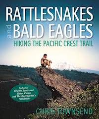
As probably the world's most experienced long distance walker who also writes, Chris Townsend has many stories to tell and many photographs with which to illustrate them. Of all his adventures, those he enjoyed on America's Pacific Crest Trail in the 80s are among his favourites. The Pacific Crest Trail runs 2,600 miles from Mexico to Canada through desert, forest and mountain wildernesses. In Rattlesnakes and Bald Eagles Chris recounts not only his own six-month walk but also the longer story of the Trail itself, sharing his ideas and reflections on how the trail is developing, its future and consequent challenges.
Sie lesen das E-Book in den Legimi-Apps auf:
Seitenzahl: 303
Veröffentlichungsjahr: 2016
Das E-Book (TTS) können Sie hören im Abo „Legimi Premium” in Legimi-Apps auf:
Ähnliche


RATTLESNAKES AND BALD EAGLES
Hiking the Pacific Crest Trail
First published in Great Britain and the United States of America by
Sandstone Press Ltd
Dochcarty Road
Dingwall
Ross-shire
IV15 9UG
Scotland
www.sandstonepress.com
All rights reserved. No part of this publication may be reproduced, stored or transmitted in any form without the express written permission of the Publisher.
EDITOR: Robert Davidson
MAPS: David Langworth, Melrose
TECHNICAL ASSISTANCE: David Ritchie
© Chris Townsend 2014
The moral right of Chris Townsend to be recognised as the author of this work has been asserted in accordance with the Copyright, Design and Patents Act 1988.
The publisher acknowledges support from Creative Scotland toward publication of this volume.
ISBN: 978-1-908737-73-1
ISBNe: 978-1-910124-58-1
Acknowledgements
Many people helped to make my walk a success and deserve thanks. Some of their names I no longer remember after all these years (or perhaps never knew). I apologise to anyone I’ve omitted.
The late Warren Rogers’ assistance was greatly appreciated. Without him planning the walk would have been much harder. Warren is also to be thanked for the decades of work he put in promoting the PCT. Without his efforts the trail as we know it might well not exist. Thanks to his son Don Rogers for the photos of Warren Rogers.
My companions on the trail all added to the walk, especially my companions in the High Sierra, Scott Steiner, Dave Rehbehn and Larry Lake, without whom I probably would not have made it through the snow. I certainly wouldn’t have survived the river crossings in Yosemite National Park without Larry. Elsewhere on the trail I enjoyed the company of Wayne Fuiten, Ron Ellis, Ron DiBaccio, Jay J.Johnson, Greg Poirier, Susie and Robert.
Throughout the walk everyone I met was supportive and friendly (with one exception as described in the book) and many local people went out of their way to provide assistance. These trail angels included Richard in Big Bear City, Phil and Bing Le Feuvre in Wrightwood, Delree Todd in Acton, Mrs Davison in the Mohave Desert, Ralph and Betty Morgan at the Fairmont Inn, Bob Frost in Sierra City, Rene Forman in Ashland.
Outdoor clothing company Rohan provided me with most of the clothing for the walk – and with work afterwards (I took part in a series of road shows talking to people about my PCT walk and how the clothing had performed).
Thanks to Barney Mann of the Pacific Crest Trail Association for all his help. The Pacific Crest Trail Association didn’t exist in 1982 but it is now an essential organisation for anything to do with the PCT and a wonderful resource which I used for much of the information on the history of the trail and the trail today.
I also discussed the PCT today with recent thru-hikers John Manning, Colin Ibbotson and Keith Foskett and learnt much about the current trail experience.
Robert Davidson of Sandstone Press suggested the book to me and encouraged and cajoled me during the writing. Heather Macpherson of Raspberry Creative Design did the design, Dave Ritchie scanned the slides, David Langworth did the maps. Thanks to them all.
My partner Denise Thorn read the manuscript and made many useful suggestions and corrections that have improved the book.
A Note on Photography
My walk taking place long before the advent of digital photography I used Kodachrome 64 transparency film. The images in the book are scans from the transparencies.
CONTENTS
Map
The Pacific Crest Trail: Beginnings
Chapter 1. Desert & Snow: Southern California
Chapter 2. Through Snow & High Water: The High Sierra
Chapter 3. Out of the Sierra, Into the Cascades: Northern California
Chapter 4. Forests, Lakes & Volcanoes: Oregon
Chapter 5. The North Cascades: Washington
The Pacific Crest Trail Present and Future
Bibliography
Books
DVD
Websites
THE PACIFIC CREST TRAIL: BEGINNINGS
Walking, camping, being in wild places. I am passionate about all three, a passion expressed in full in long distance wilderness walks, walks that take many weeks or months to complete, walks in which I can immerse myself in nature and the simple act of walking. These passions have deep roots. My love of the outdoors has been part of me as long as I can remember. Brought up in the countryside I spent my childhood exploring fields and woods. As I grew older I discovered camping and hills and wilder places. Days out became weekends, then weeks, then months. Staying out longer made trips more intense, more committing, more exciting.
No trip was totally fulfilling though, none was perfect. I didn’t know what was lacking but there was always something. I suspect it was real wildness, wildness on an epic scale. Then I discovered the Pacific Crest Trail. I can still remember the thrill of excitement on first reading about it. The idea of hiking some 2,600 miles from Mexico to Canada through deserts, forests and mountains seemed both preposterous and inviting. I remember feeling a sense of both excitement and determination. I would hike this trail.
Now, over thirty years later, I look back on the PCT with affection and gratitude. It was the defining walk of my life, the walk that set the pattern for all those that followed. Successive long walks, in the USA, Canada, Scandinavia, Scotland, have sometimes been more challenging, more demanding and more remote. All have been worthwhile. None though has been like the PCT. The walks I did before the PCT became an apprenticeship, a preparation for the real thing, though at the time I didn’t know what it was or even that it existed. The walks after the PCT were a continuation of the joy I had found on that trail. On the PCT I learnt how much I value trail life, wild camping, moving on every day, staying out for months at a time. I thought I knew this before the PCT but I didn’t know just how deep it could go, just how much it could be an essential part of my being. After the PCT I knew it would never leave me and that I would always want to return to the trails and the wilderness.
When I first read about the PCT I already knew I wanted to visit the wildernesses of the Western USA, having been inspired by first a slide show and then a book. The slide show was given in 1976 by a ranger from Yosemite National Park who was on an exchange with a ranger from the Peak District National Park in England. I marvelled at his images of vast pristine forests and huge granite mountains, all shining in brilliant sunshine, and felt overwhelmed at his stories - black bears, coyotes, real wilderness, summer-long sunshine, vast distances. How could I not want to go there? Not that I could imagine really doing so at the time. However two years later I did undertake my first really long walk, 1250 miles the length of mainland Britain from Land’s End to John O’Groats on trails and cross-country, and learnt that I loved multi-week walks, especially in wild country, the Scottish Highlands being my favourite part of that walk.
At the time I was working in an outdoor store. A customer, knowing of my long walk, lent me a book he’d picked up in the USA. It was Colin Fletchers’ The Thousand-Mile Summer, which told the story of a wilderness walk the length of California (and which I think is still one of the best long-distance walking books). I read it and was hooked. I had to do something like this. How I didn’t know. I couldn’t imagine trying to plan a walk in the USA from scratch (remember this was before the Internet - I’d never hiked outside Britain either). Then, browsing the outdoor section of a bookshop, I came across guidebooks to the Pacific Crest Trail. Suddenly the knowledge there was a trail with guidebooks made a long walk seem feasible, seemed a way into a very faraway wild land, a land that seemed almost mythical to me at the time. Not that the guidebooks were encouraging as they basically said doing the whole trail in one hike was a bad idea and probably not possible. That however didn’t put me off. The idea of a trail stretching all the way from Mexico to Canada through the wilderness – the deserts, forests and mountains - of the western USA was just too exciting. It was a visionary idea that I felt cried out for a continuous walk.
Exactly how the bold and imaginative idea for the trail arose is somewhat clouded. It first came, it seems, from outdoorswoman and teacher Catherine Montgomery who in 1926 suggested it to Joseph Hazard, a well-known member of The Mountaineers outdoor club. He put it forward to The Mountaineers and the idea was adopted. Then, somehow, one Clinton C. Clarke became involved in the early 1930s. Often referred to as the father of the PCT it was Clarke who actually began promoting the trail, setting up the Pacific Crest Trail System Conference in 1932. This federation of hiking clubs and youth groups had the task of devising a route for the PCT. The first meeting of the Conference was held in 1935 and in 1939 the PCT first appeared on a federal government map. * Clarke also compiled the first books on the PCT. The third version of these, The Pacific Crest Trailway, was published in 1945 and is available online, courtesy of Daniel Craig Giffen (pcttrailway.pctplanner.com). In this book Clarke makes clear that one of the purposes of the PCT in his eyes was the preservation of the wilderness, describing it as ‘the cord that binds this necklace; each gem encased in a permanent wilderness protected from all mechanization and commercialization’. He also saw the trail as character building and educational, writing ‘the Pacific Crest Trailway is not a recreational project for the casual camper and hiker; it is a serious educational project for building sturdy bodies, sound minds and active, patriotic citizenship’. The words, perhaps, sound dated now but the intent is I think still true.
Although some sections of trail that would become part of the PCT were in place in the early 1930s, such as the Cascade Crest Trail in Washington, the Skyline Trail in Oregon and the John Muir Trail in California there was no route much of the way so Clarke organised a series of relays during the summers from 1935 to 1938. These consisted of groups of young outdoorsmen from the YMCA under the leadership of one Warren Rogers. By walking from Mexico to Canada the YMCA teams showed that a continuous trail was possible. A log book was kept throughout and passed on from group to group - a book I would see when I visited Warren before my hike. The 2,300 mile route described in those logs, a route devised and explored in the 1930s, is the basis for the PCT today. After the relays Rogers followed Clarke in promoting the trail, keeping the idea going for the next thirty and more years. Indeed, Rogers work and passion for the trail kept the idea alive at a time when interest in backpacking and long-distance trails was low. This changed in the 1960s and the federal government set up a committee to look at a trails system. This led to official acknowledgement 1968 when the PCT was designated one of the first two National Scenic Trails (the other being the Appalachian Trail). Despite this designation the PCT was nowhere near complete in 1968. In fact it was to be another 25 years before the trail was officially finished (though due to its length and nature there have been and will be further changes), which meant it was far from completion for my 1982 hike.
At the same time as officialdom was working on the trail more information and support was appearing for hikers. In 1971, three years after the trail became official, Rogers had founded the Pacific Crest Trail Club to provide information and help for long distance hikers, not that many were around back then. Two years later in 1973 the first guidebooks were published by Wilderness Press, and this is where I come in as these were the guidebooks I was to find in a bookshop five years later. I wrote to the Pacific Crest Club in 1981 about my proposed hike and received a very helpful and encouraging reply from Warren Rogers.
The Pacific Crest Trail Club eventually merged with the Pacific Crest Trail System Conference in 1987 to become the Pacific Crest Trail Conference, which Rogers ran until the early 1990s. In 1992 the name was changed to the Pacific Crest Trail Association, as it still is today. In 1993 the PCTA became the federal government’s official partner in managing the PCT. In the same year the trail was officially completed and a ceremony was held to mark this in Soledad Canyon in Southern California. Since then the PCTA has worked to maintain and protect the trail, describing itself as ‘the voice of the PCT, its steward and its guardian’.
The trail was becoming better known, in large part due to the success of Eric Ryback’s 1973 book The High Adventure of Eric Ryback, which told the story of his 1970 hike. This book hadn’t made it across the Atlantic at the time so I didn’t even know it existed. It was to be many years after my walk before I read it. At the time of Ryback’s hike only three end-to-end trips had been done, according to the list maintained by the Pacific Crest Trail Association (the successor to both the Pacific Crest Trail Conference and the Pacific Crest Club) and published on their website, and those were the first on foot by Martin Papendick in 1952 and the first on horseback by Don and June Muford in 1959. Six others are listed as hiking the trail the same year as Ryback. The year after his book was published the numbers of end-to-end hikers, known as thru-hikers, reached double figures for the first time. Other noteworthy early thru-hikes were the first by a woman in 1972 – Mary Carstens, hiking with Jeff Smukler – and thee first solo one by a woman in 1976, Teddi Boston. Boston’s achievement is all the greater because she also started at the Canadian border, which makes the hike much harder.
By 1982, the year of my hike, 241 hikers are listed as having completed the trail. That year eleven more, including myself, were added to the list. The trail was steadily growing in popularity with numbers rising rapidly through the 1990s and 2000s. By the end of 2013 2953 hikers had completed the trail (still fewer than the number of people who have climbed Mount Everest!). With hundreds of hikers (the PCTA estimates 700-900 a year, of whom roughly 50% finish) setting off every spring the trail experience is very different now from what it was back when I hiked it, as I’ll discuss later.
Warren Rogers didn’t play down the difficulties but didn’t say hiking the whole trail was impossible either. I also came across two books that greatly encouraged me as they were by thru-hikers. David Green’s A Pacific Crest Odyssey, which told the story of his 1977 thru-hike, and Chuck Long’s Pacific CrestTrail Hike Planning Guide, which included information from 15 hikers, including Long himself, who had hiked all or most of the trail, were devoured many times in the months and years before my walk as I tried to absorb something of the reality of what would be involved.
Overall four years elapsed from finding out about the trail - and knowing immediately I wanted to hike it - and setting out from the Mexican border. During those years there were periods of intense planning and periods of suspense and waiting. There was also the question of money. I didn’t know how much such a walk would cost but I knew I’d need to have money put aside for it and this would take time. Planning such a long walk through such wild country was not easy even with the existence of a trail, guidebooks and the Pacific Crest Club. This was my first big backpacking trip outside Britain - my only other one was a two-week trip in the Pyrenees, undertaken as part of my preparation for the PCT as I wanted to experience higher altitudes than those found in Britain before I set out (I climbed the highest mountain, 11,168 foot Pico d’Aneto). The PCT was also over twice as long as my Land’s End to John O’Groats walk and in much remoter and wilder country. For making the planning much easier than it would have been without his help I have to thank Warren Rogers. He advised me, checked my plans and sent me information. As well as reading all I could about the trail I made and revised lists of gear and compiled lists of supplies and the post offices to which they would be sent. I also ripped up the Wilderness Press guidebooks into sections to go in my supply packages. Warren produced basic strip maps for the Pacific Crest Club and offered to send me these in batches every few hundred miles. I also planned on buying topographic maps when I reached the USA. Warren said I wouldn’t need these but being used to Britain’s detailed Ordnance Survey maps I knew I’d feel ill-equipped without what I thought of as proper maps.
So what is special about the Pacific Crest Trail, other than the distance? What called me across the ocean and across a continent to walk for nearly six months carrying everything on my back? The simple answer is nature and a wild landscape on a monumental scale, a scale hard to imagine for a walker from Britain. The PCT follows the westernmost chains of mountains in the USA and is in wilderness or near-wilderness for virtually the whole of its 2650 miles. Despite the name it’s not that close to the Pacific Ocean and there is no sense of the sea as a wide plain lies west of the mountains. What the PCT does have, which seemed strange and exotic to me, is a taste of the desert. More than a taste in the first 500 miles in fact. This desert feel fades as the trail progresses north until the climate is more akin to that of Britain, as I was to find out.
For roughly the first 500 miles from the Mexican border the PCT changes character frequently as it climbs from desert and chaparral to forested mountains and back again time after time. The mountain ranges here are fairly small in area but still rise to over 11,000 feet. They’re known as the transverse ranges as they tend to run east-west rather than north-south. This means a great deal of ascent and descent as the PCT crosses each one. Real desert is encountered at the end of this section when the Mohave Desert is crossed before the PCT reaches the southern end of the Sierra Nevada mountains, which it follows for around 1000 miles.
The southern Sierra Nevada - the High Sierra - is the highest section of the PCT, with the trail lying above 10,000 feet for many miles and reaching 13,153 feet on Forester Pass. This is a granite wonderland with magnificent peaks rising above tremendous forests. Here the PCT follows the John Muir Trail much of the way and passes through King Canyons-Sequoia and Yosemite National Parks. North of Yosemite the Sierra Nevada slowly becomes less dramatic and the mountains are lower, though this is still fine country. Unnoticeable to the walker the Sierra Nevada merges with the southern Cascade Range which the PCT then follows all the way to Canada. The Cascade Range is characterised by big volcanic peaks towering over the lower hills and forests, the first of which is met in Northern California with Lassen Peak in Lassen Volcanic National Park. Through Oregon the PCT is at its gentlest, winding past the mountains through forests and meadows before descending to the Columbia River and the trail’s low point of 140 feet. There follows a long thrilling finale to the PCT as it climbs into the rugged and spectacular mountains of Washington State, culminating in the grandeur of the North Cascades. In total the PCT passes through six national parks and forty-eight designated wilderness areas, which shows the value placed on the landscape and the natural history of the trail’s environs.
Finally my planning, or at least the British part of it, was over and I boarded an aircraft for the first time ever for the long flight to Los Angeles with instructions from Warren Rogers to catch a bus from the airport to Disneyland, where he would meet me. Very kindly he had invited me to stay with him and his wife Mary for a couple of days. Standing outside Disneyland in the dark dazed from the long flight I remember feeling a little unsure and a long way from home. A tall man strode over and shook my hand firmly. It was Warren. I guess my large pack and air of bewilderment made identifying me easy.
Warren’s enthusiasm for the PCT came over immediately. I knew his feelings from his letters but hearing him speak really impressed upon me how important the trail was for him. Advice and suggestions tumbled out. He showed me the precious log book from the 1930s relays, kept safely in a fireproof box. I felt I was looking at a holy relic.
One important task remained before I could start the walk. I needed to sort out food supplies. Warren reckoned I could probably find suitable breakfast foods and trail snacks along the way but that evening meals would be a problem. However he knew of a company that would send food parcels to post offices along the way so on my first full day in the USA he drove me out to North Hollywood to meet Charlie Yacoobin of Trail Foods. Here I selected what I hoped would prove adequate and tasty from a bewildering array of freeze-dried and dehydrated food. Being vegetarian I was pleased to find quite a choice of suitable food – I wouldn’t be living on macaroni and cheese for six months (a hiker’s staple that I was to eat rather too often on subsequent walks). This wasn’t the cheapest way to buy food but bringing six months’ worth from Britain was not an option and I didn’t have the time to visit supermarkets, buy food and repackage it – my visa for the USA was for six months, the longest period available, and I knew it might take that long to complete the trail. Most of the food was for evening meals but I stuck some snacks and breakfast food into the twenty-six parcels just in case I needed it plus the relevant sections of the guidebook and some rolls of film (this was long before digital photography) and left Charlie with the list of post offices.
So far all I’d seen of the USA was Disneyland, miles of low buildings, heavy traffic and freeways. The air was hot and heavy, the horizons hazy and faint. There was no sense of wild country and not much of nature. That was soon to change. I’d planned on catching buses to San Diego and then Campo at the start of the trail, a two-day trip. Warren vetoed that idea and said he’d drive me, saving a day and giving me more time to hear his stories of the trail. As we sped down the highway the hot arid scenery of Southern California flashed past the windows. I couldn’t relate to it yet, couldn’t feel it as real, didn’t know what it felt like. I would soon learn.
Warren dropped me at a campground in the tiny border hamlet of Campo, wished me luck and left me standing by the pack I was to live out of for half a year. I waved as he drove away. Alone in the dusk I realised the adventure was about to begin. High above the familiar constellation of Orion hung in the clear sky and there was bright half-moon. All the planning and preparation was over. All that was left was to walk to Canada.
* See these two pdf documents for more information on the founding of the PCT and also the fascinating research of Barney “Scout” Mann of the Pacific Crest Trail Association who investigated Catherine Montgomery and Clinton C. Clarke. http://www.pcta.org/wp-content/uploads/2012/10/Montgomery_March11.pdf . http://www.pcta.org/wp-content/uploads/2012/10/Clarke_Dec10_spreads.pdf .
CHAPTER ONE DESERTS & SNOW: SOUTHERN CALIFORNIA
Campo to Weldon
April 3 to May 9
513 miles
A broken-down barbed wire fence by a dirt road in nondescript desert scrub marked the border with Mexico. There were no notices, no signs, nothing to indicate the start of the PCT (there’s a monument now). I didn’t mind. I felt happy to be there alone and happy there was no signpost saying ‘Canada, 2650 miles’. This was my journey and I suddenly felt very possessive of it. For this year the PCT was my personal and private trail, no matter how many others I met along the way. Starting alone gave me the chance to absorb these early feelings and relish the beginning of a great adventure.
I took a few self-portraits, the camera balanced on a rock, then turned away from the border and took my first steps northwards. The journey really had begun. I felt a little unreal, elated yet calm. I didn’t know what to think about what lay ahead. The landscape here wasn’t spectacular or even particularly wild. Locals probably wouldn’t give it a second glance. For me it was quite unusual though, a semi-desert environment totally unlike anywhere in Britain. A sparse scrub of tough, drought-resistant bushes covered the ground, interspersed with small cacti and clumps of rough-barked Live Oak trees. Lizards and ground squirrels darted over the ground. This was the chaparral, vegetation I was to become very familiar with over the next few weeks. I thought it superb. The route led along dirt roads past a few ranches then after a few miles the PCT became a footpath. And I promptly lost it! I was heading in the right direction though and soon picked it up again.
After 14 miles I reached the campground where I planned on stopping for the night. To my surprise it had no water. I’d never heard of a campground without water before. I had none left either and was thirsty, having set off with far less than I needed. I hadn’t really registered that early April this far south would be so hot or that there would be little water on the trail. I quickly learnt that I must carry plenty of water. And know where the next water was to be found and drink deeply from every source. This was desert hiking and heat and thirst were major hazards. Luckily for me this first evening there was a campground host and she kindly gave me some water. This was the first example of a ‘trail angel’, a term I hadn’t heard yet but which was to become familiar. Trail angels are people who help hikers, often going out of their way to do so, and one of the aspects of trail life that gives faith in the essential goodness of humanity. The host’s son, a local volunteer ranger, gave me some tips about the next few days hiking, including possible water sources. I was on my way.
That first day my feet had become very sore and swollen in my heavy leather boots, another hazard of desert hiking. I’d removed the insoles to allow them more room but they still ached. My arms and neck were sunburnt too, despite applying sunscreen liberally several times. Time for my sunhat, I thought the next day. The sun really was the dominant feature of the first few days on the trail; hot, white and relentless. There was little shade and few shadows. Just blazing light. The sky was vast in this flat landscape, the horizons far distant. Used to the rapidly changing scenery and landscape of the British hills I felt at times as though I was walking on the spot. Only the movement of the sun showed the progression of time.
On day two I walked mostly on wide sandy and gravelly trails through the dense, often shoulder-height, impenetrable chaparral. Towards the end of the day the first hills appeared; the Laguna Mountains. The trail climbed upwards beside big red rock boulders. In the shade of one of these I met my first other PCT hikers, Scott and Jim, sitting next to huge packs with gear strapped all over the outside that looked frighteningly heavy. I gazed at them wonderingly. Was I under-equipped? I was relieved when they told me this was their third day out and the weight of their packs was already a problem. I never saw them again or heard how much further they hiked. The PCTA says only 50% of thru hikers actually complete the trail today. Back in 1982 with far less information available, and heavier gear, the percentage was lower. At least 120 through-permits were issued by the Forest Service in 1982. Only eleven of us completed a through-hike to Canada. Of the others some dropped out completely while some skipped snowbound sections and only did part of the trail.
The Laguna Mountains only reach a little over 6,000 feet, small in Western U.S. terms, but are still high enough to have a different environment to the desert not far below (and still more than 1500 feet higher than the highest mountain in Britain but then the PCT at the Mexican border is nearly 3,000 feet high). As I climbed into the Lagunas the chaparral gave way to sparse oak woods and then denser pine forest, my first experience of the wonderful pine forests I was to revel in all the way to Canada. Out to the east I could see the lifeless orange void of the Anza-Borrego Desert shimmering in a heat haze. The rich, reddish-barked pines gave welcome shade under their spreading boughs. These were Jeffery pines, the commonest conifers in Southern California as they are extremely drought resistant. Growing between 5000 and 9000 feet they cloak the mountains that rise out of the desert.
The change as I entered the pine forest was abrupt and dramatic. Here it was cool and humid with moist air rising from the snow patches that dotted the ground between the widely spaced trees. Someone had even been skiing here, their parallel tracks following the line of the trail. I found this unusual as I hadn’t discovered cross-country skiing at the time – later in the walk I was to travel with two skiers and realise how useful skis were for crossing deep snow. I’d meet this skier in a week’s time but for now I was alone. I camped beside a little creek in the forest, the first wild camp of the walk. I wasn’t far from a road though and a little exploration revealed a Mexican restaurant. I’d already learnt on my British long walks that passing by any opportunity for food was unwise so I forgot the instant noodles and packet soup I’d brought from home for these first few days and dined on much more appetising tortillas and enchiladas.
Two days and twenty-eight miles into the walk and my feet were already in tatters. I had four blisters, many sore spots and they were badly swollen and ached all over. I knew I wouldn’t get much further without doing something about this. I’d brought some light running shoes for town and camp wear so on day three I hiked in these. The difference was astounding. My feet felt fine again. The boots went in the pack and were to be carried many miles over the coming weeks. They were much more comfortable on my back than on my feet and proved to my satisfaction the old adage that a pound on the feet is equivalent to five pounds on the back. I could have dispensed with them altogether but I knew that much bigger mountains lay ahead where there was likely to be much more snow than these thin patches.
Early the next morning I reached my first supply point, the tiny little mountain hamlet of Mount Laguna. After collecting my supply parcel from the Post Office I called in at the little store, my journal in hand, open at the page with the first of many shopping lists that were to decorate its pages. This list read:
Pot scourer
Loo paper
Toothpaste
Candles
7 choc.bars
Biscuits
Margarine
Band Aids
1lb. sugar
1 pkt.soup
Trail mix
Dried fruit
Instant breakfast
Jam/honey
Postcards
Vit.pills
Eight items were checked, eight would have to wait until the next store in, I hoped, five days’ time. I also marked my supply parcel list with the day of arrival, a day earlier than my estimate. Doing so brought home to me that the walk really had begun. Twenty-five parcels to go.
Mount Laguna was a secretive little place. The dark brown, low wooden houses and wide, dusty roads blended into the surrounding forest, a forest that the town had not quite escaped from, so that the buildings seemed to be hiding cautiously amongst the trees. It vanished within minutes of my heading back to my trail. All I could see behind me were the pines.
The Laguna Mountains are a tilted block of granite with the steep slope to the east. The PCT followed the crest on a path marked as the Desert Divide Trail which gave striking views down to the ridged badlands of the Anza-Borrego Desert, some 4,000 feet below. A sterile brown colour, the hills in the desert came to life at dawn and dusk when they caught the rays of the setting and rising sun and glowed red and gold. Then Oriflamme Mountain was aptly named. To the west the mountains dipped slowly away into rolling pine and oak forest that in turn changed abruptly to the undulating chaparral country. Ahead lay the next mountain range, the San Jacinto Mountains, with 10,834 foot San Jacinto Peak looking very white. I would be there within a week.
A storm is approaching, I’d been told in Mount Laguna. By early afternoon flat saucer-shaped clouds indicated high winds. Soon the first cold gusts arrived and for the first time I needed to wear my warm fibre-pile jacket and balaclava. Clouds piled in on the wind but broke up as they reached the crest. There was no rain but snowmelt meant there were dozens of seasonal streams so I didn’t need to carry any water. The wind and the streams continued the next day during which I descended back to the chaparral and passed boarded up old gold mines outside the tiny hamlet of Banner before road walking across the San Felipe Ranch and along a highway to San Felipe itself, another small hamlet. Here the next trail angel appeared. There was a combined gas station/sandwich store/caravan site called The Log Cabin. It was closed but as I’d run out of water I knocked on the door to ask for some. The owner appeared, welcomed me in and gave me tea and a piece of her birthday cake. Friends there to celebrate with her told me there were record snows in the Sierra Nevada, something I was to hear regularly over the next few weeks. I was given the key to an outside water tap and allowed to camp behind the building sheltered from the still strong wind.


