Erhalten Sie Zugang zu diesem und mehr als 300000 Büchern ab EUR 5,99 monatlich.
- Herausgeber: Sandstone Press
- Kategorie: Geisteswissenschaft
- Sprache: Englisch
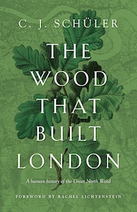
'Meticulously researched yet accessible' GeographicalStanding in the busy streets of South London today, it is hard to imagine that much of this suburban townscape was once a vast wood, stretching unbroken for almost seven miles from Croydon to the Thames at Deptford. In The Wood That Built London, C.J. Schüler takes us on a journey through time, telling tales of invaders and trade guilds, map makers and soldiers, royals and working class people. From the 8th century to current conservation efforts, Schüler offers a fresh perspective on London's history, with tales of murder, Anglo-Saxon treasure, fires, pandemics, the blitz and more along the way. This compelling narrative history charts the fortunes of the North Wood from the earliest times: its ecology, ownership, management, and its gradual encroachment by the expanding metropolis.
Sie lesen das E-Book in den Legimi-Apps auf:
Seitenzahl: 430
Veröffentlichungsjahr: 2021
Das E-Book (TTS) können Sie hören im Abo „Legimi Premium” in Legimi-Apps auf:
Ähnliche


THEWOODTHATBUILTLONDON
By the same author
Mapping the World
Mapping the City
Mapping the Sea and Stars
Writers, Lovers, Soldiers, Spies:A History of the Authors’ Club of London, 1891–2016
Along the Amber Route: St Petersburg to Venice
THE WOODTHATBUILTLONDON
A human history of the Great North Wood
C. J. SCHÜLER
Foreword by Rachel Lichtenstein
First published in Great Britain in 2021 by
Sandstone Press Ltd
PO Box 41
Muir of Ord
Highland
IV6 7YX
Scotland
www.sandstonepress.com
All rights reserved. No part of this publication may be reproduced, stored or transmitted in any form without the express written permission of the publisher.
Copyright © C. J. Schüler 2021
Foreword copyright © Rachel Lichtenstein 2021
Images by C. J. Schüler unless otherwise ascribed.
Editor: Robert Davidson
Ecological Consultant: Mathew Frith, London Wildlife Trust
The moral right of C. J. Schüler to be recognised as the author of this work has been asserted in accordance with the Copyright, Designs and Patents Act 1988.
eISBN: 978-1-913207-50-2
Jacket design by Daniel Benneworth-Gray
CONTENTS
Foreword by Rachel Lichtenstein
Introduction
Measurements, Money and Other Matters
1: TAMING THE WILDWOOD C.8000 BC–1485
The Norman Settlement
The Charter of the Forests
Working the Woods
The Colliers of Croydon
2: SURVEYS, SHIPS AND STATUTES 1485–1600
Our Most Dred Soveraigne
Beating the Bounds
Timber and Trapping
A Rough Waste Percell of Grounde
3: THE WORLD TURNED UPSIDE DOWN 1600–1700
The Fustian King of Dulwich
Havoc in the Woods
A Great Wood Called Norwood
4: FAITH OR SCIENCE? 1700–1790
A Natural History of the Enlightenment
Profit and Loss
5: INDUSTRY AND ENCLOSURE 1790–1850
The New Cartography
The End of the Commons
Pleasure in the Pathless Woods
Infamous Desperadoes
6: THE PALACE AND THE RAILWAY 1850–1910
Railway Rivalries
Woodland for Rent
From Countryside to Suburb
The Open Space Movement
7: THE HOME FRONT 1910–1945
Zeppelins over Dulwich
The New Suburbia
War in the Woods
8: A DESIGN FOR LIVING 1945–1970
From Austerity to Prosperity
A Secret Wilderness
Mid-Century Modern
9: SAVE THE WOODS! 1970–1997
Dulwich Upper Wood
An Amenity for the Few?
Strange Weather
The Battle of Beechgrove
10: A NEW MILLENNIUM 1997–2021
The Woods and the Water
The Great North Wood Project
Hearts of Oak
11: A TOUR OF THE WOODS TODAY
New Cross to Forest Hill
Dulwich and Sydenham
Upper Norwood
Southern Outliers
12: WAYS THROUGH THE WOODS 2021–?
A World in the Balance
Human Nature
Covid’s Metamorphoses
Woodland Therapy
Acknowledgements
A Woodland Glossary
Notes
Bibliography
Mapping the North Wood
FOREWORD
C. J. Schüler’s The Wood That Built London is an in-depth history of the woodland that once covered great stretches of what is now south London. This fascinating account reveals how medieval London was built from its timbers and fuelled by the charcoal they produced, before the metropolis expanded to engulf most of this ancient landscape into the surburban townscape. In twelve highly readable chapters, Schüler tells us the stories of this place and its people, from the last great Ice Age, through the arrival of the Normans, the Plantagenet, Tudor and Stuart dynasties, the Industrial Revolution and the Victorian era to the present climate crisis.
This important work of contemporary place writing combines a lively human narrative with rigorous archival research from a wide range of sources, including botanical and zoological evidence, industrial and agrarian history, church records, and even sixteenth-century court witness statements. It preserves the memory of time-honoured landmarks that have long since disappeared, rivers that have vanished underground, place names that recall a rural landscape now buried beneath city streets, and ancient parish boundaries that still shape London’s boroughs. The result is a deep mapping of London’s ever-changing topography to set beside the work of Peter Ackroyd and Iain Sinclair, and a significant addition to the growing new genre of urban nature writing.
The history of mapmaking in this book makes fascinating reading in itself, as does the detailed account of coppicing and other woodland crafts, revealing the extent to which apparently natural spaces have been shaped by human intervention since earliest times, and how this has created rich, diverse habitats for a wide range of plant and animal species.
This is not just a book about geography and ecology: it is a rich treasure trove of stories about people past and present, characters through the centuries who have in different ways interacted with this place, who have been vividly brought to life and observed with wry detachment by the author. There are not just kings and bishops, but writers and butterfly collectors, landowners, woodsmen, surveyors, tenant farmers and quarrelsome neighbours. The echoes of these communities retain a ghostly presence in the remnants of woodland familiar to present-day locals. In addition to delving into archives, the author, who has been a conservation volunteer at Sydenham Hill Wood for the past decade, has tramped the surviving pockets of woodland, meeting and recording the stories of professional ecologists, volunteers and local campaigners. These direct encounters with a range of contemporary voices have made the book a collaborative project akin to the conservation work that he and his fellow volunteers have undertaken in the woods.
This is a tale for our times, and its implications are not just local but global. Only in recent years have we come to understand the speed and severity of climate change, the crucial role that woodlands play in protecting us and our world, and how the destruction of such places causes a decline of species diversity which, as the author rightly observes, is accelerating exponentially, weakening the planet’s immune system to a dangerous degree.
We exist within nature, and it is all around us, even in the most urban places. During the recent lockdown, travel restrictions have made us acutely sensitised to our hyper-local environment, exploring the wild within the city. This book highlights the importance of these surviving urban woodlands both to an ecosystem in peril as never before, and to our social and psychological wellbeing. We should be thankful to the individuals and public bodies, especially the London Wildlife Trust, who work to protect and promote the recovery of these ancient woodlands, and those, like the author of this important and timely book, whose research and artistry emphasise their enduring value to people and the planet.
Rachel Lichtenstein, London 2021
INTRODUCTION
Standing in the busy streets of South London today, it is hard to imagine that as recently as the eighteenth century, much of this suburban townscape was covered by an expanse of woodland and wooded commons, spreading almost unbroken for seven miles from Croydon to the Thames at Deptford. Its legacy can be found in many local place names: Norwood, Collier’s Wood, Honor Oak, Gipsy Hill, Penge, which means ‘Wood’s End’, Woodside, and Selhurst, from the Anglo-Saxon for ‘dwelling in a wood’. A survival of the wildwood that once covered much of Britain, from Saxon times until the Industrial Revolution the wood was intensively managed to provide timber for construction and shipbuilding, bark, from which tannin was extracted for leathermaking, and charcoal for London’s blacksmiths and bakeries. Its produce helped to build the city that would, in the course of a millennium, whittle it down to a few surviving remnants.
The largest of these can be found at Dulwich and Sydenham Hill, where relict and secondary woodland still covers some twenty-five hectares. Smaller fragments can be found at One Tree Hill in Honor Oak, Biggin Wood, Spa Hill, Beaulieu Heights and Grangewood Park in Norwood, and at Long Lane to the south of Elmer’s End. The nearest ancient woodland to central London, they sustain wildlife in the capital, help cleanse its polluted air, and provide city dwellers with access not only to nature but to something rooted deep in our collective unconscious.
Woods occupy a central place in the folklore of many cultures as a scene of mystery, enchantment and transformation. They are the setting for dark fairy tales such as ‘Little Red Riding Hood’. They resonate in literature, from Dante’s selva oscura, a place of confusion and challenge, to Shakespeare’s Forest of Arden, a sylvan refuge from the intrigue of the court. ‘To enter a wood,’ wrote Roger Deakin in his book Wildwood, ‘is to pass into a different world in which we ourselves are transformed. It is no accident that in the comedies of Shakespeare, people go into the greenwood to grow, learn and change. It is where you travel to find yourself, often, paradoxically, by getting lost.’
Over the centuries, Dulwich Woods have attracted writers and artists such as Samuel Pepys, Byron, Robert Browning, Samuel Palmer and John Ruskin. No fewer than three books by Daniel Defoe have furnished material for this history, though sadly I have found no reference to the North Wood in his most famous work, the Life and Strange Surprizing Adventures of Robinson Crusoe. Today, Sydenham Hill Wood, with its faux-medieval folly hidden deep amid the trees, is a magnet for Goths and a popular backdrop for fashion shoots and music videos.
What makes these surviving pockets of woodland so important, aside from their cultural resonance and amenity for local residents, is the fact that their antiquity is attested by both extensive written records and the presence of Ancient Woodland Indicators (AWIs) – species characteristic of areas that have been continuously wooded for at least four hundred years. These include plants such as the wood anemone, a clump of which will expand by just one metre in a hundred years, and many beetles and other insects that, for at least part of their life cycle, are dependent on dead or decaying wood and, because they cannot travel far, rarely establish themselves in new woodland. In recent decades, moreover, scientists have discovered that woodland trees communicate with one another through their root systems, sending electrical and chemical signals to warn other trees of predators so that they may take defensive measures such as secreting toxins to repel them, and even sharing nutrients with those whose ability to photosynthesise is reduced by damage or a shady position.
This process is assisted by the fungi that grow in the forest floor. The toadstools and brackets that we see above ground are in fact only the fruiting bodies; the main body of a fungus is the underground part, or mycelium, a mass of fine filaments known as hyphae. Like fibre-optic cables, these filaments connect the roots of trees in a symbiotic relationship in which, in exchange for nutrients, they assist in the transmission of information and sustenance.1 Ancient woodland is therefore irreplaceable. You cannot ‘offset’ the destruction of so complex an ecosystem, which takes centuries to develop, by ‘mitigation’ planting elsewhere. The fact that a wood is considered ancient does not mean that any of the trees within it are necessarily four hundred years old; simply that it has never been clear-felled and ploughed over within that period. A wood may outlive the individual trees within it by many thousands of years; what matters is the persistence of the ecosystem.
Nor should the antiquity of the North Wood mislead us into thinking that any of its surviving parts are wild, pristine woodland; they have not been that for at least a thousand years, and probably for much longer. Since our Neolithic forebears first crafted flint handaxes and began to clear the wildwood for agriculture, few corners of the British Isles have remained an untouched wilderness. What we regard as natural is actually the result of millennia of interaction between human beings and their environment, and our wildest-seeming landscapes have been sculpted by centuries of husbandry. This book is therefore not only a natural history but a human one, the story of the people who owned the wood, who worked in it, who studied its flora and fauna and, most recently, who fought to save what is left of it. The great events of national and international history – the Norman Conquest, the Dissolution of the Monasteries, the English Civil War, the Industrial Revolution, the enclosure of common lands, the construction of the railways, and two world wars – all affected the woods, and are reflected in these pages.
Since before the Norman invasion, the North Wood was in effect an enormous tree farm, intensively managed and regularly harvested to produce different grades of timber for building, tool making, fencing and firewood. Though much of the wood was in private ownership, commoners had the right to graze livestock such as pigs, geese and chickens there. By trampling and cropping the undergrowth, these animals allowed sunlight to penetrate to the forest floor. The result was a symbiosis of the human and the natural, creating a distinctive biosphere that provided a haven for species not found elsewhere. Since the decline of the woodland economy after the Industrial Revolution, informed, active management has been necessary to reproduce these effects and maintain a balanced ecosystem.
Throughout the surviving parcels of the North Wood, the dominant tree is the sessile oak (Quercus petraea). So called because its acorns sit directly on the twig rather than on stems as they do on the pedunculate oak (Quercus robur), the sessile oak tends to grow tall and straight, making it suitable for shipbuilding. Across many cultures, the oak is perhaps the most revered of all trees, and resonant with symbolism. The ancient Greeks held it sacred, as did the Druids in far-off Britain. The eighteenth-century poet William Cowper called it the ‘king of the woods’, and the anthem of the Royal Navy is ‘Hearts of Oak’. The pedunculate oak is also known as the English oak, though Germans and Poles also consider the tree a symbol of resilience, strength and national identity.
An oak can live for up to a thousand years; it is said to spend three hundred years growing, three hundred years in stable maturity, and three hundred in slow decline. Each tree supports hundreds of insect species, providing many birds with an important food source, as well as offering nesting spots in its deeply creviced bark. Jays and magpies feed on the acorns, assisting the propagation of the species by burying them some distance from the parent tree and sometimes failing to retrieve them. Oak has long been prized for its strength, and was extensively used in shipbuilding and the construction of timber-framed houses, while the beauty of its grain has ensured its continued use in the making of high-quality furniture. For centuries, the galls (or ‘oak apples’) produced when parasitic wasps lay their eggs in the leaves, twigs or acorns were the most common source of ink; most of the older documents I consulted while researching this book will, satisfyingly, have been written in oak-gall ink.
The oak and hornbeam, from John Gerard’s Herball, 1597.
On the heights of Sydenham Hill and Dulwich Woods, the sessile oaks are interspersed with hornbeam (Carpinus betulus), a member of the birch family that occupies a similar ecological niche on clay uplands to that of the beech on chalk or limestone. In earlier times it was often confused with the beech or other trees: in Kent, according to the sixteenth-century herbalist John Gerard, ‘it is commonly taken for a kind of Elme’, while his seventeenth-century successor Nicholas Culpeper felt it necessary to differentiate the beech ‘from that other small rough sort, called in Sussex the smaller Beech, but in Essex Horn-beam’. Writing a few decades later, the silviculturist John Evelyn noted that the hornbeam was ‘by some called the Horse-Beech, from the Resemblance of the Leaf’, and that ‘the Places it chiefly desires to grow in are in cold Hills, stiff Ground, and in the barren and most exposed parts of Woods.’
In Britain, the hornbeam is largely confined to south-east England, where it flourishes on the slopes that rise on either side of the Thames, and in the Chilterns. The delicacy of its leaves, especially in the fresh green livery of spring, and its pagoda-like seed-bearing samaras, belie the strength of its limbs, their musculature bulging through the smooth grey bark. Its timber – sometimes known as ironwood – is so hard that it will blunt a woodworker’s tools, making it suitable only for applications such as mallets, chopping boards, axles, cogs and pulleys, where durability is more important than fine carpentry. Its high calorific content, however, means that it gives off intense heat when burned, so it was much favoured for the manufacture of charcoal for smelting iron. A hornbeam log does not catch light easily, but added to a fire that is already going strong, it will burn steadily, with a bluish flame, for hours.
For much of its history, this tract of woodland was known as Norwood, or the North Wood, on account of its position in relation to Croydon, the manor to which much of it belonged, and to distinguish it from the forests of the Weald to the south. It is nowadays referred to as the ‘Great North Wood’, but this appears to be a Victorian invention; I have found no record of it earlier than 1863, in the proceedings of the Surrey Archaeological Society – and there the word ‘great’ has a lower-case ‘g’, indicating a prenominal adjective rather than a part of the name itself. By 1898, when the Croydon historian John Corbet Anderson published his book The Great North Wood, the name had taken root. It is ironic that, like the River Effra that flowed from its slopes, the wood only acquired the name by which we know it today when it was already fading into the past.
Similarly, the botany and zoology of the woods became the object of scientific study only in the late eighteenth and early nineteenth centuries, just as the Industrial Revolution and the Enclosure Acts were reducing their extent. Prior to that, the records chiefly concerned land ownership, woodland management, and the income it generated. Fortunately, the archives of the Archbishopric of Canterbury and the Dulwich Estate, which between them owned much of the North Wood, survive, and have preserved a record of its stewardship over more than four centuries. Other early evidence survives in the National Archives at Kew, including witness statements in disputes over the ownership of parts of the woods. Much of this documentation is written in secretary hand, the script used by legal and administrative writers in the sixteenth and seventeenth centuries. Designed for speed, its cursive letters often bear scant resemblance to their modern equivalents, and many common words – which, with, parish, person, majesty – are abbreviated. Poring over worn, creased and sometimes torn or worm-eaten sheets of paper or parchment, I learnt, painstakingly, to decipher the hand, bringing the past alive in all its quotidian detail and casual cruelty.
Despite the survival of these valuable records, a word of caution is necessary. Even these archives have frustrating gaps, and others have vanished altogether as a result of fire, damp, mice, mildew, insects, indifference, neglect, and the normal human desire to dispose of seemingly redundant paperwork. How far back do any of us keep our bank statements before consigning them to the shredder? And even where records do survive, as the historian Patrick Collinson has observed, ‘it is possible for competent historians to come to radically different conclusions on the basis of the same evidence.’2
This is the first full-length history of the woods since Anderson’s, though Lucy Neville’s 1987 booklet The Great North Wood packed a great deal of well-researched historical information into a brief thirty-two pages. I am indebted to both, though once I began to research the subject, it soon became apparent that many aspects of the story – ecological, social, cultural and political – remained to be explored. The purpose of this book is to chart the history of the North Wood and its surviving fragments: their natural and human history, their management, their gradual encroachment by the expanding metropolis, their survival against the odds, and the opportunities and challenges faced by the professional and volunteer environmentalists who maintain them as urban nature reserves today.
On a personal note, I have volunteered at the London Wildlife Trust’s Local Nature Reserve at Sydenham Hill Wood since 2011. I have learned the names and habits of many plants and insects, and how to handle ancient tools such as scythes and billhooks. I have taken part in twilight bat surveys on Dulwich and Sydenham Hill golf course, as our handheld detectors amplified the clatter of noctules’ and pipistrelles’ echolocation signals, and hunched over a fluorescent moth-trap (powered by an ancient car battery) in a damp glade as a curious fox came to investigate. I have seen a kestrel methodically eviscerate a twitching wood mouse on a branch of an oak. I have watched as a dragonfly larva climbed out of a pond up the stem of a flag iris, and the adult burst from its carapace and unfolded its wings to dry in the sun. These experiences have been as enriching as any travel to far-flung parts of the globe, and I would recommend them to anyone.
C. J. Schüler, Herne Hill 2021
MEASUREMENTS, MONEY AND OTHER MATTERS
For much of the period covered by this book, land area was measured in acres, rods (or roods) and perches, and these appear regularly in the historic records quoted in these pages. For the sake of visualisation, an acre is about half the size of a football pitch. There were four rods in an acre, and forty perches in a rod. Confusingly, a rod was also a measure of distance, corresponding to about sixteen and a half feet, or about five metres.
Since the 1985 Weights and Measures Act, however, town planners, councils, developers and environmentalists have used the metric system, though many farmers still prefer to measure the fields they have cultivated for generations in acres. The standard unit of area became the hectare, made up of ten thousand square metres or about two and a half acres. It seems anachronistic, if not downright jarring, to introduce metric units when discussing an era in which place names such as ‘Eighteen Acre Field’ and ‘Forty Acre Wood’ were common, so area has been given in acres up to and including Chapter 8; in Chapter 9, both acres and hectares are given; and thereafter hectares are used exclusively.
Readers under the age of sixty or thereabouts may not be familiar with Britain’s pre-decimal currency. Until 1971, the pound consisted of twenty shillings, and each shilling was made up of twelve pence. These values were represented as £ s d. Five shillings and sixpence was also rendered as 5/6, or ‘five and six’. Trying to provide modern equivalents for historic prices (‘about £1,000 in today’s money’) is a pretty fruitless exercise, however, since inflation has not taken place evenly across the whole range of goods and services. Before the Industrial Revolution, many basic goods such as clothing that can now be obtained cheaply were extremely expensive in relation to the wages of the day.
Until 1753 England used the Julian calendar, which by that time had lagged eleven days behind the Gregorian calendar followed elsewhere in Western Europe. This rarely impinges on this narrative. More problematically, the New Year was considered to begin on Lady Day, 25 March, so Queen Elizabeth I was thought by her contemporaries to have died on the very last day (24 March) of 1602, whereas we would say her death occurred almost three months into 1603. In narrative text, I have converted ‘Old Style’ dates to modern usage, starting the year on 1 January; when citing historic documents the format 1 February 1606/7 is used.
In transcribing manuscript and printed sources, I have preserved the original spelling and punctuation in all its glorious inconsistency, except for the sixteenth- and seventeenth-century practice of using ‘j’ and ‘i’, and ‘u’ and ‘v’, interchangeably; these I have altered to their modern equivalents, except for the terminal j then favoured in Roman numerals (e.g. viij).
Plants and animals are classified according to the binomial system devised by the Swedish scientist Carl Linnaeus in the mid-eighteenth century, which remains the standard today. This identifies each organism by genus and species, thus indicating, for example, that the kestrel (Falco tinnunculus) is closely related to the peregrine falcon (Falco peregrinus) and the hobby (Falco subbuteo), but less closely to the sparrowhawk (Accipiter nisus). Since Linnaeus’s day, as knowledge has increased, some of the names that he and his followers used have been revised. When citing early botanical and zoological records, I have sometimes given both the old and new forms; elsewhere, to avoid cluttering the text, I have silently updated them.
1
TAMING THE WILDWOOD
c.8000 BC–1485
At the end of the last Ice Age some ten thousand years ago, Britain was connected to continental Europe by a land bridge known as Doggerland across what are now the shallow southern reaches of the North Sea. After the permafrost retreated northwards, the low-lying south was gradually colonised by birch, a pioneer species tolerant of Arctic conditions. As the climate warmed, it was followed in succession by pine, elm, oak, alder, hawthorn, hazel and holly.1 Among the last species to arrive before the melting glaciers raised the sea level and cut these islands off from mainland Europe were lime, field maple and hornbeam. The trees were followed by large mammals such as deer, bison, wild boar, the wild horse or tarpan, and the huge oxen known as aurochs. These in turn attracted apex predators such as wolves and lynx. Here and there, the wildwood was broken by glades where some great tree had been felled by the wind, and which were kept clear by grazing herbivores.
The wide, sluggish Thames meandered between creeks and marshes over beds of alluvial clay, sedimentary deposits laid down in an ancient sea. Beneath Norwood Hill lies a bed of fossilised oysters, while workmen digging the railway tunnel under Sydenham Hill in the nineteenth century unearthed a rich deposit of marine fossils.2 On the southern shore of the river lay the marshes of present-day Deptford; beyond them, at Brockley, a ridge of clay hills began to rise to the south, through Telegraph Hill, Friern Hill and Oak of Honor Hill, reaching twin summits at Sydenham Hill and Norwood. From there, it dropped precipitously towards Croydon, where it met the chalk of the Weald.
At 110 metres (350 feet) above sea level, the Norwood Ridge is scarcely a ripple by Alpine standards, but height is always relative to the surrounding landscape, and its summit is the highest point between Hampstead and the North Downs, commanding sweeping views over London. Until the formation of the London County Council in 1889, the ridge marked the boundary between the counties of Surrey and Kent. It also forms the watershed between two catchment areas: to the west, that of the rivers Effra and Peck, and to the east, that of the Ravensbourne. Springs bubbled from its slopes, creating tributary streams that fed these rivers.
The Peck flowed from the slopes of Oak of Honor Hill, through Peckham Rye (where a short stretch is still visible above ground), to Bermondsey, where it joined the Earl’s Sluice, which entered the Thames at Rotherhithe. The Effra was formed of two main branches, the Upper Norwood, which rose just below the summit of the ridge, where Crystal Palace Parade now meets Church Road, and the Lower Norwood, which emerged half a mile away in what is now Westow Park. Though the whole river has long since been channelled underground, the upper branch formed the boundary between the parishes of Lambeth and Camberwell, and the modern boroughs that succeeded them. The tributaries converged near the junction of South Croxted Road and Thurlow Park Road, before flowing north through Herne Hill, Brixton and Kennington. From there, the river probably headed north-east to meet the Earl’s Sluice, but by the mid-fourteenth century the monks of Bermondsey Abbey, to alleviate flooding of their farmland, had diverted it to the west so that it now joined the Thames at Vauxhall.3 On the eastern, Kentish side of the ridge, small brooks such as the Penge Stream and the Willmore flowed into the River Pool, which joins the Ravensbourne at Catford. The larger river then winds its way north to debouch into the Thames via Deptford Creek. Every raindrop that fell on the Kent side of the Norwood Ridge found its way into the Ravensbourne; on the Surrey side, into the Effra or the Peck.
Before the melting ice sheets filled the North Sea and separated Britain from the mainland around 7500 bc, people returned. The first arrivals were Mesolithic hunter-gatherers, pursuing animals, foraging for edible plants, seldom settling in one place for long enough to make much impact on the landscape. Around 4000 bc, however, agriculture reached Northwestern Europe, marking the beginning of the Neolithic era. People began to form settlements, growing early forms of wheat such as emmer and einkorn, and domesticating animals. In the southern parts of Britain, they cleared much of the forest for fuel and building material, carving out fields for their livestock and crops. By the late Iron Age, some 2,500 years ago, most of the wildwood had gone, although the Norwood Ridge, too steep to be easily farmed, retained its tree cover.
The arrival of the Romans in ad 43 led to the rapid growth of Londinium as a commercial entrepôt; by ad 100 it had supplanted Camulodunum (Colchester) as the capital of the province of Britannia. The site was probably chosen because it was the lowest point at which the Thames could be bridged with the technology available at the time; it remained so until the construction of Tower Bridge in the 1890s. At the southern end of the Roman bridge, the suburb of Southwark grew up, keeping close to the riverbank. From here, a road ran through the woods to the south coast, roughly along the line of the present A23. At Croydon, where it crossed the River Wandle, a number of Roman burials have been discovered around the junction of George Street and the High Street, suggesting the presence of a well-established settlement nearby.4 The Romans may also have introduced a number of plants and animals now widely regarded as intrinsic to the English landscape: sweet chestnut, blackberries, nettles, fallow deer, brown hare and even rabbits, although the archaeological evidence is uncertain and contentious.
Following the Roman withdrawal in ad 410, Britain fell into an extended period of tribal warfare and socio-economic decline. Anglo-Saxons started to arrive from mainland Europe around 450, and by 600 had consolidated their hold on England. Colonised by Jutes from Denmark, north-east Surrey became part of the kingdom of Kent, before being annexed by the powerful Mercian state to the north. Croydon grew in importance: around 800, the Mercian King Coenwulf attended a council there, and a Church synod was held in the town in 809. In 825, the region was annexed by Wessex, and by 871 Croydon – and the woods that lay to its north – had become a possession of the Archbishops of Canterbury.5
In 874, the Danes invaded Mercia, driving its king, Burgred, into exile in Rome. In these unsettled times, someone decided to bury their fortune in the North Wood and, for whatever reason, never came back to retrieve it. In 1862, as workmen were cutting the railway line from Thornton Heath to Selhurst, their picks struck a rotting chest, in which they found a bag of coins. In the ensuing scramble for treasure, the contents were dispersed, but a brittle, oxide-fused lump was taken into Croydon where it was sold for silver. On examination, it turned out to be a hoard of about 250 mostly well-preserved Anglo-Saxon coins, together with a few small silver ingots and a part of a silver torc, or neck ornament.
THE NORMAN SETTLEMENT
For much of its history, the Norwood Ridge was border country, straddling the sparsely peopled margins of two counties and five parishes: Croydon, Lambeth, Camberwell, Lewisham and the hamlet of Penge, then a detached outpost of the manor and parish of Battersea. A parish was then – and for most of the period covered in this book – far more than an ecclesiastical division; it was also a civil administrative unit that performed many of the functions of local government, including highway maintenance and poor relief.
Throughout this area, the Domesday Book, compiled in 1086, records a mosaic of fields, pastures, woods, hedges and scattered farmsteads and hamlets. It measured the extent of woodland in each manor not by acreage but by the number of pigs, released into the woods each autumn to forage for acorns or beech mast, that it could feed, a custom known as pannage or mastage. The woodland ecologist Oliver Rackham calculated that the density was often one pig per acre,6 and while this can provide only a rough estimate – the number of pigs a wood could support would vary according to the mix of tree species, density of cover and other factors – it does suggest the relative amount of woodland in each manor, bearing in mind that there were other areas of forest beside the North Wood.
The woods formed part of six manors: Hatcham, Camberwell, Lewisham, Lambeth, Croydon and Benchesham. The most northerly part lay within the manor of Hatcham, or Hatcham Barnes, to the south of Deptford and west of Greenwich. Now absorbed into New Cross, this all but forgotten district lives on only in the names of Haberdashers’ Aske’s Hatcham College and the Hatcham Liberal Club. Under Edward the Confessor, it was held by Brixi (or Brihtsige), the Saxon nobleman who gave his name to Brixton. William the Conqueror conferred the manor on his half-brother, Odo, Bishop of Bayeux, from whom it was leased by Gilbert Maminot, Bishop of Lisieux. The Domesday Book records that Hatcham contained woodland for three pigs.
Camberwell was originally one large manor, with woodland for sixty swine. Under Edward the Confessor its lord was Northmann of Mereworth, one of the great Saxon landowners, but after the Conquest William granted the manor to his sheriff Hamon. In the century that followed, Camberwell was split into several smaller manors. The area around the village of Camberwell itself became the manor of Camberwell Buckingham, sometimes called Camberwell and Peckham, a direct tenancy of the king that was held for a time by Robert de Melhent, Earl of Gloucester and illegitimate son of Henry I. Honor Oak may derive its name from a boundary tree that stood at the summit of the hill to mark the southern limit of the Honour of Gloucester; an alternative tradition attributes it to the story that Elizabeth I rested beneath it in 1602.
Among the sub-manors that included or adjoined parts of the woods was Dulwich, first mentioned in a charter of 967 by which King Edgar granted five hides there to one of his thanes, Earl Aelfheah.7 The name was spelled variously as Dilwihs, Dylways or Dullag, and may derive from the Old English words dill and wihs, meaning ‘the meadow where dill grows’. In 1127 it was granted by Henry I to Bermondsey Abbey. By 1333, its population was recorded as one hundred. Croxted Road, now a broad street of handsome Victorian houses, was then a winding lane lined with large trees, hedgerows and ditches; it is named in a charter of 1334 as Crokestret.8
Their proximity to London, with its constant demand for fuel and building material, meant that the woods around Dulwich were an important source of revenue for Bermondsey Abbey, and it guarded its rights to them jealously. In 1235, an Abbey employee, William Gerard, catching a woman taking brushwood from its land, wounded her in the arm and seized her cloak. She took him to the Justice in Eyre, a travelling court that dealt, among other things, with woodland matters. The court found her guilty of theft, but waived the fine in view of her poverty and jailed Gerard for assault.9 When Bermondsey Abbey leased the Manor of Dulwich to a London ‘pepperer’ (a spice merchant) called Thomas Dolsaly in 1359, it specified that the wood would form no part of the lease, but would be retained by the Abbey.10 In 1530, just five years before the Abbey was dissolved, the monks leased the manor to John Scott, a Baron of the Exchequer, once again excluding the ‘great wood called Dulwich woode and Dulwich common hedgerowes and underwoodes, &c.’ from the lease.11
The name Penge is Celtic in origin, from the ancient British words corresponding to the Welsh pen (head) and coed (wood).12 Though it is located on the eastern flank of the Norwood Ridge, it was assigned to the manor of Battersea by King Eadwig in a charter of 957: Herto ge byreo se pude pe hatte Paenge. seofen milen. seofen furlang. and seofen fet embeganges (‘Hereto belongeth the wood that is called Penge, seven miles, seven furlongs and seven feet in circumference’).13 It was the only significant area of woodland belonging to Battersea, which the Domesday Book assessed as having ‘wood for 50 swine’. The whole of the manor of Battersea, including the hamlet and common of Penge, was granted to Westminster Abbey by William the Conqueror.14
The manor of Lewisham belonged to the Abbey of St Pierre in Ghent, in what is now Belgium, to whom it had been granted by King Edgar in 964. The Domesday Book records that it had woodland for fifty pigs. Like Camberwell, Lewisham had been divided into several subsidiary manors by 1290, when a new law put a stop to the practice. One of these was Sydenham – the old spelling was Cypenham or Sippenham – which was given by John Besville to the priory of Rochester some time around 1400.15 The term Westwood, referring to woods to the west of Lewisham, first appears in the thirteenth century; it continued to be used to refer to Sydenham Common until the 1800s, and still features in local street names. In 1414, when Henry V expelled foreign monks from England and confiscated their possessions, the manor was granted to the Carthusians of Sheen. New land was given over to farming, and much of Sydenham’s woodland was cleared.
The manor of Lambeth, which extended from the bank of the Thames as far as West Norwood, was held by the monks of Waltham Abbey from the time of Harold I (1035–40), and was regranted to them, ‘with all belonging to it; commons, arable lands, meadows, woods and waters’, by Edward the Confessor (1042–66). At the time of the Domesday Book it was held by Earl Robert of Mortain, and from 1190 by the Archbishop of Canterbury. To the south, the sub-manor of Milkwood (or Milkwell) and Wickwood occupied some eighty-six acres of woodland on either side of Coldharbour Lane near what is now Loughborough Junction.16
Croydon, or Crogedene, is first mentioned in a charter of 809; the name derived from the Old English croh, meaning crocus, and denu, valley.17 By the end of the Saxon period, the manor was owned by Harold Godwinson, and following his defeat and death at the Battle of Hastings, it passed to the victor, William I. The Conqueror subsequently bestowed it, along with the forest that extended over its northern part, on Lanfranc, the newly installed Archbishop of Canterbury. The Domesday Book states that ‘Archiepiscopus Lanfrancus tenet in dominio Croindene’ (Archbishop Lanfranc holds Croydon in demesne) with ‘Silua de CC. porcis’ (wood for two hundred pigs). Apart from a brief interval under the Commonwealth, this extensive domain, which included the largest part of the North Wood, would remain the property of the Archbishops of Canterbury until the nineteenth century.
The manor of Benchesham extended from the centre of Croydon to Beulah Hill. Soon after the Norman Conquest, its tithes were given to the Priory of St Andrew at Rochester by Godfrey de Straenbrook, a grant that was confirmed by successive archbishops.18 At the end of the thirteenth century, Benchesham was divided into two, possibly as a result of the Second Barons’ War of 1264–7. The northern part, ‘Northbenchesham’, became ‘Northborough’ and finally ‘Norbury’; the southern, ‘Suthbenchesham’, is now known as Thornton Heath, a name first recorded in 1511. In September 1359, Thomas de Benchesham granted part of the manor to William Walkelate and his wife Joan, namely ‘all his lands with all the woods, hedges and appurtenances in Benchisham in the parish of Croydon, to wit all those lands and woods which lie between the land of the said William and the wood called Northwode, and so wholly to the way called Beulestret’.19 In 1368, the manor was granted to Walter Whitehorse, shield-bearer to King Edward III and Westminster’s first recorded Black Rod, which is how it is believed to have acquired the name White Horse.20
THE CHARTER OF THE FORESTS
One effect of the Norman Conquest on the management of woodland was the introduction by William I of the Forest Law, under which large areas were set aside as royal hunting grounds, where no commoner was allowed to hunt, fell trees, collect firewood or allow their animals to graze. When the Domesday Book was compiled in 1086, there were already some twenty-five such forests, and under William’s successors – avid huntsmen all – the practice continued apace. By the reign of Henry II (1154–89) and his sons Richard I (1189–99) and John (1199–1216), there were no fewer than 143 royal forests throughout England, covering almost a third of the country.
Although the terms ‘forest’ and ‘woodland’ are now used interchangeably, they once had quite distinct meanings. Forest – the word itself was a Norman French import – meant an area reserved for game, and did not necessarily indicate the level of tree cover. While several large royal forests, such as Sherwood and the New Forest, were densely wooded, others were not: the Forest of Bowland in Lancashire, for example, consists of moorland and fells, with few trees on its upper slopes.
The Forest Law was bitterly resented, as it deprived many people of fuel and grazing, and was enforced by cruel punishments including mutilation and death. When the barons forced King John to sign Magna Carta at Runnymede on 15 June 1215, the abuses of royal power it addressed included ‘all the evil customs relating to forests’. Two years later, these provisions were expanded to form a separate charter, the Carta de Foresta or Charter of the Forests, which was sealed by William Marshal, Earl of Pembroke, and the Papal legate Cardinal Guala Bicchieri, on behalf of the infant Henry III in St Paul’s Cathedral on 6 November 1217. It was at this point that Magna Carta got its name – the ‘Great Charter’ – to distinguish it from the shorter, more narrowly focused piece of legislation. Both charters were reissued in 1225, when Henry had reached the age of majority, and reconfirmed in 1297. The Charter of the Forests would frame the legal status of much English woodland for at least four centuries, and remained on the statute books until 1971.
The Charter reduced the royal forests to their boundaries at the time of Henry II’s coronation, returning the disafforested areas to their previous owners, and abolished capital punishments for offences such as poaching. It also guaranteed the right of free men and women to pasture animals in the woods (known as agistment), to allow their pigs to forage for acorns or beech mast (pannage), to collect wood for building and fuel (estover), to dig peat for fuel and clay for bricks, tiles and pottery, to draw water, to fish, to pick fruit and to gather honey.
Although no part of the North Wood had been designated a royal forest, several of the Charter’s provisions had a bearing on it, as they influenced the practices of freeholders such as the Archbishop of Canterbury and the several abbeys that between them owned most of it. A freeholder’s rights extended ‘only to felling, not to destroying these woods, since the springs must be left in the ground that they may grow to be coverts again’; in other words, it discouraged the grubbing up of woodlands and promoted coppicing, leaving the trees to regenerate. Moreover, the custumal rights to graze animals and collect wood that it enshrined were also practised on freehold properties, and would be invoked in the course of many disputes in the centuries that followed.21
The power struggle between the barons and the king erupted into armed conflict again in 1264, when the North Wood appears to have become the scene of an engagement in the Second Barons’ War. On 14 May that year, rebel barons led by Simon de Montfort defeated Henry III at the Battle of Lewes, taking him prisoner and forcing him to sign the Mise of Lewes, conceding many powers. Before the barons won the day, however, a contingent of Londoners fighting for them were driven from the field and fled back towards the city. Outside Croydon, they were ambushed and massacred by a detachment of the king’s forces from the garrison at Tonbridge. Near the bridge on the London Road over Norbury Brook was an area later known as Battle Close; the Croydon historian Clarence Paget believed that this was the scene of the engagement, and that the North Wood provided cover for the attackers.22
A century later, around 1364, someone buried a hoard of gold and silver coins in Biggin Hill Coppice, part of the Archbishop of Canterbury’s woods. After the hoard was discovered by a woman digging her garden in the Woodlands Estate, just south of Beulah Hill, in 1953, it was found to consist of fourteen gold and 124 silver coins. The gold was made up of the noble, a handsome 3.5-centimetre coin valued at one-third of a pound, and its fractions, while the silver was mostly groats, worth four pence each. Except for two battered silver pennies of Edward I, all the coins post-dated Edward III’s recoinage of 1351, and were thus very recent when deposited. The total face value of the hoard came to £3 15s 10d, the equivalent of several thousand pounds today. What induced the owner to bury such a large sum, and what prevented him or her from retrieving it, we will almost certainly never know.23
A coroner’s inquest at Croydon declared the find to be treasure trove, and the coins were submitted to the British Museum, which retained a small number while the rest were purchased by the Museum of London. There is a curious postscript to this story. After the finder, Joy Hulme, died in 2013, her husband Jack found a further fourteen coins in an old handbag, and handed them over to the British Museum. Apparently she had held on to them because she was dissatisfied with the amount she had been paid for the hoard. The additional coins were also declared treasure trove.24
WORKING THE WOODS
Once much of the wildwood had been cleared for arable and pasture, what remained became an intensively managed resource. Wood was regularly harvested using a technique known as coppicing. This consists of cutting a tree close to ground level to encourage multiple shoots to grow from the stump, or coppice stool, to provide a renewable source of timber. Since the tree already has a fully developed root system, regrowth is rapid, producing a large quantity of round, even, strong and flexible poles. These poles are then harvested at intervals of five to twenty years, depending on the species, after which the cycle starts again.
The practice was described by the Roman writers Cato and Pliny the Elder, but archaeological evidence has shown that it was already more ancient in their day than they are in ours. In waterlogged sites, where timbers are not exposed to the air, they may survive for millennia, and archaeologists are able to date them using a technique known as dendrochronology. Put simply, in a wet summer a tree will grow a wide ring, in a dry year a narrow one. The resulting patterns do not repeat themselves, and are broadly consistent over an entire climatic region such as Northwest Europe. Working backwards from timbers that can be accurately dated by other archaeological evidence or documentary sources, scientists have managed to piece together a chronology stretching back more than twelve thousand years.
As a result, we know that the Sweet Track, a Neolithic wooden causeway across a marsh in the Somerset Levels, was built in 3807 bc. The long, straight crosspieces that support its oak planking appear to be coppice poles.25 A Bronze Age platform at Must Farm, near Peterborough, is built on oak piles dating from around 1240 bc; during a later phase of construction, around 1000–800 bc, an enclosure of coppiced ash was added.26 Closer both in time and geographically, archaeological sites from Roman London have produced structural timbers from managed woodlands, along with charcoal that probably originated as coppice poles.27
The most frequently coppiced trees were oak, hazel, ash, willow, field maple and sweet chestnut. The cut wood, known as underwood, was used for many purposes, including basketwork, hurdles, the wattle used in the walls of timber-framed buildings, thatching spars, fencing, tool handles, chair and table legs, wheel spokes and axles. Everything was used: bark was peeled to tan leather; leaves were used as fodder for animals, twigs were tied up into bundles known, according to the thickness of the wood, as faggots, bavins or pimps, to serve as kindling or torches. Alongside roads and around fields where livestock grazed, trees were pollarded, a procedure similar to coppicing except that the trunk was lopped at a height of about eight or ten feet above ground so that animals could not eat the young shoots.
As Oliver Rackham observed, ‘a wood need no more be destroyed by felling than a meadow is destroyed by cutting a crop of hay.’28 Far from depleting woodlands, regular coppicing encourages them to regenerate. It is sustainable, avoiding the need to replant, and trees that are regularly cropped tend to live much longer. A well developed root system capable of sustaining a mature tree can put all its energy into producing new shoots, which it does with great speed and vigour. While old trees often retrench naturally, shedding rotten or damaged branches in order to extend their lives, coppicing speeds up the process, increasing the longevity of the tree by up to three times its natural span. It also encourages biodiversity by letting sunlight and rain penetrate to the forest floor, allowing shrubs and wildflowers to flourish, while the close-growing poles provide a haven for insects, which in turn attract birds.
Once we enter the era of documentary record, we know that woods were divided into plots, also known as coppices or copses. These would be cropped each year in rotation, so that by the time the last was felled, the first would have regrown sufficiently to be harvested. This practice helped to foster biodiversity, albeit incidentally, since it resulted in areas with different levels of light and shade and trees at various stages of growth being located in close proximity, each providing a habitat for a different range of plants and animals.


