
Erhalten Sie Zugang zu diesem und mehr als 300000 Büchern ab EUR 5,99 monatlich.
- Herausgeber: Origin
- Kategorie: Geisteswissenschaft
- Sprache: Englisch
Trains and stagecoaches stuck in the snow, wild storms driving sailing ships off course, traffic pile-ups on so-called 'killer' highways - stories abound about the horrors of travel in the Highlands and Islands, and have done for as far as the records go back. James Miller tells the dramatic and sometimes surprisingly humorous story of travel and transport in the Highlands. Some of the figures in the story are familiar - General George Wade, Thomas Telford and Joseph Mitchell among them - but there are a host of others too, including the intrepid Lady Sarah Murray, who offered sound advice for travellers ('Provide yourself with a strong roomy carriage, and have the springs well corded'). This thought-provoking book will appeal to all who like stories of travel and transport, and are interested in how changing modes of transport have affected the ways of life in the Highlands and remain crucial to the modern life and the future of the region.
Sie lesen das E-Book in den Legimi-Apps auf:
Seitenzahl: 469
Veröffentlichungsjahr: 2025
Das E-Book (TTS) können Sie hören im Abo „Legimi Premium” in Legimi-Apps auf:
Ähnliche


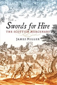

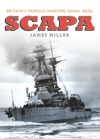


James Miller was born in Caithness and studied zoology in Aberdeen and marine biology in Montreal. After working for the British Council he became a full-time freelance writer. He has written a number of acclaimed books, including Scapa, The Dambuilders, The Foresters, Inverness, Swords for Hire and The Gathering Stream.
The Finest Road in the World
The Story of Travel and Transport in the Scottish Highlands
James Miller
This edition published in 2025 by
Origin, an imprint of Birlinn Limited
West Newington House
10 Newington Road
Edinburgh
EH9 1QS
www.birlinn.co.uk
First published by Birlinn Limited in 2019
Copyright © James Miller 2017
The moral right of James Miller to be identified as the author of this work has been asserted by him in accordance with the Copyright, Designs and Patents Act 1988.
All rights reserved. No part of this publication may be reproduced, stored or transmitted in any form without the express written permission of the publisher.
ISBN: 978 1 83983 084 6
eISBN: 978 1 78885 175 6
British Library Cataloguing-in-Publication Data
A catalogue record for this book is available from the British Library
Typeset by Sabon LT by Hewer Text UK Ltd, Edinburgh
Printed and bound by Ashford Press Ltd, Gosport
Contents
List of Plates and Maps
Introduction
Part 1 The old ways on land and sea
1. Foot and saddle
2. The drovers
3. Coastal seas
4. The early post service
Part 2 The military roads
5. Wade’s work
6. Hard travelling
Part 3 Public roads and new ways of travel
7. County roads
8. Patchy improvements
9. The Commission
10. Destitution roads
11. The stagecoach
12. Trustees and tolls
Part 4 The growth of shipping
13. Maritime traffic
14. Canals
15. Fishing and smuggling
16. Steam at sea
Part 5 The new iron roads
17. The first railways
18. New connections
19. Road versus rail
20. Highland lines
21. Tourists and an end to droving
Part 6 Cars, trains and planes
22. The motor car
23. New roads needed
24. Changing transport
25. Early air travel
26. Threats to the lines
27. Upgrading the A9
28. Connectivity
Appendices
1. Bills to account for Frances Cochrane from Drummond to Edinburgh
2. Road tolls in the Highland counties, 1846–47
3. Foreign and coastal shipping movements in 1893
Notes and References
Bibliography
Index
List of Plates and Maps
List of Plates
1. Thomas Bowen’s map of the north road, now the A93, as a series of strips.
2. D.G. Moir’s map of old paths and tracks.
3. The packhorse bridge at Carrbridge.
4. An early nineteenth-century engraving of the bridge over the Tay at Dunkeld.
5. Schooners and steamships jostle for quay space in Wick harbour.
6. The St Ola, which ran between Scrabster in Caithness and Stromness in Orkney for 59 years from 1892.
7. The paddle steamer Iona on the Glasgow to Oban run.
8. An advertisement for the coach services offered by the National Hotel in Dingwall in the early nineteenth century.
9. The post wagon at the Rhiconich Hotel, Sutherland, about 1906.
10. The worst rail accident in the Highlands: Carrbridge, 18 June 1914.
11. A nineteenth-century railway conductor.
12. The coffeepot loco, as it was known, at Dornoch in 1936.
13. A locomotive tries to batter through deep snow at Scotscalder in Caithness.
14. A late nineteenth-century cyclist.
15. A flock of sheep on the A9 near the Drumochter Pass, 1930s.
16. The Fergie: a boon to hundreds of farmers and crofters throughout the Highlands.
17. The vehicle ferry across Loch Duich in the 1930s.
18. Ted Fresson and islanders on the occasion of the opening of an airmail service to North Ronaldsay.
19. A small house being transported by lorry on the Black Isle.
20. A timber lorry crossing the Easter Fearn burn in Ross-shire.
21. Hermann Moll’s 1718 map of Scotland.
22. The A9 at Navidale on the approach to the Ord of Caithness.
23. The Wade Stone, beside the A9 a few miles south of the Drumochter Pass.
24. General Wade’s bridge over the Tay at Aberfeldy.
25. The inscribed stone at the Well of the Lecht.
26. The clapper bridge at Aultbea.
27. Workmen erecting the new bridge at Bonar in 1893.
28. The present bridge at Bonar, the third on the site.
29. Inverness railway station in its heyday.
30. A lone cyclist waits at Lairg station.
31. The course of the old road over the Devil’s Elbow seen in surviving ox-bows of tarmac.
32. The Devil’s Elbow hairpin: daunting to drivers in the early days of motoring.
33. A Highland Airways De Havilland DH84 Dragon I flies over Scapa Flow in the mid-1930s.
34. The Iona, the first roll-on roll-off ferry in the Caledonian MacBrayne fleet.
35. The Berriedale braes in Caithness: a notorious traffic chokepoint on the A9.
36. The diamond-shaped sign for a passing place on stretches of single-track road in the north-west Highlands.
List of Maps
1. The rugged landscape of the north of Scotland.
2. James Brodie’s route in 1680.
3. The main drove routes of Scotland.
4. The extent of mail delivery in 1813, by coach, horse and foot.
5. The military roads built under General George Wade and his successors.
6. Roads built under the Commission for Highland Roads and Bridges by 1821.
7. Map of the railways in northern Scotland at their maximum extent.
8. The principal features of the transport infrastructure of the Highlands and Islands.
‘The Ord of Caithness had been represented to me by many in so frightful a Shape, that I longed much to see it, and when I came to it, my Imagination had far outshot reality; for I rode up every Inch of it, a thing rarely done by any Persons, and all along looked down ye dreadful precipice to the Sea . . . My fellow-Travellers, both Gentlemen and Servts, took to the Foot, and walked it from the Bottom to the Top, a full long Mile. Its Steepness, and being all along on the very Brink of a Precipice, are the only Difficulties; for otherwise it is one of the finest Roads in the World, being so broad, yt in most places two Coaches might pass one another . . . But then so very steep it is, particularly at entering upon it, that no Machine can be drawn up it by any Cattle whatsoever, unless it be empty; and even then there must be some Sturdy Fellows at the back of it, pushing it forward to assist the Horses . . .’
– From Journals of the Episcopal Visitations of the Right Rev Robert Forbes on his first visit to Caithness in 1762 (Craven, 1886)
‘The new Glasgow–Inverness road was one of the finest roads in the world and fitted in with the most delightful Highland scenery one could see anywhere.’
– Sir Murdoch Macdonald MP in tribute to the engineer Major Robert Bruce after the construction of the A82 in the early 1930s
Introduction
‘Yin muckle hill at islands Caithness’ – so reads the first line in a poem I wrote a few years ago in my mother dialect about the Ord, the ridge of moor that forms the boundary between my native county and Sutherland, our neighbour to the south.1 It is not especially high, rising to a mere 650 feet or so above sea level at the viewpoint beside the A9, but it makes up for this deficiency by its windy bareness and the precipitate drop to the sea below. In my boyhood, it still carried a reputation for being, if not dangerous, as Bishop Robert Forbes had found out in 1762 and had dismissed with amused irony, a place that required respect. In a real sense, it did make an island of the county to the north, as there was only the single railway line and one other road across the county boundary, and in winter blizzards all three routes could be blocked.
Until the recent past for the Caithnessian, as I have written elsewhere, crossing the Ord for the first time was something to remember, a rite of passage.2 At the layby on the summit stands a stone with an inscription commemorating a traveller, a vagrant called William Welch, who perished here in a snowstorm in 1878. ‘Be ye also ready’ warns the crudely carved wording. The grandeur of the hills, the distant horizon of the sea, the inherent danger – the Ord just about summarises the story of land travel in the Highlands, travel in a country with a relatively sparse population clustered in widely scattered settlements, and a climate with winters that can be brutal. In the past, many parts of the Highlands could have been viewed as islands, so far separated were they from each other by long miles of mountain and moorland. Travellers have had to contend with and overcome these difficulties, as have the engineers, surveyors and labourers who have sought to ease their lot.
But, no matter the obstacles, where there are people, there will be roads. We are a travelling species and everywhere we have marked places with our paths. When we run out of land we make trade routes – ‘roads’ – on the sea, and in the twentieth century our technology allowed us to establish ‘roads’ in the air. The modern term for the links between one place and another is connectivity. High connectivity is essential for healthy economic life and, in the north of Scotland, in the Highlands and Islands, the infrastructure that allows it is especially of concern. We are deemed to comprise a remote society. Our connectivity within the region and to the rest of the world is crucial to our economic well-being.
A glance at a relief map of the Highlands shows the pattern imposed on travel and makes it obvious why, after crossing the Forth in Scotland’s egg-timer waist, there were only a few routes that seemed natural ones for travellers from the south to follow. The most obvious one bears to the east, along the corridor of Strathmore and the Howe o’ the Mearns, to squeeze over or around the eastern slopes of the Cairngorm massif to reach the fertile lowlands of the Moray Firth. This is the way the Romans came, and the invading armies of Edward Longshanks, and centuries later the first railway lines and the A90. There is no comparable route to the west through the crumpled mountains and glens, and here in the distant past sea travel was more the norm. For the daring and those who had local knowledge, however, there were other routes north through the Highland wall, from Perth via Dunkeld and the braes of Atholl, from the Clyde via Loch Lomond to the natural corridor of the Great Glen. These of course are the routes now graced by the A9 and the A82, the Highland Main Line and the West Highland Line.
Map 1. The rugged physical landscape of the north of Scotland – with mountains, rivers, sea lochs and many islands – presents challenges to transport infrastructure.
The network is mainly of indigenous origin, the response of the people to the need to connect with each other and with the world beyond the horizon. Elements of it, however, have been imposed: Wade’s soldiers laid their roads across the hills to occupy and pacify the country, and the railway surveyors cut their tracks in response to gradients and the demands and constraints of steam technology.
The network of routes for travellers to follow, the choices as to which way to go and which mode of transport to adopt, developed as technology improved, opening new possibilities while making older solutions redundant or obsolete. This can be seen with striking effect in the pass of Killiecrankie, where the Garry threads through a narrow, steep-sided glen. The old drove road called the Bealach follows the bank of the river. Above it passes the railway viaduct built in 1863 to a design by Joseph Mitchell; above that, following the route of an old track, passes the military road cut by General Wade’s men in 1728, more familiar as the old A9 and now the B8079; and above that again, as the uppermost stratum in an archaeology of transport, the modern A9, a dual carriageway.
The older forms of transport were built and serviced by local people, by the horse breeders, saddlers, wheelwrights, blacksmiths, boat-builders and seamen of the Highlands, and were usually well adapted to the environment. This is not so with modern transport. Since the appearance of the steam engine, but more so since the introduction of its internal combustion successor, fuelled by petrol or diesel, there has been a loss of control over local transport to outside bodies. Although almost every village has a garage where a car can be fixed, the machines themselves are inevitably manufactured elsewhere and are not always suitable for local conditions. For example, the less sturdy stretches of the Highland roads take a destructive pounding from juggernauts.
In this book I hope to take the reader on a journey through the last few centuries and describe how the present network of connectivity evolved. Along the way we meet some colourful characters and spend a little time with each mode of transport – travelling by foot, horse, coach, schooner, steamer, locomotive, motor car and aircraft – in a way that I hope the reader finds entertaining and informative. In my own lifetime the transport infrastructure in the north has improved in great measure. I can recall train journeys south from Wick in winter in which we joked about conditions in the carriages being reminiscent of the train journey across Russia in Doctor Zhivago, the David Lean movie current at the time, with music and drams and an occasional glance through the frosted windows to see how far we had yet to travel.
*
As with all works of this kind, I owe an unlimited debt to those who have trod the road before me, and to those who have helped me on my way. Written sources are detailed in the Notes and References section; and for help with research, comments and illustrations I would also like to thank the staff of the library and archive services of High Life Highland in Inverness, Dr Cait McCullagh and Lesley Junor at Inverness Museum and Art Gallery, Rachel Chisholm at Highland Folk Museum, Dr Juliet Gayton, Jamie Gaukroger of Am Baile, Heike Gehringer at Ullapool Museum, Sinclair and Kathleen Dunnett, Allan Cameron and Maureen Kenyon of Inverness Local History Forum, Alasdair Cameron, Kathryn Logan of Moray Firth Partnership, Willie Morrison, Roy Pedersen, Dr Andrew Rae, Mairi Stewart, and Pauline Ward – worthy fellow travellers all. A special thank you goes to my agent, Duncan McAra, to Hugh Andrew and his colleagues at Birlinn, and particularly to editor Deborah Warner, for their seemingly inexhaustible patience. Mistakes en route are, of course, my own doing.
Currency
Before 1971 and decimalisation, readers should remember that prices in Britain were expressed in pounds (£), shillings (s) and pence (d). There were 12d in each shilling, and 20s in each £1. The Scots pound was used in accounting and rentals, among other things, and was valued by the eighteenth century at one-twelfth of the pound Sterling.
PART 1
The old ways on land and sea
CHAPTER 1
Foot and saddle
‘we sett upon our way and journay, and cam forward . . .’
In 1804, Donald Sage, the 15-year-old son of the parish minister in Kildonan in Sutherland, left home to begin his studies at Aberdeen University. In his autobiography, he recalled the journey:
. . .on Monday morning early, my father, Muckle Donald, and I set out for Aberdeen. My father accompanied me as far as Tain, where we arrived on Tuesday morning. The night previous we spent at Dornoch. At Tain we breakfasted at Turnbull’s Inn . . . After breakfast [Mrs Turnbull] stuffed my pockets with fine large apples; and my father parted with me to return home. Muckle Donald and I then tramped it on foot from thence all the way to Aberdeen. The day we left Tain, crossing the Invergordon ferry, we slept and supped at the Inn of Balblair . . . the length of the journey proved too much for me. Within two miles of Inverurie I fairly broke down and fell prostrate upon the roadside . . .
After a much-needed rest, the youth and his companion reached Aberdeen the following day. Sage does not tell us for how many days they walked after leaving Balblair on the Black Isle or where they stayed at night, but it must have taken them at least three days to get as far as Inverurie. This is assuming they kept up a pace of 25 miles daily.1
Sage’s story is a vivid reminder that up until the relatively recent past most people, even on substantial journeys, walked. It is a curious though understandable feature of Scots dialects, although one that survives in the speech of only a few localities, that ‘traivel’ specifically means making a journey on foot, while its equivalent ‘travel’ co-existed with the conventional English meaning. This could give rise to such exchanges as:
‘I went til the toun.’
‘Did ye traivel?’
‘No, I took the bus.’
In his account of his boyhood in the early 1800s, Hugh Miller recalls walking with his mother the 30 miles from Cromarty to Lairg to visit a relative and arriving ‘early on the evening of the second day’; later, as a young apprentice stonemason, he walked from the banks of the Conon via Contin and Loch Maree to a job in Wester Ross, staying in two inns en route.2 A family tradition in my boyhood was that the women of Dunnet in Caithness, including my great-grandmother, wove herring nets during the winter and in the summer walked with them to Wick on the other side of the county to sell. Only the better-off could afford to own or hire a horse or a carriage and, in any case, the state of the roads before 1800 was such that venturing any distance in a vehicle was a highly risky business. The north of Scotland was covered by a well-trodden network of routes, but these were often little better than tracks – dry enough in the summer but in the winter often impassable with mud, snow or ice – and it was wise and often quicker to rely on Shanks’s pony.
Roads were poor throughout the country, including the Lowlands. William Cunningham of Craigend in Renfrewshire recorded in his diary in the 1670s how he always went by horse to Edinburgh – trips he called ‘voyages’ – as that was the only feasible means of transport outside the immediate environs of any urban centre. It was normal for a lady to ride on a pillion or pad behind her husband in the saddle, and luggage was carried strapped on pack horses. Cunningham kept in his account book details of his expenditure on ‘voyaging’: perhaps 5s for a night’s accommodation for his horse with an extra shilling or two for the stable lad; £3 12s for the freight of his wife’s coffer (chest) from Glasgow to Edinburgh; a cost of between £500 and £700 to keep a horse for a year.3
James Brodie described a difficult journey in December 1680, from Edinburgh north to his home at Brodie near Forres, a trip that normally could be accomplished in five days. The problems began when the riders approached the ferry to cross the Firth of Tay to Dundee – ‘The frost hinderd our passage many hours.’ The party continued north. ‘We cam nixt forenoon to Brichen, and on this Saturday at evening we cam to Fettercairn, wher we purposd to stay the nixt day, being the Sabbath.’ The threat of approaching bad weather forced a change of mind on the Sabbath:
. . .fearing a storm in the Kairn [Cairn o’Mount] and the waters, we considered on it as fitt to croce the water of Die [Dye]. After we had worshipd God . . . we sett upon our way and journay, and cam forward . . . We cam to Lumfannan finding no good lodging elswher . . . The nixt morning [it was now 20 December] we cam to Putachie [near Alford]; had verie ill way, and ill crossing of the water of Dolie . . . I staid there al night.
On the 21st, Brodie struggled north from Putachie to Mulbenn, and on the 22nd, as he wrote, ‘I was in a most immanent and apparent danger beyond what ever I was al my lyff tym.’ The Spey had swollen with the winter rain.
The [ferry] boat and al in it was caried doun by the force of the speat . . . more than half a myl . . . We wer, in the opinion and estimation of onlookers, past al hop and expectation of coming to land, and ther was nothing but a present looking for death. It pleasd God at last that we wer brought to land to the sam syd of the water which we entred in . . . I cam back to Mulbenn . . . We crocd the Spey in the evening and cam lait to Elgin.
Brodie eventually won home on the 23rd after another challenging river crossing at the Findhorn, eight long days after leaving the capital.4
Map 2. James Brodie’s route in 1680.
For all the problems, people did travel – and often quite widely. That long journeys required time, preparation and endurance had to be accepted as an unfortunate but inescapable fact of life, perhaps much as we expect today to be held up in city traffic. As long as people relied on their own feet or their horses, and the elements remained reasonable, a journey was usually more time-consuming than dangerous. Eight days was regarded as normal for an overland journey from Caithness to Edinburgh. John Sinclair of Barrock made this trip in February 1734 and wrote to a friend afterwards:
I had good traveling wether and good ludging untill I came to Reven [Ruthven in Strathspey] which was on a Saturday night. Sunday’s morning was frosty, windy and cold. I took my horse in the morning and road [rode] five or six miles without seeing any snow but after that to Delquhiny [Dalwhinnie] I had nothing but snow drift and bad wether in my face and when I came to the house I was refused ludging for myself or my hors, however I went in and with much difficulty was admitted there and was there only one bed free from snow and there was six officers possessed of it . . .
Sinclair put up that night with snow drifting in through the walls and roof, melting to form a great puddle on the floor, the company of a crowd of soldiers and no food ‘but drink enugh’. He managed to share a bed with a customs officer from Dornoch. The two men kept their clothes on and spent the night under a big coat and plaid ‘with abundance of snow above all’. On the next day, warm enough in Sinclair’s view, his horse laboured through deep snow and came to ‘Dalnachurdich’ (Dalnacardoch) in the afternoon ‘where we were exceeding well accommodate and from that place I had very good wether and ludging’. By the time Sinclair reached Dysart the snow had been left behind but horse and rider fell twice on the ice – ‘However I got no harm.’5
The rough accommodation was not unusual. In 1769, Thomas Pennant had to lodge in a whisky house that passed for an inn at the east end of Loch Maree: ‘Mr Mackenzie complimented Mr Lightfoot and me with the bedstead, well covered with a warm litter of heath: we lay in our clothes, wrapped ourselves in plaids; and enjoyed a good repose.’ Pennant was surprised some locals chose even less comfortable arrangements, forming a bed from wet hay and flinging a plaid over it.6
A particular example of a route with a special purpose was the ‘coffin road’, the path along which men bore the remains of the dead to their last resting place. In Wester Ross, the coastal route between Ullapool and Achiltibuie has won a measure of fame as the Postie’s Path, after a postal service opened in the 1860s and the postmen began to use it on a regular basis. The postman Kenneth Maclennan of Blairbuie followed it to Ullapool twice a week for the mail, 15 miles each way at 2s 3d a time. The route, however, had probably already enjoyed centuries of use by the local people; it appears on Aaron Arrowsmith’s map of Scotland in 1807.7 In the Middle Ages, some routes became associated with pilgrimage, the most notable example in the north being the route to Tain, to the shrine of Saint Duthac, a pilgrimage made every year after his first visit in 1493 by James IV (1488–1513).
In general, only a few of the old routes are recorded on early maps or mentioned in charters.8 Timothy Pont includes hardly any roads on his maps drawn around the turn of the 1600s, but his scattering of settlements, more or less foreshadowing the present distribution of population, implies an infrastructure of connections. The Blaeu Atlas of Scotland, published in Amsterdam in 1654 and based on information supplied by Robert Gordon of Straloch, and in turn drawing on Pont’s work, indicates the existence of the Causewaymire route across the Caithness moors.9 One route that Pont does show is the Causey Mounth, an important and ancient way south from Deeside; and in his surviving notes Pont mentions a rad na pheny, a road for wheels from Ruthven to Blair Atholl.10 This may be the same as one of the two routes called Comyn’s Road and Minigaig Pass respectively.11 Both of these are more direct than the route eventually chosen by General Wade through the central mountains via Dalnaspidal but climb to higher altitudes.
When Joseph Mitchell took part in a survey in 1837 of alternatives to the military road then followed by the stagecoaches through Drumochter Pass, he proposed a practicable route between Glen Feshie and Glen Bruar that was ten miles shorter than the current one but rose to an altitude 660 feet higher.12 Mitchell had, as it were, rediscovered Pont’s rad na pheny, although it had probably remained a customary way for shepherds and drovers. In 1806 the surveyor Alexander Nimmo mentioned that a track led from Blair Athol via the Bruar Water to the glen of the Feshie, and also that the post to Ruthven barracks used to come this way from Perth, ‘descending by the Frommie’.13
Some of the old ways have names that are evocative of a bygone age. D.G. Moir recorded many in two small booklets he compiled under the name of Scottish Hill Tracks: Old Highways and Drove Roads first published in 1947 and re-issued several times.14 Moir aimed his work at the hillwalkers and hostellers who were frequenting the countryside in increasing numbers, emulating earlier generations who had laid down the ways through necessity rather than for recreation. Thus we have a series of named routes, passes through the hills of the Mounth, connecting the low country of the Mearns with Deeside and further north. Similar networks existed in other parts of the Highlands. There is evidence now for an ancient continuous route from the Beauly to the Dornoch firths, fragments of which survive as double embankments, paths and field boundaries.15 Indeed, the network of paths in the central Highlands, as mapped by Moir, suggests the country was better served in the old days than it is now by paved roads, and conjures the image of a countryside with a continual, albeit low, level of traffic. In his study of old roads, the Inverness architect Alexander Ross mentioned the tradition of routes and tracks called Picts’ roads in the Mearns area.16 Parts at least of the network are incorporated into the better known distribution of drove roads.
Before the eighteenth century, accounts of travel survive in the context of military campaigning and there are few records of journeys for peaceful or quotidian reasons, but one is a summary of the route followed by the messengers sent north to greet the Princess Margaret, Alexander III’s grand-daughter, on her voyage from Norway in 1290, admittedly a very special errand. The men stayed on three successive nights at Skelbo, Helmsdale and a place on the Caithness coast referred to as the Hospital, probably near Latheron, an itinerary that means up to 20 miles per day.17 Hospital or spital, in variant forms, is found in several place names, all of which mark where in medieval times a hospice provided travellers with refuge and shelter. In the summer of 1654, General Monck marched troops through the Highlands as far as Inverness and Kintail in pursuit of rebels against the regime of Oliver Cromwell. Leaving Perth – or S. Johnstons, as Monck has it – on 9 June, the soldiers reached Loch Tay on the 12th, covering a distance of some 30 miles, suggesting that the going must have been relatively straightforward. Speed of travel slowed when the troops moved further into the mountain fastnesses:
The 30th the army march’t from Glenteugh to Browling the way for neere 5 miles soe boggie that about 100 baggage horses were left behinde, and many other horses begg’d [bogged?] or tired. Never any Horse men (much lesse an armie) were observ’d to march that way.18
The construction and maintenance of roads, at least outside settlements, was haphazard. There are some early statutes, from the reign of William the Lion (1143–1214) onward through the centuries, that refer to highways and rights of passage but it is doubtful if any of these had impact in the Highlands. In 1610, the justices of the peace in each shire were charged with ‘the upholding and repairing of the briggis that ar not utterlie ruined’. They were also ‘to provide for helping of the kingis heiche wayis alsweill for the benefite of careagis as ease of passingeris’ and ‘to consult eftir what forme the cuntray may be best provydit of goode innes and luidgeings for the ease of passingeris of all sortis’.19 Such legislation had little permanent effect and it was to be a very long time before ‘passingeris of all sortis’ were well lodged. These pronouncements from the Privy Council were repeated by an Act of Parliament in 1617 which also laid down that all the common highways leading to market towns should be at least 20 feet wide.20 A new Act in 1669, during the reign of Charles II, reiterated these demands and gave power to lairds to call out their tenants to perform six days’ statute labour on road-making – the roads were to be fit to take horses and carts in summer and winter – and while this no doubt had beneficial effects in some localities, it was never enough to bring about large improvement over long distances. Occasionally, we come across a local solution to an infrastructure problem, such as in 1649 when the Presbytery of Dingwall deployed the stipend funds for a vacant kirk to fix old bridges in its vicinity.21 Patrick Graham in his account of Aberfoyle for the Statistical Account of Scotland also noted that ‘several bridges have been thrown over the torrents, by the judicious application of the vacant stipend’.22
Robert Greene’s map of Scotland of 1679 is the earliest to show several roads. It includes a route north from Perth through Dunkeld, Blair, Ruffen (Ruthven), Dundaf (Dava?) and Taruway (Darnaway) to Forres. A fork west from Dundaf leads to Nairn and on to Inverness, while another road runs from Nairn to the coast at Ardersier to connect across the firth to Chanonrie (Fortrose) and overland to Cromartie. The map also indicates a ferry from Inverness to the Black Isle and a route proceeding to Dungwell (Dingwall). A road also runs all the way up the east coast to Duncansby. Another road cuts east from Perth to Brenchun (Brechin), Monros (Montrose), Aberdeen and so on up to Fraserburgh, before turning west along the Moray Firth to Elgin and Forres. What is surprising about the map is that it shows no roads at all running beyond Dumbarton or Stirling into the western Highlands. There was, however, a west coast route that passed by Loch Lomond over what was later to be dubbed the Rest and Be Thankful to Inveraray and Dalmally, and northward by the Black Mount to Glencoe and the Great Glen.
A Dutch or German mapmaker with an inventive frame of mind, Herman Moll settled in London in 1678 (he died in 1732). His ‘A pocket companion of ye roads of ye North part of Great Britain called Scotland’, published in London in 1718, shows not only many roads – with double lines for major routes and single lines for the secondary ones – but also the mileages between key points.23
Few, if any, of the references to roads and travel before the eighteenth century relate to the northern Highlands. This is hardly a surprise, as documents from this time in general concern mainly the low country to the south and east. In the north-east, the road network was basic but comprehensive, much as in the Lowlands. In the descriptions of Aberdeenshire parishes gathered by Walter Macfarlane, clan chief and devoted collector of manuscripts, there is mention of many bridges of stone or wood as well as fords and ferries. For Caithness, it was noted that the river in Wick was bridged by timber laid over 11 pillars of loose stone. There was ‘a good timber bridge’ on the Orrin in Easter Ross, but the difficulty of travel where there was none was evident in part of Strathnaver, where ‘the river Bagasty’ – the Vagastie, draining into Loch Naver and forming a natural routeway from the eastern lowland of Sutherland into the Mackay country to the north – ‘is very troublesome when high, the passengers that ride being obliged to cross it upwards of four and twenty times in the distance of three or four miles, and all the adjacent ground is boggy and full of stanks [pools]’. What is called the ‘highway’ between Perth and Inverness passed through the parish of Strathdon and a bridge was erected over the Don at the ‘Pot of Pool d’oylie’ in about 1720.24 This reference to ‘highway’ is clearly to the same route followed by James Brodie in 1680, and the standard way around the Cairngorm massif for travellers between Angus and the Moray Firth. This eastern route was facilitated by the construction of a wooden bridge over the Dee in about 1230 at Kincardine O’Neil and the establishment there of a spital for travellers.25 In the far north of the mainland, however, in the parish of Canisbay, washed by the Pentland Firth, the contributor to Walter Macfarlane’s collection wrote that the district
has no highways except what leads from all quarters to the church, and the roads everywhere so bad, that there is scarce any travelling betwixt any two towns in the parish by horse except by bridges made of turff and heath, which must be changed once in the two or three years when the soft mossy ground being cutt by the feet of cattell becomes impassable; such bridges we have in store, frequently 30, 40 or 50 of them in less than half a mile of way and some good large ones too. One particularly that is ¼ mile long and called the Long Bridge.
These ‘bridges’ were probably thick carpets of turf laid to provide a relatively dry, although short-lived, path over boggy ground.
In the Highlands we can accept that many modern roads follow roughly the routes people have always taken for their daily purposes. There are, on the other hand, instances of once customary routes being relegated to some minor purpose or abandoned altogether. One notable case occurs in the parish of Kintail. In 1792 the minister, the Revd Roderick Morison, noted that the shortest route from his district to the main towns – Inverness and Dingwall – on the east coast lay through Glen Affric, a distance of 13 miles, he reckoned, between Kilduich and Strathglass. This path was in daily use at the time, even by people ‘with heavy loads’. From the head of Loch Duich the route lay through Strath Croe before climbing steeply – in its higher part ‘truly steep and vexatious’ – up Gleann Chòinneachain to the narrow Bealach na Sgàirne. Once through this rocky gap that Morison called the ‘Belloch’, which was wide enough for three people to proceed abreast, the path falls gently eastward through Glen Affric. There was no inn on the way and the only shelter in bad weather was provided by crude shepherd ‘booths’ which from time to time were burnt by benighted travellers for fuel. ‘Of all the roads, none calls for more attention,’ wrote Morison. The Belloch was, however, fated never to have any attention from road builders: they preferred to approach Loch Duich through the easier Glen Shiel to the south and it has been left to enjoy a modern popularity among hillwalkers.26
Other traditional routes that did not become roads include one that lay from the Glutt in the upper reaches of the Thurso river to Dunbeath in Caithness; another led through Glenfeshie from Strathspey to Deeside. One ancient route from the west through the Great Glen towards Inverness passed by Bunloit down to the low swampy ground at the mouth of the Enrick and then up a steep climb to Achpopuli and Blackfold.27
In his now classic work The Old Deeside Road, which tells the stories of old routes associated with the River Dee, G.M. Fraser has left us an almost unique example of research into the subject. The Causey Mounth was the most celebrated road south from Aberdeen – it had a toll on it in 1634 – but it was just the foremost in a list Fraser compiled of 15 passes or routes leading out of Deeside mainly to the low country of Strathmore but also south-west to central Perthshire and to Strathspey. The traveller who wished to cross the Dee also seems to have been spoilt for choice; Fraser counted 27 ferries in the early eighteenth century between the river mouth in Aberdeen harbour and Braemar, and 36 fords, where there are now some 16 bridges. Fraser argued that the Causey Mounth road was probably an established route when William the Lion (1143–1214) granted a charter to the burgesses of Aberdeen in around 1175. The first documented source for it occurs in 1384 in a contract in which the Aberdeen burgess John Crab provides to his son Paul money to maintain the Causey Mounth and the bridge of Dee.28 Professor Geoffrey Barrow summarised the evidence in medieval Scotland for the wide existence of a road network, albeit only fit for foot or horse, and pointed to the existence at that time of a bridge over the Spey a few miles below Rothes, where later there was the ferry called Boat o’Brig, and to the earliest record of a ferry on the same waterway being in the thirteenth century with a ferryman called Dougal at Fochabers.29
CHAPTER 2
The drovers
‘the Horse is the surest Judge of his own safety . . .’
A.R.B. Haldane’s seminal study The Drove Roads of Scotland, first published in 1952, firmly cemented in the public mind the existence of the network of routes associated with the droving of cattle from the Highlands to the southern markets.1
Droving began in the seventeenth century and increased greatly in scale after the Treaty of Union in 1707, but the routes used by the drovers almost certainly have a much older pedigree. As Haldane points out, in the more distant days of interclan strife at least some of the routes would have been the ways by which cattle thieves drove home their booty. The Gaelic term bealach, meaning a pass between hills, and the obvious way to drive cattle, occurs in many places throughout the Highlands. And no doubt the same routes would have been used by other travellers with no nefarious purpose in mind. A glance at the map of drove roads as compiled by Haldane reveals that by and large they follow the paths logically suggested to the traveller by the Highland landscape, and it is no surprise to find that Thomas Telford and his engineers also followed drove routes in places when they were building a new road network for the Commissioners for Highland Roads and Bridges in the early 1800s. The drovers had in mind the needs of their beasts, such as access to grazing and water, and soft ground that was kind to hooves, but other desirables – convenience and the shortest possible distance – were as for any traveller.
Map 3. The main drove roads in Scotland.
The drovers enjoy a romantic reputation and even Haldane, for all his sober scholarship, succumbs and imagines drovers in old age by their home fires recalling the adventure and comradeship of the open trail. It is easy to understand how the concept of droving, with its image of a herd of shaggy, wide-horned cattle moving over a great distance through the glens, fosters such a response. A similar evocation springs from the cattle drives of the American prairie, as portrayed in countless westerns, and it is historical fact that cattle ranching in the United States owes much to the enterprise of Highland emigrants already steeped in the tradition of shifting beasts over long distances.2 The Scottish drovers acquired a reputation as a tough, honest breed of men, worthy successors to their clan-warrior forebears. They often slept out beside the animals in their charge, wrapped in their plaids against frost and rain, sustained by oatmeal and whisky and, during the time of the Jacobite risings when Highlanders were forbidden to carry weapons, they were among the selected groups who enjoyed the licence to bear arms. In his report to the government on 31 January 1725, General Wade stated that he had issued 230 licences to the ‘Forresters, Drovers and Dealers in Cattle, and other merchandize, belonging to the several clans who have surrendered their arms’.3
The romantic aura of course obscures the hard-headed business that was the real driving force. This is exemplified by John Cameron from Lochaber, better known as Corriechoillie. Joseph Mitchell wrote:
He was the son of a crofter, who died early in very poor circumstances, his only stock being a few goats. When quite a lad he [Corriechoillie] was employed by the principal dealers to drive their sheep and cattle to market. He was so poor that his first journeys south were made without shoes, he wearing only a pair of footless stockings . . . He soon acquired a character for acuteness in the buying and selling of stock as well as being the largest sheep-farmer in the Highlands. At one time he was tenant of 11 farms and reputed possessor of 60,000 sheep.
Mitchell also says he was ‘a badly dressed little man, about five feet six inches in height, of thin make, with a sharp hooked nose and lynx eyes’, but he was tough and kept his word. ‘A man of great energy,’ wrote Mitchell admiringly, ‘he frequently rode night and day on a wiry pony from Falkirk to the Muir of Ord, 120 miles, carrying for himself some bread and cheese in his pocket and giving his pony now and then a bottle of porter.’4 Corriechoillie, who died at Spean Bridge in 1856, is commemorated in the name of a lively bagpipe march tune.
The drove routes led from all the corners of the north and west to a few gathering points dictated by geography. Thus, from Ross, Caithness and Sutherland, they focused on Muir of Ord on the neck of the Black Isle, between the eastern firths and the hills, the departure point for the main routes south through the Cairngorms. A series of gathering points for droves marked the northern fringe of the eastern Grampians – at Grantown, Craigellachie, Cabrach, Huntly, Turriff and Aikey. Some major sea crossings were swum by cattle, most notably the half-mile between Kylerhea on Skye and Glenelg but also the Dornoch Firth between Creich and Easter Fearn. The longer sea crossings between the Outer Hebrides and the mainland were done by boat to Poolewe in Wester Ross or to Skye, and boats also took the cattle from Coll and Tiree (the two islands exported 400 and 500 head per year in the 1780s) to Mull, and from the southern islands such as Islay to the drove heads in Lorn and Argyll. In 1622, Sir John MacDougall, the laird of Dunolly, was punished for levying heavy tolls on cattle shipped from Mull by having property and the ferry removed from his hands.5
The scale of droving thrills the imagination now. In 1723, more than 30,000 cattle were being sold in Crieff, mostly to English drovers, who paid down 30,000 guineas in cash to the Highlanders.6 By the end of the eighteenth century more than 60,000 head of cattle were being handled at the Falkirk Tryst every year. At Dalwhinnie in 1762, Bishop Robert Forbes encountered a party of drovers en route from Skye to Crieff:
On the dusky Muir of Drumochtir we had a full view of all the Cattle, from Rear to Front, which would take up about a Mile in length, and were greatly entertained in driving along through the midst of them, some of them skipping it away before us, like so many Deer. They were sleek and in good Order . . . [at] Lochgarry . . . we saw another Drove of Cattle, about 300, resting, on their way to Crief-Fair, some of them, through the Heat of the Day, wading into the Loch.7
The railways were to bring an end to large-scale droving but some continued in a small way into the late nineteenth century. A few drovers, strengthened by the ordeals of their job, survived to old age to find themselves the symbols of a long-gone era. Such a one was Alexander Gordon of the Gauch, Cabrach, who died early in 1922 at the age of 85 and who, in his boyhood, had driven cattle with his father from Aberdeenshire to the Falkirk Tryst via Braemar and the Spittal of Glenshee; on the return journey he recalled walking 40 miles a day and sleeping wherever they found shelter.8
Rivers had either to be forded or swum by human travellers, horses and herds alike, a nerve-wracking undertaking whenever the rainfall had raised the water level. ‘I have always found, as the Rivers while they are passable, are pretty clear, the Horse is the surest Judge of his own safety,’ advised Edmund Burt in one of his letters from the Highlands, continuing:
There is a certain Giddiness attends the violent Passage of the Water when one is in it, and therefore I always at entering resolved to keep my Eye steadily fixed on some remarkable Stone on the Shore of the further Side, and my Horse’s Ears, as near as I could, in a Line with it, leaving him to choose his Steps . . . I still retain the Custom of my own Country [England] in not sending my Servant before me through these dangerous Waters, as is the constant Practice of all the Natives of Scotland.9
Burt admired the way in which a herd of cattle took to a river crossing: ‘The cows were about fifty in number and took the water like spaniels, and when they were in, their drivers made a hideous cry to urge them forwards: this, they told me, they did to keep the foremost of them from turning about.’10 The technique did not always guarantee safety and there were times when cattle were plucked from the throng by the current and carried off to be drowned before they could be rescued.11
On the occasion described by Burt, the drovers themselves had crossed the spate by boat. Ferries of this simple sort were maintained on many river crossings, often by the local laird or a tenant. As usual, Burt deployed a critical eye for his English readership. Referring to a crossing of an unnamed river but probably the Beauly, he wrote: ‘We . . . passed a pretty wide River, into the County of Ross, by a Boat that we feared would fall to Pieces in the Passage.’12 Several places along the Spey and other larger rivers are named after the ferries that used to operate at them: among these we find Boat of Garten, Boat of Insch, Boat of Cromdale and Boat o’Brig. On some of these crossings the vessel was a coracle, and it must have taken some courage or faith on the part of a stranger to step into such an apparently frail cup of wood and hide.
Seagoing crossings to the islands for a long time were probably organised on an ad hoc basis, a boatman or shipmaster taking to the water when required and travellers finding a passage or hiring a boat where they could. We do have scant records of one regular crossing: John o’ Groats famously derived its name from Jan de Groot, either Dutch or of Dutch extraction, who was charged in the late fifteenth century with running a ferry between Caithness and Orkney, then recently having become part of the Scottish realm. Many tall stories have accrued around Jan de Groot but a charter from the Earl of Caithness to John Grot in March 1496 of a pennyland of ground at Duncansby would seem to confirm the essence of the matter.13
CHAPTER 3
Coastal seas
‘a small barke once in a yeere from Leith . . .’
While livestock could be driven to market, bulk commodities such as grain, meal, bolts of cloth and peats were usually transported by horse in baskets or packs slung on wooden saddles. The state of the roads precluded much wagon haulage, but a type of sledge, sometimes called a slipe, could be dragged along by a horse, the rear end of the long shafts or poles trailing on the ground. A platform fixed between the poles allowed the use of a basket, box or wicker container.1 Thomas Pennant saw strings of pack ponies bringing in peat to Tayside in 1769. Joseph Taylor, the parish minister of Watten in 1792, when road building had barely begun in his area, recorded that everything was carried in small loads on horseback.2 William Sutherland, the minister in the neighbouring parish of Wick, noted the technique, how goods were placed in straw creels, called cassies in the dialect of Caithness, which were slung over a wooden pack saddle (clubber), tied with straw ropes (simmans), with a straw cushion (flet) between the wood and the horse’s back. Variants of this apparatus existed across the country. ‘When a call comes to ship the master’s victual [grain],’ wrote Sutherland, ‘some scores of the garrons or small horses . . . are sent out by the tenants, tied to one another by the tail, with a cassie of meal or bear [a form of barley] on either side of every horse. A boll of meal or half a boll of bear is all the load each can carry in this miserable mode of conveyance.’3 The boll is a measure of volume and the weight varies according to the commodity, but a boll of oatmeal would have tipped the scale at around nine stone (roughly 60 kilos). Smaller quantities of goods could be borne by men and women in baskets on their backs. In Strathspey and other valleys where river transportation was feasible it was customary to float timber from the forests to where it was needed, the workers often waiting for a spring spate to bring down large quantities of felled trees.4
Osgood MacKenzie described in his memoirs how in the days of his grandfather, around 1800, a team of men and ponies would come from Gairloch to bring the laird and his family across the county from the east side to their home on the west coast. A day would be spent in packing. ‘Everything had to go west – flour, groceries, linen, plate, boys and babies, and I have heard that my father was carried to Gairloch on pony-back in a kind of cradle when he was only a few weeks old.’ The pack train went as far as Scatwell on the first day where there was an inn ‘and as there was a road of a kind thus far and no farther, the old yellow family coach carried “the quality” (i.e. the gentry) there before dark’. The second day of the journey ended at Kinlochewe, 12 hours or more of slog across the high country, and the third day was spent sailing or rowing the goods and chattels down Loch Maree to the west end, and another short distance of road to the destination. Such travelling was open only to those who had command of considerable resources in manpower and money.5
The sea offered the best opportunities for transporting both people and goods. On his journey up the west coast from Oban to Durness in 1786, John Knox frequently took to the water among the islands and sea lochs rather than travel overland.6
Just as for land travel, much of what we know about coastal shipping before the eighteenth century is anecdotal. We can be sure, nevertheless, that both the sea and fresh water have supported a steady traffic from the earliest times. Several examples of prehistoric logboats have been found in Scotland. One was uncovered at Carpow on the Tay: dated to 1000 BC, this slim vessel, 30 feet long, fashioned from a single oak log, was probably typical of the craft used on inland and inshore waters for fishing, fowling and transport in the Bronze Age. The substantial, sturdy hull, with a few shaped features in the interior such as ridges capable of supporting seats, and evidence of maintenance – plant material soaked in oil and fat and stuffed into a split – point to craftsmanship and a long working life.7 An older logboat, albeit incomplete, was found at Locharbriggs in Nithsdale in the 1970s; it dates to 1900 BC. But this is much younger than the oldest vessel of this type uncovered in western Europe, in the Netherlands at Pesse: this hull carved from Scots pine has been dated to 7900–6500 BC.8
The Carpow logboat is unlikely to have ventured safely far from the seashore; some other design of craft must have been used to travel among the islands. Boats made from planks lashed together have been found in Britain – for example, the Ferriby boat, discovered on the Humber. This technology could have allowed the construction of a more robust seagoing vessel. The lashing together of two or more logboats to support a floating platform or a raft-like boat is another possible solution. Plank-built seagoing boats were also in use on the Atlantic coast by the first century BC, when Julius Caesar described the seaworthy boats used by the Veneti people on the coast of Brittany. In the Hebrides and the Northern Isles, where timber is scarce, it is more likely that the skin boat became the customary craft. Hide boats were widespread along the Atlantic seaboard in Roman times and were used, for example, for shipping tin from Cornwall to the continent. The Irish curragh is a well-known variant, and the Brendan, a replica sailed by Tim Severin and his crew from Ireland to Iceland and Newfoundland, showed the seagoing capabilities of the craft.9


